


<< Text Pages >> Pewit Farm - Round Barrow(s) in England in Oxfordshire
Submitted by coldrum on Sunday, 04 October 2009 Page Views: 4248
Neolithic and Bronze AgeSite Name: Pewit FarmCountry: England County: Oxfordshire Type: Round Barrow(s)
Map Ref: SU40968412
Latitude: 51.554486N Longitude: 1.410611W
Condition:
| 5 | Perfect |
| 4 | Almost Perfect |
| 3 | Reasonable but with some damage |
| 2 | Ruined but still recognisable as an ancient site |
| 1 | Pretty much destroyed, possibly visible as crop marks |
| 0 | No data. |
| -1 | Completely destroyed |
| 5 | Superb |
| 4 | Good |
| 3 | Ordinary |
| 2 | Not Good |
| 1 | Awful |
| 0 | No data. |
| 5 | Can be driven to, probably with disabled access |
| 4 | Short walk on a footpath |
| 3 | Requiring a bit more of a walk |
| 2 | A long walk |
| 1 | In the middle of nowhere, a nightmare to find |
| 0 | No data. |
| 5 | co-ordinates taken by GPS or official recorded co-ordinates |
| 4 | co-ordinates scaled from a detailed map |
| 3 | co-ordinates scaled from a bad map |
| 2 | co-ordinates of the nearest village |
| 1 | co-ordinates of the nearest town |
| 0 | no data |
Be the first person to rate this site - see the 'Contribute!' box in the right hand menu.
Internal Links:
External Links:
Round Barrow(s) in Oxfordshire
"A Bronze Age bell barrow partially survives as earthworks. The barrow was excavated by Stuart Piggot in 1938. A central oval grave, which appeared to have been plank-lined, contained a cremation accompanied by a bronze awl and bronze rivetted dagger suggesting a transitional early-mid Bronze Age date."
From Pastscape.
You may be viewing yesterday's version of this page. To see the most up to date information please register for a free account.
Do not use the above information on other web sites or publications without permission of the contributor.
Nearby Images from Geograph Britain and Ireland:
©2005(licence)
©2005(licence)
©2008(licence)
©2010(licence)
©2022(licence)
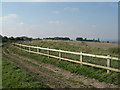
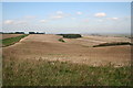
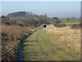
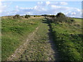
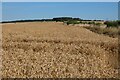
The above images may not be of the site on this page, they are loaded from Geograph.
Please Submit an Image of this site or go out and take one for us!
Click here to see more info for this site
Nearby sites
Key: Red: member's photo, Blue: 3rd party photo, Yellow: other image, Green: no photo - please go there and take one, Grey: site destroyed
Download sites to:
KML (Google Earth)
GPX (GPS waypoints)
CSV (Garmin/Navman)
CSV (Excel)
To unlock full downloads you need to sign up as a Contributory Member. Otherwise downloads are limited to 50 sites.
Turn off the page maps and other distractions
Nearby sites listing. In the following links * = Image available
751m ESE 121° Grim's Ditch 1 (Oxfordshire) Misc. Earthwork (SU41618374)
1.1km E 83° Yew Down Round Barrow Round Barrow(s) (SU42088426)
1.6km E 89° Yew Down Round Barrow(s) (SU42528416)
2.5km W 279° Segsbury Camp* Hillfort (SU385845)
2.9km ENE 73° Grim's Ditch 2 (Oxfordshire) Misc. Earthwork (SU43768499)
3.8km NNW 344° King Alfred's Well* Holy Well or Sacred Spring (SU399878)
3.9km SSW 196° South Fawley* Barrow Cemetery (SU39908039)
4.8km E 79° Skutchamer Knob* Round Barrow(s) (SU4565585038)
6.7km W 280° Sincombe Farm Bowl Barrow* Round Barrow(s) (SU34368521)
8.1km W 262° Lambourn Seven Barrows* Barrow Cemetery (SU32898288)
8.6km W 266° Lambourn Long Barrow* Long Barrow (SU32328338)
8.9km ENE 76° Mount Skippet* Round Barrow(s) (SU496864)
9.0km WNW 290° The Blowing Stone* Holed Stone (SU324871)
9.3km SSW 199° Great Shefford Churchyard Cross* Ancient Cross (SU380753)
9.4km WSW 252° Hangman's Stone - Upper Lambourn* Standing Stone (Menhir) (SU320812)
9.5km WNW 295° Fawler Modern Stone Circle* Modern Stone Circle etc (SU323880)
9.6km SSE 168° Hangman's Stone - Leckhampstead* Marker Stone (SU431748)
9.6km SSE 159° Leckhampstead Bowl Barrow Round Barrow(s) (SU44507518)
9.7km E 91° Churn Farm West* Round Barrow(s) (SU5070483990)
9.8km E 97° Fox Barrow* Round Barrow(s) (SU50718308)
9.8km WNW 283° Rams Hill* Causewayed Enclosure (SU314863)
9.8km WSW 238° Lambourn Market Cross* Ancient Cross (SU326789)
10.4km WSW 250° St Luke's Church Barrow Round Barrow(s) (SU31228042)
10.5km E 93° Churn Farm East* Round Barrow(s) (SU515837)
10.8km W 274° Idlebush Barrow* Ancient Village or Settlement (SU302848)
View more nearby sites and additional images


 We would like to know more about this location. Please feel free to add a brief description and any relevant information in your own language.
 Wir möchten mehr über diese Stätte erfahren. Bitte zögern Sie nicht, eine kurze Beschreibung und relevante Informationen in Deutsch hinzuzufügen.
 Nous aimerions en savoir encore un peu sur les lieux. S'il vous plaît n'hesitez pas à ajouter une courte description et tous les renseignements pertinents dans votre propre langue.
 Quisieramos informarnos un poco más de las lugares. No dude en añadir una breve descripción y otros datos relevantes en su propio idioma.