<< Our Photo Pages >> Hoar Stone at Enstone - Chambered Tomb in England in Oxfordshire
Submitted by Tom_Wilson on Thursday, 11 March 2021 Page Views: 28834
Neolithic and Bronze AgeSite Name: Hoar Stone at EnstoneCountry: England County: Oxfordshire Type: Chambered Tomb
Nearest Village: Enstone
Map Ref: SP37792375 Landranger Map Number: 164
Latitude: 51.911008N Longitude: 1.452041W
Condition:
| 5 | Perfect |
| 4 | Almost Perfect |
| 3 | Reasonable but with some damage |
| 2 | Ruined but still recognisable as an ancient site |
| 1 | Pretty much destroyed, possibly visible as crop marks |
| 0 | No data. |
| -1 | Completely destroyed |
| 5 | Superb |
| 4 | Good |
| 3 | Ordinary |
| 2 | Not Good |
| 1 | Awful |
| 0 | No data. |
| 5 | Can be driven to, probably with disabled access |
| 4 | Short walk on a footpath |
| 3 | Requiring a bit more of a walk |
| 2 | A long walk |
| 1 | In the middle of nowhere, a nightmare to find |
| 0 | No data. |
| 5 | co-ordinates taken by GPS or official recorded co-ordinates |
| 4 | co-ordinates scaled from a detailed map |
| 3 | co-ordinates scaled from a bad map |
| 2 | co-ordinates of the nearest village |
| 1 | co-ordinates of the nearest town |
| 0 | no data |
Internal Links:
External Links:
I have visited· I would like to visit
elad13 Hordernm would like to visit
poho visited on 19th Nov 2022 - their rating: Cond: 3 Amb: 4 Access: 5 The nearest long barrow to where I live, but have never been before. Quite atmospheric at dusk on an autumn evening with the sun setting to the west - it was easy to imagine it as a sacred site in the past.
BarryC visited on 21st Aug 2022 - their rating: Cond: 3 Amb: 4 Access: 5 Somehow, despite living relatively close by (<20 miles) I've never visited this site, having been put off by reports of it being "partially hidden in vegetation", "dark, hard to photograph" and similar. In the event, I found the site to be remarkably open, accessible, and more than light enough to explore and get good photographs. Perhaps I was lucky!
I found the site to be very tidy, only a couple of small pieces of "ritual litter" (no offence intended), and nil regular litter. Nobody else about, either, so I was able to just quietly explore and think about how the place might have been there - and around - in times long gone.
Richard13 visited on 25th May 2020 - their rating: Cond: 2 Amb: 4 Access: 5 This site sits directly adjacent to the road but is still extremely easy to miss amongst the trees unless you know the exact location. The huge megaliths still manage to impress and in my opinion this site much more atmospheric and imposing than the more famous Whsipering Knights at Rollright. Well worth the slight detour from Enstone on the A44.
SimonBlackmore visited on 25th Jan 2020 - their rating: Cond: 4 Amb: 4 Access: 4
Catrinm visited on 30th Sep 2017 - their rating: Cond: 3 Amb: 4 Access: 5
SteveC visited on 5th Jan 2010 - their rating: Cond: 3 Amb: 4 Access: 5
NickyD visited - their rating: Cond: 2 Amb: 3 Access: 5
Hodur visited - their rating: Cond: 4 Amb: 2 Access: 5
ChristopherJones visited - their rating: Cond: 2 Amb: 5 Access: 5 Huge, but could be possible to miss.
h_fenton hamish have visited here
Average ratings for this site from all visit loggers: Condition: 2.89 Ambience: 3.78 Access: 4.89

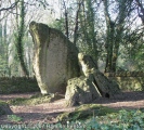
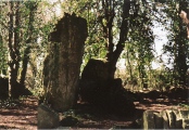
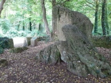
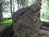
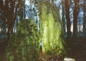
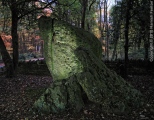
He thought it to be the remains of a dolmen, surrounded by earth, but until substantial excavation work occurs, it is impossible to tell. The present entrance to the site comes from the east. There are various pieces of curious folklore attached here. One of which its local names is the Old Soldier which, says Corbett (1962), "was supposed to go down to the village to drink on midsummer's eve. But (another)... version was that he wentto the brook at Woodford," north-north-east of here. The tale of the stones' journey through the village is important when seen in relation to the folklore described by Stuart (1987). She interviewed a local character by the name of 'Old Mont' who was a farmer and a shepard of these parts. Old Mont told her that the "The old aboriginies of these parts named us Enna's Stan after our ancient monument, the Hoar Stwun, still standing among the holly bushes at the top of Fulwell on the road to Charlbury. They stwun all of a yup is supposed to the burial chamber of an ancient King, thousands of years before the Romans; as his body is fabled to have been bourne from Ditchley direction all along the trail knowed for centuries as in Dead King's Rise or Dead Man's Riding. Our Hoar Stwun and the Whispering Knight's be the two oldest monuments in Oxfordshire."
Of considerable importance to this lore is Old Mont's reference to where the legendary King came from at Ditchley, a couple of miles due south. This is one of the two 'Leys' that have been distinctly identified meeting here. The other one travels east-west linking the Hawk Stone near Dean.Intriguingly, the ambler and dowser Laurence Main (1997) also thought "sacred pathways... meet here". Both of us would agree with him, but his dowsed 'leys' leave much to be desired. He describes finding three leys running through our Hoar Stone: one travelling west to Knollbury; another travelling due south to the hillfort at Eynshem Hall Park; and the other elsewhere. It appears that none of these lines exist- although we are willing to be proved wrong. Perhaps the oddest thing about these dowsed leys' is the writers inability to 'sense' the east-west and King leys.
Old Mont's tales demonstrate the importance of oral folk tradition. However this can change as we know. We find an example from Enstone village where a young lady said that the stones are the remains of an old man, his horse and dog, turned to stone, for reasons unknown. This element of petrification tion is found at many ancient sites around the Cotswolds, folklore also tells of a ghost that has been seen walking from the tomb, along the old road northwards into the village.
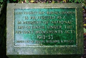
Although this site is under the protection of English Heritage, the place is falling into neglect and should be better preserved. Nevertheless, it is well worth visiting.
Text from the 1997 publication The Old Stones of Rollright and District (archive link) by Paul Bennett & Tom Wilson
You may be viewing yesterday's version of this page. To see the most up to date information please register for a free account.







These are just the first 25 photos of Hoar Stone at Enstone. If you log in with a free user account you will be able to see our entire collection.
Do not use the above information on other web sites or publications without permission of the contributor.
Click here to see more info for this site
Nearby sites
Key: Red: member's photo, Blue: 3rd party photo, Yellow: other image, Green: no photo - please go there and take one, Grey: site destroyed
Download sites to:
KML (Google Earth)
GPX (GPS waypoints)
CSV (Garmin/Navman)
CSV (Excel)
To unlock full downloads you need to sign up as a Contributory Member. Otherwise downloads are limited to 50 sites.
Turn off the page maps and other distractions
Nearby sites listing. In the following links * = Image available
2.5km SW 228° Thor Stone* Standing Stone (Menhir) (SP35932208)
2.6km SW 224° Thorsbrook Spring* Holy Well or Sacred Spring (SP360219)
2.9km S 170° Model Farm Ancient Village or Settlement (SP383209)
3.3km SE 134° Home Farm Ancient Village or Settlement (SP402215)
3.9km W 267° Hawk Stone* Standing Stone (Menhir) (SP33922354)
4.3km ESE 123° Grimsdyke Farm Ancient Village or Settlement (SP41402141)
4.6km SE 131° Out Wood & Berrings Wood Ancient Village or Settlement (SP413208)
5.0km SSW 200° Sturt Henge* Modern Stone Circle etc (SP36111899)
5.6km SSW 207° Cornbury Park Round Barrow(s) (SP35311878)
6.1km SE 132° Glympton Farm Ancient Village or Settlement (SP423197)
6.2km W 264° Knollbury Enclosure* Ancient Village or Settlement (SP316230)
6.9km NW 312° Druids Barrow Round Barrow(s) (SP32612835)
7.3km SE 138° Blenheim Great Park Ancient Village or Settlement (SP427183)
7.3km WNW 297° New Street Stone* Holed Stone (SP312270)
7.5km WNW 296° Serpent's Well (Chipping Norton) Holy Well or Sacred Spring (SP310270)
8.0km E 88° Hoar Stone at Barton* Long Barrow (SP458241)
8.2km WSW 254° Lyneham Camp* Hillfort (SP299214)
8.2km SW 231° Smallstones Farm Long Barrow (SP31411852)
8.3km SW 214° Churchill Copse* Long Barrow (SP33161685)
8.5km WSW 252° Lyneham Long Barrow* Long Barrow (SP29752107)
8.5km SSE 168° North Leigh Roman Villa* Ancient Village or Settlement (SP39661547)
8.6km WNW 283° Churchill Standing Stone* Standing Stone (Menhir) (SP29372568)
8.6km SW 224° High Lodge Tumuli Round Barrow(s) (SP318175)
8.7km SW 214° Slatepits Copse* Chambered Tomb (SP329165)
8.8km W 266° Old Vicarage* Standing Stone (Menhir) (SP290230)
View more nearby sites and additional images


 We would like to know more about this location. Please feel free to add a brief description and any relevant information in your own language.
 Wir möchten mehr über diese Stätte erfahren. Bitte zögern Sie nicht, eine kurze Beschreibung und relevante Informationen in Deutsch hinzuzufügen.
 Nous aimerions en savoir encore un peu sur les lieux. S'il vous plaît n'hesitez pas à ajouter une courte description et tous les renseignements pertinents dans votre propre langue.
 Quisieramos informarnos un poco más de las lugares. No dude en añadir una breve descripción y otros datos relevantes en su propio idioma.