


<< Text Pages >> Money Hills - Barrow Cemetery in England in Hampshire
Submitted by SolarMegalith on Friday, 14 October 2011 Page Views: 3848
Neolithic and Bronze AgeSite Name: Money HillsCountry: England County: Hampshire Type: Barrow Cemetery
Nearest Town: Southampton Nearest Village: Copythorne
Map Ref: SU31771505
Latitude: 50.934028N Longitude: 1.549265W
Condition:
| 5 | Perfect |
| 4 | Almost Perfect |
| 3 | Reasonable but with some damage |
| 2 | Ruined but still recognisable as an ancient site |
| 1 | Pretty much destroyed, possibly visible as crop marks |
| 0 | No data. |
| -1 | Completely destroyed |
| 5 | Superb |
| 4 | Good |
| 3 | Ordinary |
| 2 | Not Good |
| 1 | Awful |
| 0 | No data. |
| 5 | Can be driven to, probably with disabled access |
| 4 | Short walk on a footpath |
| 3 | Requiring a bit more of a walk |
| 2 | A long walk |
| 1 | In the middle of nowhere, a nightmare to find |
| 0 | No data. |
| 5 | co-ordinates taken by GPS or official recorded co-ordinates |
| 4 | co-ordinates scaled from a detailed map |
| 3 | co-ordinates scaled from a bad map |
| 2 | co-ordinates of the nearest village |
| 1 | co-ordinates of the nearest town |
| 0 | no data |
Internal Links:
External Links:
Barrow Cemetery in Hampshire
A Bronze Age barrow cemetery including 4 barrows (bowl barrows and bell barrows). The largest one is of 28 m diameter.
Read More at Pastscape.
You may be viewing yesterday's version of this page. To see the most up to date information please register for a free account.
Do not use the above information on other web sites or publications without permission of the contributor.
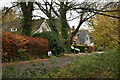
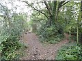
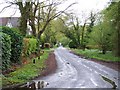
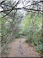
Nearby Images from Geograph Britain and Ireland:
©2020(licence)
©2015(licence)
©2010(licence)
©2015(licence)
©2015(licence)
The above images may not be of the site on this page, they are loaded from Geograph.
Please Submit an Image of this site or go out and take one for us!
Click here to see more info for this site
Nearby sites
Key: Red: member's photo, Blue: 3rd party photo, Yellow: other image, Green: no photo - please go there and take one, Grey: site destroyed
Download sites to:
KML (Google Earth)
GPX (GPS waypoints)
CSV (Garmin/Navman)
CSV (Excel)
To unlock full downloads you need to sign up as a Contributory Member. Otherwise downloads are limited to 50 sites.
Turn off the page maps and other distractions
Nearby sites listing. In the following links * = Image available
1.4km ESE 118° Tatchbury Mount* Hillfort (SU3300014400)
2.7km E 81° Testwood Lakes* Museum (SU344155)
3.4km WNW 287° Stagbury Hill* Barrow Cemetery (SU285160)
4.9km SW 234° Malwood Castle* Hillfort (SU2780012100)
5.2km NW 312° Plaitford Barrow* Round Barrow(s) (SU27901852)
6.8km SSE 165° Ashurst Lodge Earthworks* Misc. Earthwork (SU336085)
6.8km WNW 303° Landford Common Tumulus* Round Barrow(s) (SU260187)
7.0km W 276° Black Bush Plain* Barrow Cemetery (SU248157)
7.1km SSE 165° Matley Heath* Round Barrow(s) (SU336082)
7.1km SSW 195° New Forest Museum* Museum (SU30020813)
7.3km ENE 61° Toothill Camp* Hillfort (SU38151865)
7.5km W 261° Fritham Butt* Round Barrow(s) (SU244138)
7.6km WNW 295° Hamptworth Common Tumulus* Round Barrow(s) (SU248182)
8.0km N 357° Dunwood Camp* Hillfort (SU3130023000)
8.1km SSE 147° Longdown (New Forest) tumuli* Round Barrow(s) (SU363083)
8.6km N 7° Awbridge Hill Stone Circle* Modern Stone Circle etc (SU3275023550)
8.8km W 268° Irons Well (Eyeworth)* Holy Well or Sacred Spring (SU22931476)
9.0km ENE 79° Castle Hill (Southampton)* Misc. Earthwork (SU40571688)
9.4km W 262° Hiscocks Hill barrow* Round Barrow(s) (SU22481371)
9.4km SSE 155° Yew Tree Heath* Round Barrow(s) (SU3589506556)
9.5km NW 314° Earldoms earthwork Hillfort (SU2488721664)
9.7km E 79° Chilworth Ring* Hillfort (SU413170)
10.3km SE 139° Ipley Cross* Round Barrow(s) (SU38670735)
10.4km W 274° The Butts (Godshill)* Round Barrow(s) (SU21391565)
10.8km WNW 286° Jacob's Barrow* Round Barrow(s) (SU21321793)
View more nearby sites and additional images


 We would like to know more about this location. Please feel free to add a brief description and any relevant information in your own language.
 Wir möchten mehr über diese Stätte erfahren. Bitte zögern Sie nicht, eine kurze Beschreibung und relevante Informationen in Deutsch hinzuzufügen.
 Nous aimerions en savoir encore un peu sur les lieux. S'il vous plaît n'hesitez pas à ajouter une courte description et tous les renseignements pertinents dans votre propre langue.
 Quisieramos informarnos un poco más de las lugares. No dude en añadir una breve descripción y otros datos relevantes en su propio idioma.