<< Text Pages >> Seven Brideron - Stone Circle in England in Derbyshire
Submitted by Alastair_McIvor on Saturday, 13 July 2002 Page Views: 6215
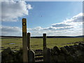
Neolithic and Bronze AgeSite Name: Seven BrideronCountry: England County: Derbyshire Type: Stone Circle
Nearest Town: Matlock
Map Ref: SK309639 Landranger Map Number: 119
Latitude: 53.171321N Longitude: 1.539201W
Condition:
| 5 | Perfect |
| 4 | Almost Perfect |
| 3 | Reasonable but with some damage |
| 2 | Ruined but still recognisable as an ancient site |
| 1 | Pretty much destroyed, possibly visible as crop marks |
| 0 | No data. |
| -1 | Completely destroyed |
| 5 | Superb |
| 4 | Good |
| 3 | Ordinary |
| 2 | Not Good |
| 1 | Awful |
| 0 | No data. |
| 5 | Can be driven to, probably with disabled access |
| 4 | Short walk on a footpath |
| 3 | Requiring a bit more of a walk |
| 2 | A long walk |
| 1 | In the middle of nowhere, a nightmare to find |
| 0 | No data. |
| 5 | co-ordinates taken by GPS or official recorded co-ordinates |
| 4 | co-ordinates scaled from a detailed map |
| 3 | co-ordinates scaled from a bad map |
| 2 | co-ordinates of the nearest village |
| 1 | co-ordinates of the nearest town |
| 0 | no data |
Internal Links:
External Links:
Stone Circle in Derbyshire
Once quite large but now destroyed. A watercolour of this circle from 1784 can be seen here.
You may be viewing yesterday's version of this page. To see the most up to date information please register for a free account.
Do not use the above information on other web sites or publications without permission of the contributor.
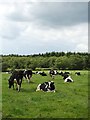
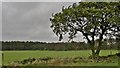
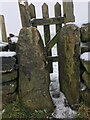
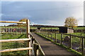
Nearby Images from Geograph Britain and Ireland:
©2014(licence)
©2014(licence)
©2021(licence)
©2021(licence)
©2010(licence)
The above images may not be of the site on this page, they are loaded from Geograph.
Please Submit an Image of this site or go out and take one for us!
Click here to see more info for this site
Nearby sites
Key: Red: member's photo, Blue: 3rd party photo, Yellow: other image, Green: no photo - please go there and take one, Grey: site destroyed
Download sites to:
KML (Google Earth)
GPX (GPS waypoints)
CSV (Garmin/Navman)
CSV (Excel)
To unlock full downloads you need to sign up as a Contributory Member. Otherwise downloads are limited to 50 sites.
![]()
Turn off the page maps and other distractions
Nearby sites listing. In the following links * = Image available
1.3km SW 227° Farley Moor Stone* Standing Stone (Menhir) (SK29966300)
1.8km SSE 164° Cuckoo Stone (Derbyshire)* Natural Stone / Erratic / Other Natural Feature (SK314622)
3.0km NW 308° Woodbrook Quarry Stone Circle (SK28496573)
3.8km WNW 304° Fallinge Edge* Ring Cairn (SK277660)
3.9km E 99° Ashover School* Rock Art (SK348633)
4.1km NW 316° Beeley Triple Cairn* Ring Cairn (SK2800366824)
4.3km WSW 258° St Helen’s Church (Darley Dale)* Carving (SK26676298)
4.5km NNW 328° Beeley Moor South* Ring Cairn (SK285677)
4.5km NNW 328° Beeley Moor North Ring Cairn (SK285677)
4.5km N 5° Longside Moor* Cairn (SK313684)
4.9km NNE 14° Holymoorside* Rock Art (SK321687)
5.0km NNW 342° Harland Edge* Ring Cairn (SK293686)
5.4km NNW 329° Park Gate* Stone Circle (SK2804868513)
5.6km NW 326° Beeley Moor Bronze Age Enclosure* Misc. Earthwork (SK27756850)
5.6km W 264° Cat Stone* Rock Outcrop (SK253633)
5.7km NNW 328° Beeley Warren 1 Ring Cairn (SK278687)
5.7km NNW 338° Hob Hurst's House* Round Barrow(s) (SK28746923)
5.8km W 265° Stanton Moor Cairn T57* Cairn (SK25136331)
5.8km SSE 148° Dethick Moor* Stone Circle (SK3459)
5.8km NNW 329° Beeley Warren 2 Ring Cairn (SK279689)
5.9km W 261° Gorse Stone* Rock Outcrop (SK251629)
6.0km W 268° Stanton Moor 1* Stone Circle (SK249637)
6.0km W 266° Nine Ladies* Stone Circle (SK24916349)
6.0km W 266° The King (Stanton Moor)* Standing Stone (Menhir) (SK24876347)
6.0km N 354° Rodknoll Cairn (SK302699)
View more nearby sites and additional images


 We would like to know more about this location. Please feel free to add a brief description and any relevant information in your own language.
 Wir möchten mehr über diese Stätte erfahren. Bitte zögern Sie nicht, eine kurze Beschreibung und relevante Informationen in Deutsch hinzuzufügen.
 Nous aimerions en savoir encore un peu sur les lieux. S'il vous plaît n'hesitez pas à ajouter une courte description et tous les renseignements pertinents dans votre propre langue.
 Quisieramos informarnos un poco más de las lugares. No dude en añadir una breve descripción y otros datos relevantes en su propio idioma.