


<< Our Photo Pages >> Churchill Standing Stone - Standing Stone (Menhir) in England in Oxfordshire
Submitted by baz on Thursday, 03 June 2004 Page Views: 13243
Neolithic and Bronze AgeSite Name: Churchill Standing Stone Alternative Name: Boulter's Barn StoneCountry: England County: Oxfordshire Type: Standing Stone (Menhir)
Nearest Town: Chipping Norton Nearest Village: Churchill
Map Ref: SP29372568 Landranger Map Number: 164
Latitude: 51.928865N Longitude: 1.574277W
Condition:
| 5 | Perfect |
| 4 | Almost Perfect |
| 3 | Reasonable but with some damage |
| 2 | Ruined but still recognisable as an ancient site |
| 1 | Pretty much destroyed, possibly visible as crop marks |
| 0 | No data. |
| -1 | Completely destroyed |
| 5 | Superb |
| 4 | Good |
| 3 | Ordinary |
| 2 | Not Good |
| 1 | Awful |
| 0 | No data. |
| 5 | Can be driven to, probably with disabled access |
| 4 | Short walk on a footpath |
| 3 | Requiring a bit more of a walk |
| 2 | A long walk |
| 1 | In the middle of nowhere, a nightmare to find |
| 0 | No data. |
| 5 | co-ordinates taken by GPS or official recorded co-ordinates |
| 4 | co-ordinates scaled from a detailed map |
| 3 | co-ordinates scaled from a bad map |
| 2 | co-ordinates of the nearest village |
| 1 | co-ordinates of the nearest town |
| 0 | no data |
Internal Links:
External Links:
I have visited· I would like to visit
ChristopherJones visited - their rating: Cond: 4 Amb: 5 Access: 5 Very hidden, so looking for this whilst driving would be almost impossible, especially before the hedge is trimmed.
h_fenton have visited here
")
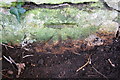
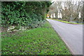
This stone stands in the northern road-side hedge on the B4450, half-way between Churchill and Chipping Norton. It's often quite difficult to find, being hidden within the hedge; however, on my visit the hedge had recently been cut, freeing the stone from its usual covering. Unfortunately, the stone had been trimmed, too. If this is an annual event, then I fear that the Churchill Standing Stone is slowly being reduced in size.
Update April 2007: Information on this stone can be found on Pastscape Monument No. 332495, which say that: "The 'Churchill Stone' (name not used locally), stands upright on the N side of the Chipping Norton to Churchill road which runs nearly half-way down a gently NNW facing slope, and not in a prominent position. It is a very weathered oolitic block, on average 0.5m by 0.3m and 1.5m high. There are no traces of tool-marks on the surface. It is not in association with any known prehistoric site, neither can its relationship to the road be determined. The stone does not seem to be associated with any local tradition or folklore; its antiquity is unproven."
The stone also features on The Northern Antiquarian, see their page for Boulter's Barn Stone, Churchill, Oxfordshire, where they give details on how to reach the stone together with a brief archaeology and history.
You may be viewing yesterday's version of this page. To see the most up to date information please register for a free account.
")
")
Do not use the above information on other web sites or publications without permission of the contributor.
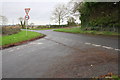
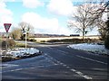
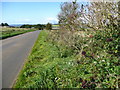
Nearby Images from Geograph Britain and Ireland:
©2014(licence)
©2010(licence)
©2008(licence)
©2014(licence)
©2014(licence)
The above images may not be of the site on this page, they are loaded from Geograph.
Please Submit an Image of this site or go out and take one for us!
Click here to see more info for this site
Nearby sites
Key: Red: member's photo, Blue: 3rd party photo, Yellow: other image, Green: no photo - please go there and take one, Grey: site destroyed
Download sites to:
KML (Google Earth)
GPX (GPS waypoints)
CSV (Garmin/Navman)
CSV (Excel)
To unlock full downloads you need to sign up as a Contributory Member. Otherwise downloads are limited to 50 sites.
Turn off the page maps and other distractions
Nearby sites listing. In the following links * = Image available
1.9km SSW 212° Churchill* Stone Circle (SP284241)
2.1km NE 51° Serpent's Well (Chipping Norton) Holy Well or Sacred Spring (SP310270)
2.3km NE 54° New Street Stone* Holed Stone (SP312270)
2.4km NNW 345° Salford Wayside Cross* Ancient Cross (SP2872927960)
2.5km NNW 343° Salford Cross Cup Marks (Salford)* Ancient Cross (SP2864428058)
2.7km S 188° Old Vicarage* Standing Stone (Menhir) (SP290230)
3.5km SE 141° Knollbury Enclosure* Ancient Village or Settlement (SP316230)
3.9km NW 316° Burnt Hill barrow* Long Barrow (SP26602850)
4.0km NW 318° Burnt Hill Dolmen* Burial Chamber or Dolmen (SP26672865)
4.2km NE 51° Druids Barrow Round Barrow(s) (SP32612835)
4.3km NW 306° Chastleton Camp* Hillfort (SP259282)
4.3km S 173° Lyneham Camp* Hillfort (SP299214)
4.4km N 0° Little Rollright Churchyard Cross* Ancient Cross (SP2935230116)
4.4km NW 305° Barrow Hill (Oxfordshire) Standing Stone (Menhir) (SP257282)
4.6km S 176° Lyneham Long Barrow* Long Barrow (SP29752107)
4.8km WNW 303° Adlestrop Hill* Long Barrow (SP25362827)
4.8km WNW 302° Adlestrop Hill (round) Round Barrow(s) (SP253282)
4.9km NW 308° Goose Stones* Standing Stone (Menhir) (SP255287)
5.0km ESE 116° Hawk Stone* Standing Stone (Menhir) (SP3392023540)
5.2km N 7° Whispering Knights* Portal Tomb (SP29933084)
5.2km N 3° Rollright Stones* Stone Circle (SP29583087)
5.2km N 1° Gough's Barrow (Long Compton) Cairn (SP29463090)
5.3km N 3° King Stone at the Rollrights* Standing Stone (Menhir) (SP2962030950)
5.3km N 3° King Stone Round Cairn* Cairn (SP2961430968)
7.4km SSE 164° Smallstones Farm Long Barrow (SP31411852)
View more nearby sites and additional images


 We would like to know more about this location. Please feel free to add a brief description and any relevant information in your own language.
 Wir möchten mehr über diese Stätte erfahren. Bitte zögern Sie nicht, eine kurze Beschreibung und relevante Informationen in Deutsch hinzuzufügen.
 Nous aimerions en savoir encore un peu sur les lieux. S'il vous plaît n'hesitez pas à ajouter une courte description et tous les renseignements pertinents dans votre propre langue.
 Quisieramos informarnos un poco más de las lugares. No dude en añadir una breve descripción y otros datos relevantes en su propio idioma.