

<< Our Photo Pages >> Chastleton Camp - Hillfort in England in Oxfordshire
Submitted by vicky on Tuesday, 03 December 2002 Page Views: 12222
Iron Age and Later PrehistorySite Name: Chastleton CampCountry: England County: Oxfordshire Type: Hillfort
Nearest Village: Chastleton
Map Ref: SP259282 Landranger Map Number: 163
Latitude: 51.951693N Longitude: 1.624552W
Condition:
| 5 | Perfect |
| 4 | Almost Perfect |
| 3 | Reasonable but with some damage |
| 2 | Ruined but still recognisable as an ancient site |
| 1 | Pretty much destroyed, possibly visible as crop marks |
| 0 | No data. |
| -1 | Completely destroyed |
| 5 | Superb |
| 4 | Good |
| 3 | Ordinary |
| 2 | Not Good |
| 1 | Awful |
| 0 | No data. |
| 5 | Can be driven to, probably with disabled access |
| 4 | Short walk on a footpath |
| 3 | Requiring a bit more of a walk |
| 2 | A long walk |
| 1 | In the middle of nowhere, a nightmare to find |
| 0 | No data. |
| 5 | co-ordinates taken by GPS or official recorded co-ordinates |
| 4 | co-ordinates scaled from a detailed map |
| 3 | co-ordinates scaled from a bad map |
| 2 | co-ordinates of the nearest village |
| 1 | co-ordinates of the nearest town |
| 0 | no data |
Internal Links:
External Links:
I have visited· I would like to visit
poho visited on 29th Dec 2022 - their rating: Cond: 4 Amb: 4 Access: 4 Visited as part of a walk. Used as a field for horses currently, but the circular ditch and bank is still present and easy to see.
Hordernm visited on 31st Jul 2020 - their rating: Cond: 2 Amb: 4 Access: 3
4clydesdale7 visited on 8th Apr 2012 - their rating: Cond: 3 Amb: 4 Access: 4 I am intrigued as to why this is also called 'Chastleton Barrow' - could 'Barrow' be a corruption of 'Bury' (in the local dialect where there 'y' is not pronounced) - and it is still populated by horses -
ChristopherJones visited - their rating: Amb: 5 Access: 3 Found it on a footpath on the search for Goose stones.
h_fenton have visited here
Average ratings for this site from all visit loggers: Condition: 3 Ambience: 4.25 Access: 3.5
")
Have you visited this site? Please add a comment below.
You may be viewing yesterday's version of this page. To see the most up to date information please register for a free account.
")
")
")
")
")
")
Do not use the above information on other web sites or publications without permission of the contributor.
Click here to see more info for this site
Nearby sites
Key: Red: member's photo, Blue: 3rd party photo, Yellow: other image, Green: no photo - please go there and take one, Grey: site destroyed
Download sites to:
KML (Google Earth)
GPX (GPS waypoints)
CSV (Garmin/Navman)
CSV (Excel)
To unlock full downloads you need to sign up as a Contributory Member. Otherwise downloads are limited to 50 sites.
Turn off the page maps and other distractions
Nearby sites listing. In the following links * = Image available
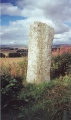
199m W 270° Barrow Hill (Oxfordshire) Standing Stone (Menhir) (SP257282)
543m W 278° Adlestrop Hill* Long Barrow (SP25362827)
598m W 270° Adlestrop Hill (round) Round Barrow(s) (SP253282)
640m NW 322° Goose Stones* Standing Stone (Menhir) (SP255287)
760m ENE 67° Burnt Hill barrow* Long Barrow (SP26602850)
890m ENE 60° Burnt Hill Dolmen* Burial Chamber or Dolmen (SP26672865)
2.7km E 93° Salford Cross Cup Marks (Salford) Ancient Cross (SP2864428058)
4.3km SE 126° Churchill Standing Stone* Standing Stone (Menhir) (SP29372568)
4.5km NE 53° Gough's Barrow (Long Compton) Cairn (SP29463090)
4.5km NE 54° Rollright Stones* Stone Circle (SP29583087)
4.6km NE 54° King Stone at the Rollrights* Standing Stone (Menhir) (SP29623095)
4.6km NE 54° King Stone Round Cairn* Cairn (SP2961430968)
4.8km SSE 149° Churchill* Stone Circle (SP284241)
4.8km ENE 57° Whispering Knights* Portal Tomb (SP29933084)
5.2km ESE 104° Serpent's Well (Chipping Norton) Holy Well or Sacred Spring (SP310270)
5.4km ESE 103° New Street Stone* Holed Stone (SP312270)
6.0km SSE 150° Old Vicarage* Standing Stone (Menhir) (SP290230)
6.7km E 89° Druids Barrow Round Barrow(s) (SP32612835)
6.8km WSW 251° Stow Camp* Hillfort (SP19442595)
6.9km W 260° Broadwell Chambered Tomb (SP191270)
6.9km WSW 252° St Edwards (Stow Well) Well* Holy Well or Sacred Spring (SP1931126039)
7.3km NW 311° Batsford Camp* Ancient Village or Settlement (SP2038932974)
7.5km SW 228° Icomb Camp* Hillfort (SP20352315)
7.7km SE 133° Knollbury Enclosure* Ancient Village or Settlement (SP316230)
7.7km WSW 242° St Edwards well* Holy Well or Sacred Spring (SP191245)
View more nearby sites and additional images


 We would like to know more about this location. Please feel free to add a brief description and any relevant information in your own language.
 Wir möchten mehr über diese Stätte erfahren. Bitte zögern Sie nicht, eine kurze Beschreibung und relevante Informationen in Deutsch hinzuzufügen.
 Nous aimerions en savoir encore un peu sur les lieux. S'il vous plaît n'hesitez pas à ajouter une courte description et tous les renseignements pertinents dans votre propre langue.
 Quisieramos informarnos un poco más de las lugares. No dude en añadir una breve descripción y otros datos relevantes en su propio idioma.