


<< Text Pages >> Moot Lowe - Round Barrow(s) in England in Derbyshire
Submitted by coldrum on Tuesday, 25 October 2011 Page Views: 2403
Neolithic and Bronze AgeSite Name: Moot LoweCountry: England County: Derbyshire Type: Round Barrow(s)
Map Ref: SK23935656
Latitude: 53.105701N Longitude: 1.644013W
Condition:
| 5 | Perfect |
| 4 | Almost Perfect |
| 3 | Reasonable but with some damage |
| 2 | Ruined but still recognisable as an ancient site |
| 1 | Pretty much destroyed, possibly visible as crop marks |
| 0 | No data. |
| -1 | Completely destroyed |
| 5 | Superb |
| 4 | Good |
| 3 | Ordinary |
| 2 | Not Good |
| 1 | Awful |
| 0 | No data. |
| 5 | Can be driven to, probably with disabled access |
| 4 | Short walk on a footpath |
| 3 | Requiring a bit more of a walk |
| 2 | A long walk |
| 1 | In the middle of nowhere, a nightmare to find |
| 0 | No data. |
| 5 | co-ordinates taken by GPS or official recorded co-ordinates |
| 4 | co-ordinates scaled from a detailed map |
| 3 | co-ordinates scaled from a bad map |
| 2 | co-ordinates of the nearest village |
| 1 | co-ordinates of the nearest town |
| 0 | no data |
Be the first person to rate this site - see the 'Contribute!' box in the right hand menu.
Internal Links:
External Links:
Round Barrow(s) in Derbyshire
"Two Bronze Age round barrows are visible as earthworks on air photographs. Remnants of both features appear to be still extant on Google Earth 30th April 2007 imagery (accessed on 21st January 2010). 2 tumuli both called 'Moot Lowe'."
Read More at Pastscape.
You may be viewing yesterday's version of this page. To see the most up to date information please register for a free account.
Do not use the above information on other web sites or publications without permission of the contributor.
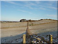
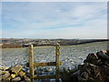
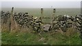
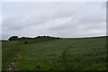
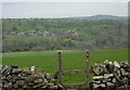
Nearby Images from Geograph Britain and Ireland:
©2009(licence)
©2009(licence)
©2012(licence)
©2017(licence)
©2011(licence)
The above images may not be of the site on this page, they are loaded from Geograph.
Please Submit an Image of this site or go out and take one for us!
Click here to see more info for this site
Nearby sites
Key: Red: member's photo, Blue: 3rd party photo, Yellow: other image, Green: no photo - please go there and take one, Grey: site destroyed
Download sites to:
KML (Google Earth)
GPX (GPS waypoints)
CSV (Garmin/Navman)
CSV (Excel)
To unlock full downloads you need to sign up as a Contributory Member. Otherwise downloads are limited to 50 sites.
Turn off the page maps and other distractions
Nearby sites listing. In the following links * = Image available
629m SW 223° Curzon Lodge Ancient Village or Settlement (SK235561)
1.4km S 169° Harborough Cave* Cave or Rock Shelter (SK242552)
1.4km SSE 166° Harborough Rocks* Ancient Village or Settlement (SK2427455185)
1.6km NNW 333° Green Low (Aldwark)* Chambered Cairn (SK232580)
1.7km S 182° Round Low (Brassington)* Round Barrow(s) (SK2388854905)
1.8km SW 227° Rains Cave Cave or Rock Shelter (SK226553)
2.1km ESE 123° Round Low (Hopton) Round Barrow(s) (SK2572955426)
2.1km W 269° Galley Low* Round Barrow(s) (SK218565)
2.4km WNW 302° Stoney Low* Chambered Cairn (SK21855784)
2.5km SW 225° Rainster Rocks* Ancient Village or Settlement (SK222548)
2.7km WNW 289° Rockhurst Long Barrow (SK214574)
2.7km SSW 200° Brassington Moor Stone Circle (SK230540)
2.9km S 176° Carsington Pasture* Cave or Rock Shelter (SK24155368)
2.9km NE 46° Horsedale Standing Stone* Standing Stone (Menhir) (SK2601558596)
3.0km SW 220° 'Pasture Lane' rock* Natural Stone / Erratic / Other Natural Feature (SK2202654298)
3.0km SE 137° Ivet Low* Round Barrow(s) (SK2596254396)
3.1km WNW 284° Minning Low* Round Cairn (SK2093557290)
3.5km W 269° Roystone Grange 2 Round Barrow(s) (SK204565)
3.6km W 279° Roystone Grange 1 Round Barrow(s) (SK204571)
3.8km WSW 237° 'Cow Close Farm' standing stone* Marker Stone (SK2072654460)
4.2km SE 124° The Bradstone* Standing Stone (Menhir) (SK2740054207)
4.3km S 188° The Stoup* Standing Stone (Menhir) (SK2335852257)
4.7km SW 221° Bradbourne Stone* Standing Stone (Menhir) (SK209530)
4.9km ESE 117° Stardisc Wirksworth* Modern Stone Circle etc (SK2835654381)
5.0km SW 219° All Saints (Bradbourne)* Ancient Cross (SK2082052660)
View more nearby sites and additional images


 We would like to know more about this location. Please feel free to add a brief description and any relevant information in your own language.
 Wir möchten mehr über diese Stätte erfahren. Bitte zögern Sie nicht, eine kurze Beschreibung und relevante Informationen in Deutsch hinzuzufügen.
 Nous aimerions en savoir encore un peu sur les lieux. S'il vous plaît n'hesitez pas à ajouter une courte description et tous les renseignements pertinents dans votre propre langue.
 Quisieramos informarnos un poco más de las lugares. No dude en añadir una breve descripción y otros datos relevantes en su propio idioma.