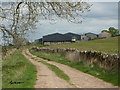
<< Other Photo Pages >> Stoney Low - Chambered Cairn in England in Derbyshire
Submitted by vicky on Wednesday, 18 September 2002 Page Views: 5886
Neolithic and Bronze AgeSite Name: Stoney LowCountry: England County: Derbyshire Type: Chambered Cairn
Nearest Town: Matlock Nearest Village: Aldwark
Map Ref: SK21855784 Landranger Map Number: 119
Latitude: 53.117295N Longitude: 1.674994W
Condition:
| 5 | Perfect |
| 4 | Almost Perfect |
| 3 | Reasonable but with some damage |
| 2 | Ruined but still recognisable as an ancient site |
| 1 | Pretty much destroyed, possibly visible as crop marks |
| 0 | No data. |
| -1 | Completely destroyed |
| 5 | Superb |
| 4 | Good |
| 3 | Ordinary |
| 2 | Not Good |
| 1 | Awful |
| 0 | No data. |
| 5 | Can be driven to, probably with disabled access |
| 4 | Short walk on a footpath |
| 3 | Requiring a bit more of a walk |
| 2 | A long walk |
| 1 | In the middle of nowhere, a nightmare to find |
| 0 | No data. |
| 5 | co-ordinates taken by GPS or official recorded co-ordinates |
| 4 | co-ordinates scaled from a detailed map |
| 3 | co-ordinates scaled from a bad map |
| 2 | co-ordinates of the nearest village |
| 1 | co-ordinates of the nearest town |
| 0 | no data |
Internal Links:
External Links:
Chambered Cairn in Derbyshire
"Remains of a round cairn, possibly a chambered tomb comprising a circular mound incorporating megalithic "cist"-like chambers." - Pastscape monument no. 310779.
You may be viewing yesterday's version of this page. To see the most up to date information please register for a free account.
Do not use the above information on other web sites or publications without permission of the contributor.
coldrum has found this location on Google Street View:
Nearby Images from Geograph Britain and Ireland:
©2008(licence)
©2009(licence)
©2009(licence)
©2011(licence)
©2011(licence)
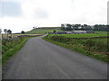
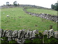
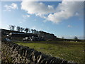
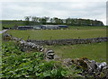
The above images may not be of the site on this page, they are loaded from Geograph.
Please Submit an Image of this site or go out and take one for us!
Click here to see more info for this site
Nearby sites
Key: Red: member's photo, Blue: 3rd party photo, Yellow: other image, Green: no photo - please go there and take one, Grey: site destroyed
Download sites to:
KML (Google Earth)
GPX (GPS waypoints)
CSV (Garmin/Navman)
CSV (Excel)
To unlock full downloads you need to sign up as a Contributory Member. Otherwise downloads are limited to 50 sites.
Turn off the page maps and other distractions
Nearby sites listing. In the following links * = Image available
628m SW 226° Rockhurst Long Barrow (SK214574)
1.1km WSW 239° Minning Low* Round Cairn (SK2093557290)
1.3km S 182° Galley Low* Round Barrow(s) (SK218565)
1.4km E 83° Green Low (Aldwark)* Chambered Cairn (SK232580)
1.6km WSW 243° Roystone Grange 1 Round Barrow(s) (SK204571)
2.0km SW 227° Roystone Grange 2 Round Barrow(s) (SK204565)
2.4km SE 137° Curzon Lodge Ancient Village or Settlement (SK235561)
2.4km ESE 122° Moot Lowe Round Barrow(s) (SK23935656)
2.6km SSE 164° Rains Cave Cave or Rock Shelter (SK226553)
3.1km S 174° Rainster Rocks* Ancient Village or Settlement (SK222548)
3.5km SE 139° Harborough Cave* Cave or Rock Shelter (SK242552)
3.6km SE 146° Round Low (Brassington)* Round Barrow(s) (SK2388854905)
3.6km SE 138° Harborough Rocks* Ancient Village or Settlement (SK2427455185)
3.6km NW 326° Borther Lowe Round Barrow(s) (SK1980260803)
3.7km NW 311° Sites of Meaning Marker Stone, Long Dale* Modern Stone Circle etc (SK1906060254)
4.0km SSE 164° Brassington Moor Stone Circle (SK230540)
4.2km N 8° Dudwood* Stone Circle (SK224620)
4.2km E 80° Horsedale Standing Stone* Standing Stone (Menhir) (SK2601558596)
4.3km NW 314° Smerril Moor Chambered Cairn (SK187608)
4.3km WSW 238° Foufinside stones* Standing Stones (SK1818655507)
4.4km NNE 18° Rockingstone Farm* Rock Outcrop (SK2322062065)
4.5km N 8° Robin Hood's Stride* Rock Art (SK22476225)
4.5km N 11° Cratcliff Rocks* Hillfort (SK227623)
4.6km ESE 122° Round Low (Hopton) Round Barrow(s) (SK2572955426)
4.6km NNE 22° St Michael’s Church (Birchover)* Carving (SK23576210)
View more nearby sites and additional images


 We would like to know more about this location. Please feel free to add a brief description and any relevant information in your own language.
 Wir möchten mehr über diese Stätte erfahren. Bitte zögern Sie nicht, eine kurze Beschreibung und relevante Informationen in Deutsch hinzuzufügen.
 Nous aimerions en savoir encore un peu sur les lieux. S'il vous plaît n'hesitez pas à ajouter une courte description et tous les renseignements pertinents dans votre propre langue.
 Quisieramos informarnos un poco más de las lugares. No dude en añadir una breve descripción y otros datos relevantes en su propio idioma.