


<< Our Photo Pages >> Jacob's Barrow - Round Barrow(s) in England in Hampshire
Submitted by JimChampion on Monday, 29 May 2006 Page Views: 7132
Neolithic and Bronze AgeSite Name: Jacob's Barrow Alternative Name: Jacobs barrowCountry: England County: Hampshire Type: Round Barrow(s)
Nearest Town: Downton Nearest Village: Lover
Map Ref: SU21321793
Latitude: 50.960405N Longitude: 1.697804W
Condition:
| 5 | Perfect |
| 4 | Almost Perfect |
| 3 | Reasonable but with some damage |
| 2 | Ruined but still recognisable as an ancient site |
| 1 | Pretty much destroyed, possibly visible as crop marks |
| 0 | No data. |
| -1 | Completely destroyed |
| 5 | Superb |
| 4 | Good |
| 3 | Ordinary |
| 2 | Not Good |
| 1 | Awful |
| 0 | No data. |
| 5 | Can be driven to, probably with disabled access |
| 4 | Short walk on a footpath |
| 3 | Requiring a bit more of a walk |
| 2 | A long walk |
| 1 | In the middle of nowhere, a nightmare to find |
| 0 | No data. |
| 5 | co-ordinates taken by GPS or official recorded co-ordinates |
| 4 | co-ordinates scaled from a detailed map |
| 3 | co-ordinates scaled from a bad map |
| 2 | co-ordinates of the nearest village |
| 1 | co-ordinates of the nearest town |
| 0 | no data |
Internal Links:
External Links:
I have visited· I would like to visit
JimChampion has visited here
")
English Heritage's Pastscape database says that Jacob's Barrow is a bowl barrow 13m in diameter and 0.7m high, without any traces of a surrounding ditch, and partly mutilated on its northeast side by a boundary bank [source].
This is in conflict with the Hampshire Treasures online resource which says that there are two bowl barrows south of Windyeats Farm, one of which is as described above, and the other - which it calls Jacob's barrow - is 18m in diameter and 1m high, without a ditch [source].
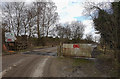
The mutilated barrow is marked on the 1:25000 Ordnance Survey map, although a closer look on the MAGIC map (click on the "i" icon above) shows a mound on the NE side of the fence inside and nothing on the actual boundary. The barrow on the boundary seems to have been used in the past as a boundary marker in a relatively featureless part of the open New Forest - it is the place where the three parishes of Godshill (Hampshire), Hale (Hampshire) and Redlynch (Wiltshire) meet. The area that it is in is called Golden Cross, referring to a crossing of ancient trackways here [source].
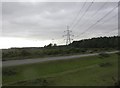
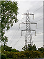
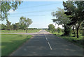
Access The barrow is (or barrows are?) on the boundary of the New Forest less than 100m SE of the entrance to Pound Bottom quarry and landfill site, beneath the 400kV power lines. Don't park on the verge of the B3080, instead use the Forestry Commission's Turf Hill car park at grid reference SU211176.
You may be viewing yesterday's version of this page. To see the most up to date information please register for a free account.
")
Do not use the above information on other web sites or publications without permission of the contributor.
coldrum has found this location on Google Street View:
Nearby Images from Geograph Britain and Ireland:
©2010(licence)
©2006(licence)
©2012(licence)

©2013(licence)
©2017(licence)
The above images may not be of the site on this page, they are loaded from Geograph.
Please Submit an Image of this site or go out and take one for us!
Click here to see more info for this site
Nearby sites
Key: Red: member's photo, Blue: 3rd party photo, Yellow: other image, Green: no photo - please go there and take one, Grey: site destroyed
Download sites to:
KML (Google Earth)
GPX (GPS waypoints)
CSV (Garmin/Navman)
CSV (Excel)
To unlock full downloads you need to sign up as a Contributory Member. Otherwise downloads are limited to 50 sites.
Turn off the page maps and other distractions
Nearby sites listing. In the following links * = Image available
2.3km S 178° The Butts (Godshill)* Round Barrow(s) (SU21391565)
3.5km E 86° Hamptworth Common Tumulus* Round Barrow(s) (SU248182)
3.6km SSE 153° Irons Well (Eyeworth)* Holy Well or Sacred Spring (SU22931476)
3.7km S 191° Ashley Cross tumuli* Round Barrow(s) (SU20641431)
4.0km SSW 199° Ashley Walk mound* Artificial Mound (SU20041413)
4.1km NNW 345° Templeman's Tumulus* Artificial Mound (SU202219)
4.1km ESE 123° Black Bush Plain* Barrow Cemetery (SU248157)
4.4km SSE 165° Hiscocks Hill barrow* Round Barrow(s) (SU22481371)
4.7km E 81° Landford Common Tumulus* Round Barrow(s) (SU260187)
5.1km SE 144° Fritham Butt* Round Barrow(s) (SU244138)
5.2km NE 44° Earldoms earthwork Hillfort (SU2488721664)
5.4km WSW 240° Frankenbury* Hillfort (SU167152)
6.6km E 85° Plaitford Barrow* Round Barrow(s) (SU27901852)
6.9km NW 314° Giant's Chair (Downton)* Round Barrow(s) (SU1627422705)
7.3km NW 314° Giant's Grave (Downton)* Long Barrow (SU16102300)
7.4km ESE 105° Stagbury Hill* Barrow Cemetery (SU285160)
7.5km WNW 288° Breamore Miz-Maze* Maze or Labyrinth (SU1412520266)
7.8km WNW 286° Giants Grave (Breamore)* Long Barrow (SU138200)
8.2km SW 217° Gorley Hill* Hillfort (SU164113)
8.4km SSW 210° Ibsley Common barrows* Barrow Cemetery (SU172106)
8.4km WNW 294° Gallows Hill (Downton) Round Barrow(s) (SU13592136)
8.7km SE 132° Malwood Castle* Hillfort (SU2780012100)
8.8km W 281° Whitsbury* Hillfort (SU127196)
8.9km NW 317° Clearbury Ring* Hillfort (SU152244)
9.0km NNE 27° Whiteparish 3 Bowl Barrow Round Barrow(s) (SU25312597)
View more nearby sites and additional images


 We would like to know more about this location. Please feel free to add a brief description and any relevant information in your own language.
 Wir möchten mehr über diese Stätte erfahren. Bitte zögern Sie nicht, eine kurze Beschreibung und relevante Informationen in Deutsch hinzuzufügen.
 Nous aimerions en savoir encore un peu sur les lieux. S'il vous plaît n'hesitez pas à ajouter une courte description et tous les renseignements pertinents dans votre propre langue.
 Quisieramos informarnos un poco más de las lugares. No dude en añadir una breve descripción y otros datos relevantes en su propio idioma.