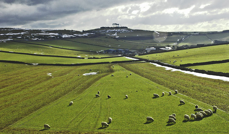
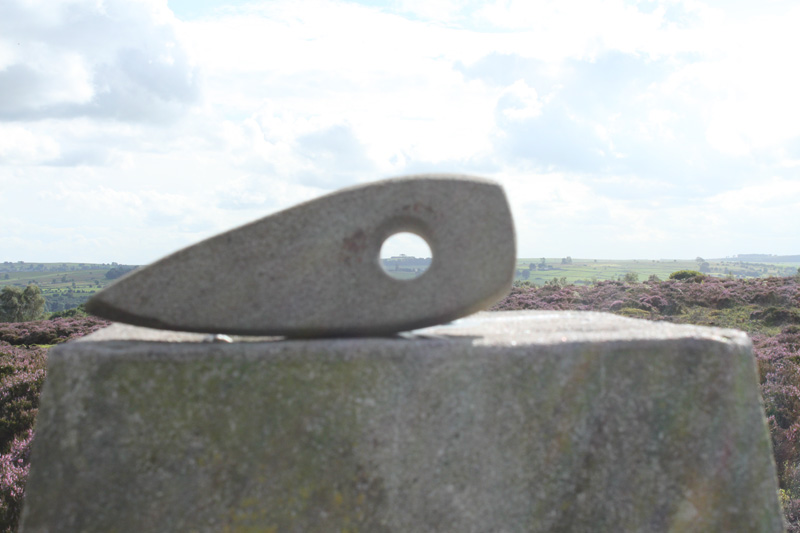
<< Our Photo Pages >> Minning Low - Round Cairn in England in Derbyshire
Submitted by Andy B on Friday, 20 January 2017 Page Views: 34446
Neolithic and Bronze AgeSite Name: Minning Low Alternative Name: Minninglow; Roystone CairnCountry: England County: Derbyshire Type: Round Cairn
Nearest Town: Ashbourne Nearest Village: Parwich
Map Ref: SK2093557290 Landranger Map Number: 119
Latitude: 53.112388N Longitude: 1.688701W
Condition:
| 5 | Perfect |
| 4 | Almost Perfect |
| 3 | Reasonable but with some damage |
| 2 | Ruined but still recognisable as an ancient site |
| 1 | Pretty much destroyed, possibly visible as crop marks |
| 0 | No data. |
| -1 | Completely destroyed |
| 5 | Superb |
| 4 | Good |
| 3 | Ordinary |
| 2 | Not Good |
| 1 | Awful |
| 0 | No data. |
| 5 | Can be driven to, probably with disabled access |
| 4 | Short walk on a footpath |
| 3 | Requiring a bit more of a walk |
| 2 | A long walk |
| 1 | In the middle of nowhere, a nightmare to find |
| 0 | No data. |
| 5 | co-ordinates taken by GPS or official recorded co-ordinates |
| 4 | co-ordinates scaled from a detailed map |
| 3 | co-ordinates scaled from a bad map |
| 2 | co-ordinates of the nearest village |
| 1 | co-ordinates of the nearest town |
| 0 | no data |
Internal Links:
External Links:
I have visited· I would like to visit
SumDoood Frontenac would like to visit
Pezzco visited on 1st Oct 2024 - their rating: Cond: 3 Amb: 4 Access: 3 Looked like lots of cattle to navigate on the concession path but luckily they mooved away by the time we got there
Moonbeams visited on 7th Sep 2024 - their rating: Cond: 3 Amb: 4 Access: 4
Couplands visited on 6th Mar 2023 - their rating: Cond: 3 Amb: 5 Access: 3
Neil1911 visited on 21st Feb 2021 - their rating: Cond: 2 Amb: 4 Access: 3 A good place to visit and stretch the legs, a great site with magnificent views obvious why it was significant to the first users.
elad13 visited on 18th Jul 2018 - their rating: Cond: 3 Amb: 5 Access: 3 i have a video on youtube of this site- https://www.youtube.com/watch?v=KVnOyJonVBU&t=30s
UnnaturalDisaster visited on 21st Feb 2018 - their rating: Cond: 3 Amb: 4 Access: 3
dpickup69 visited on 1st Oct 2011 - their rating: Cond: 3 Amb: 5 Access: 3 A very atmospheric site, quite Tolkienesque
nicoladidsbury visited on 1st Jan 2007 - their rating: Cond: 2 Amb: 5 Access: 3
lscollinson visited on 1st Jan 2007 - their rating: Cond: 2 Amb: 5 Access: 2 A very enigmatic place visible from miles around.
RABarnett visited on 1st Jan 1993 - their rating: Cond: 3 Amb: 4 Access: 3
Orcinus visited on 1st Jan 1990 - their rating: Amb: 4 visited in 1990 with Sheffield University undergrads, whilst excavating Wigber Low
malboll rldixon DrewParsons TimPrevett have visited here
Average ratings for this site from all visit loggers: Condition: 2.7 Ambience: 4.45 Access: 3

Measuring 34m by 44m, the cairn consists of at least four chambers and has undergone a number of construction phases. The Low originally began life as a single chamber with a small mound comprised mainly of limestone probably during the Neolithic period. It was later covered by a long cairn with four chambers and later still converted into a massive circular mound, perhaps during the Bronze Age.
The Northern Antiquarian (TNA) features a page for this site - see their entry for Minning Low, Ballidon, Derbyshire, which gives directions for finding these cairns, together with an aerial photograph and a brief archaeology & history. TNA asks if anyone knows of any potential astronomical orientations - if so, please post a comment below. Thanks!
This site is also recorded as Pastscape Monument 310760, an extract of which reads: "The barrow now has the appearance of an old quarry dump; robbing has been extensive in the western half, but the eastern portion is still 8ft high. Possibly Middle/Late Neolithic. Excavated by Bateman (a)(b) during 1843-51 who found Roman coins and pottery of apparently 3rd-4th century. The remains of at least five cists are visible, the whole mound having been extensively disturbed."
This monument is also scheduled as Historic England List ID 1009102, an extract of which reads: "Minning Low hill lies within the south-eastern uplands of the limestone plateau of Derbyshire. The monument includes the chambered tomb and two bowl barrows." For more details click on the HE link.
Page created and authored by Vicky Morgan; updated with links December 2017
Note: Access to Minning Low extended, see the latest comment on our page
You may be viewing yesterday's version of this page. To see the most up to date information please register for a free account.


These are just the first 25 photos of Minning Low. If you log in with a free user account you will be able to see our entire collection.
Do not use the above information on other web sites or publications without permission of the contributor.
Click here to see more info for this site
Nearby sites
Key: Red: member's photo, Blue: 3rd party photo, Yellow: other image, Green: no photo - please go there and take one, Grey: site destroyed
Download sites to:
KML (Google Earth)
GPX (GPS waypoints)
CSV (Garmin/Navman)
CSV (Excel)
To unlock full downloads you need to sign up as a Contributory Member. Otherwise downloads are limited to 50 sites.
Turn off the page maps and other distractions
Nearby sites listing. In the following links * = Image available
477m ENE 77° Rockhurst Long Barrow (SK214574)
566m WSW 251° Roystone Grange 1 Round Barrow(s) (SK204571)
953m SW 214° Roystone Grange 2 Round Barrow(s) (SK204565)
1.1km ENE 59° Stoney Low* Chambered Cairn (SK21855784)
1.2km SE 133° Galley Low* Round Barrow(s) (SK218565)
2.4km ENE 73° Green Low (Aldwark)* Chambered Cairn (SK232580)
2.6km SE 140° Rains Cave Cave or Rock Shelter (SK226553)
2.8km SSE 153° Rainster Rocks* Ancient Village or Settlement (SK222548)
2.8km ESE 115° Curzon Lodge Ancient Village or Settlement (SK235561)
3.1km ESE 104° Moot Lowe Round Barrow(s) (SK23935656)
3.3km WSW 237° Foufinside stones* Standing Stones (SK1818655507)
3.5km NNW 328° Sites of Meaning Marker Stone, Long Dale* Modern Stone Circle etc (SK1906060254)
3.7km NNW 342° Borther Lowe Round Barrow(s) (SK1980260803)
3.7km W 277° Parwich Ring Cairn (SK172577)
3.8km SE 129° Round Low (Brassington)* Round Barrow(s) (SK2388854905)
3.9km ESE 123° Harborough Cave* Cave or Rock Shelter (SK242552)
3.9km SSE 148° Brassington Moor Stone Circle (SK230540)
3.9km ESE 123° Harborough Rocks* Ancient Village or Settlement (SK2427455185)
4.1km WNW 303° Aleck Low* Round Barrow(s) (SK175595)
4.2km NNW 328° Smerril Moor Chambered Cairn (SK187608)
4.3km S 181° Bradbourne Stone* Standing Stone (Menhir) (SK209530)
4.6km S 182° All Saints (Bradbourne)* Ancient Cross (SK2082052660)
4.8km SE 139° Carsington Pasture* Cave or Rock Shelter (SK24155368)
4.9km NNE 17° Dudwood* Stone Circle (SK224620)
5.1km WSW 250° Cross Low 1* Round Barrow(s) (SK16185552)
View more nearby sites and additional images


 We would like to know more about this location. Please feel free to add a brief description and any relevant information in your own language.
 Wir möchten mehr über diese Stätte erfahren. Bitte zögern Sie nicht, eine kurze Beschreibung und relevante Informationen in Deutsch hinzuzufügen.
 Nous aimerions en savoir encore un peu sur les lieux. S'il vous plaît n'hesitez pas à ajouter une courte description et tous les renseignements pertinents dans votre propre langue.
 Quisieramos informarnos un poco más de las lugares. No dude en añadir una breve descripción y otros datos relevantes en su propio idioma.