<< Text Pages >> Battery Hill Long Barrow - Long Barrow in England in Wiltshire
Submitted by SolarMegalith on Thursday, 28 April 2011 Page Views: 3645
Neolithic and Bronze AgeSite Name: Battery Hill Long BarrowCountry: England County: Wiltshire Type: Long Barrow
Nearest Village: Idmiston
Map Ref: SU20493481
Latitude: 51.112221N Longitude: 1.708673W
Condition:
| 5 | Perfect |
| 4 | Almost Perfect |
| 3 | Reasonable but with some damage |
| 2 | Ruined but still recognisable as an ancient site |
| 1 | Pretty much destroyed, possibly visible as crop marks |
| 0 | No data. |
| -1 | Completely destroyed |
| 5 | Superb |
| 4 | Good |
| 3 | Ordinary |
| 2 | Not Good |
| 1 | Awful |
| 0 | No data. |
| 5 | Can be driven to, probably with disabled access |
| 4 | Short walk on a footpath |
| 3 | Requiring a bit more of a walk |
| 2 | A long walk |
| 1 | In the middle of nowhere, a nightmare to find |
| 0 | No data. |
| 5 | co-ordinates taken by GPS or official recorded co-ordinates |
| 4 | co-ordinates scaled from a detailed map |
| 3 | co-ordinates scaled from a bad map |
| 2 | co-ordinates of the nearest village |
| 1 | co-ordinates of the nearest town |
| 0 | no data |
Internal Links:
External Links:
Long Barrow in Wiltshire
Remains of a Neolithic long barrow with visible traces of a ditch.
Read More at PastScape.
You may be viewing yesterday's version of this page. To see the most up to date information please register for a free account.
Do not use the above information on other web sites or publications without permission of the contributor.
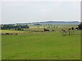
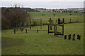
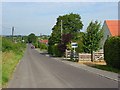
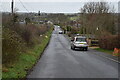
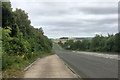
Nearby Images from Geograph Britain and Ireland:
©2007(licence)
©2020(licence)
©2007(licence)
©2020(licence)
©2017(licence)
The above images may not be of the site on this page, they are loaded from Geograph.
Please Submit an Image of this site or go out and take one for us!
Click here to see more info for this site
Nearby sites
Key: Red: member's photo, Blue: 3rd party photo, Yellow: other image, Green: no photo - please go there and take one, Grey: site destroyed
Download sites to:
KML (Google Earth)
GPX (GPS waypoints)
CSV (Garmin/Navman)
CSV (Excel)
To unlock full downloads you need to sign up as a Contributory Member. Otherwise downloads are limited to 50 sites.
Turn off the page maps and other distractions
Nearby sites listing. In the following links * = Image available
89m ENE 64° Battery Hill Bowl Barrow Round Barrow(s) (SU20573485)
1.0km S 191° Thorny Down Enclosure Ancient Village or Settlement (SU203338)
1.9km WSW 239° Figsbury Rings* Hillfort (SU18833382)
1.9km WNW 286° Horse Barrow Round Barrow(s) (SU18623533)
2.7km SSW 209° Fussell's Lodge* Long Barrow (SU19183247)
4.0km S 177° Clarendon Park Bowl Barrows Barrow Cemetery (SU20733079)
4.1km WNW 295° Downbarn West Enclosure* Ancient Village or Settlement (SU16713654)
4.7km SSW 199° Grim's Ditch 2 (Wiltshire) Misc. Earthwork (SU19023039)
4.7km W 261° Hand Barrows* Barrow Cemetery (SU1588034050)
5.8km NE 52° Martin's Clump Long Barrow Long Barrow (SU25053845)
6.2km NE 50° Martin's Clump Flint Mine Ancient Mine, Quarry or other Industry (SU252388)
6.2km NE 48° Martin's Clump Bowl Barrow Round Barrow(s) (SU25133896)
7.0km WSW 252° Old Sarum* Hillfort (SU13783266)
7.1km WNW 300° Ogbury Camp* Hillfort (SU143383)
7.1km E 84° Lopcombe Disc Barrow Round Barrow(s) (SU27563561)
7.1km NNE 34° Grateley Down Barrows* Barrow Cemetery (SU24414074)
7.3km NW 310° Amesbury Down Triple Bell Barrow Round Barrow(s) (SU14833944)
7.6km WNW 290° Little Down Barrow Group* Barrow Cemetery (SU13333738)
7.6km W 260° North Hill Down* Barrow Cemetery (SU12953343)
8.2km NW 311° Amesbury Down Bowl Barrows Barrow Cemetery (SU14314020)
8.2km WNW 298° Wilsford Cum Lake Bowl Barrow* Round Barrow(s) (SU13213866)
8.4km SW 230° Salisbury and South Wiltshire Museum* Museum (SU141294)
8.4km NW 322° Amesbury History Centre* Museum (SU1526841462)
8.4km NNE 28° Barrow Field Clumps* Barrow Cemetery (SU2446242274)
8.5km NE 47° Palestine Bowl Barrow* Round Barrow(s) (SU26684060)
View more nearby sites and additional images


 We would like to know more about this location. Please feel free to add a brief description and any relevant information in your own language.
 Wir möchten mehr über diese Stätte erfahren. Bitte zögern Sie nicht, eine kurze Beschreibung und relevante Informationen in Deutsch hinzuzufügen.
 Nous aimerions en savoir encore un peu sur les lieux. S'il vous plaît n'hesitez pas à ajouter une courte description et tous les renseignements pertinents dans votre propre langue.
 Quisieramos informarnos un poco más de las lugares. No dude en añadir una breve descripción y otros datos relevantes en su propio idioma.