


<< Other Photo Pages >> Bulford Barrow Cemetery - Barrow Cemetery in England in Wiltshire
Submitted by Bladup on Thursday, 13 November 2025 Page Views: 246
Neolithic and Bronze AgeSite Name: Bulford Barrow CemeteryCountry: England
NOTE: This site is 0.6 km away from the location you searched for.
County: Wiltshire Type: Barrow Cemetery
Map Ref: SU19604460
Latitude: 51.200282N Longitude: 1.720857W
Condition:
| 5 | Perfect |
| 4 | Almost Perfect |
| 3 | Reasonable but with some damage |
| 2 | Ruined but still recognisable as an ancient site |
| 1 | Pretty much destroyed, possibly visible as crop marks |
| 0 | No data. |
| -1 | Completely destroyed |
| 5 | Superb |
| 4 | Good |
| 3 | Ordinary |
| 2 | Not Good |
| 1 | Awful |
| 0 | No data. |
| 5 | Can be driven to, probably with disabled access |
| 4 | Short walk on a footpath |
| 3 | Requiring a bit more of a walk |
| 2 | A long walk |
| 1 | In the middle of nowhere, a nightmare to find |
| 0 | No data. |
| 5 | co-ordinates taken by GPS or official recorded co-ordinates |
| 4 | co-ordinates scaled from a detailed map |
| 3 | co-ordinates scaled from a bad map |
| 2 | co-ordinates of the nearest village |
| 1 | co-ordinates of the nearest town |
| 0 | no data |
Internal Links:
External Links:
")
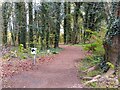
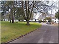
Bulford Barrow Cemetery constists of many tumuli to the north of Bulford Camp on/by some shooting ranges.
You may be viewing yesterday's version of this page. To see the most up to date information please register for a free account.
Do not use the above information on other web sites or publications without permission of the contributor.
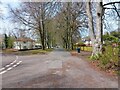
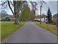
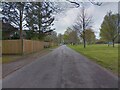
Nearby Images from Geograph Britain and Ireland:
©2023(licence)
©2023(licence)
©2023(licence)
©2023(licence)
©2023(licence)
The above images may not be of the site on this page, they are loaded from Geograph.
Please Submit an Image of this site or go out and take one for us!
Click here to see more info for this site
Nearby sites
Key: Red: member's photo, Blue: 3rd party photo, Yellow: other image, Green: no photo - please go there and take one, Grey: site destroyed
Download sites to:
KML (Google Earth)
GPX (GPS waypoints)
CSV (Garmin/Navman)
CSV (Excel)
To unlock full downloads you need to sign up as a Contributory Member. Otherwise downloads are limited to 50 sites.
Turn off the page maps and other distractions
Nearby sites listing. In the following links * = Image available
2.3km N 349° Silk Hill* Barrow Cemetery (SU1915246835)
2.5km WSW 245° Bulford Reconstructed Henges* Henge (SU1737243560)
2.6km WSW 238° Bulford Stone* Standing Stone (Menhir) (SU17364318)
2.7km NE 52° Milston Down Long Barrows* Long Barrow (SU2171146251)
2.7km SW 216° Bulford Crossroads Barrows* Round Barrow(s) (SU1800542396)
2.9km NE 49° Devil's Ditch (Wiltshire) Misc. Earthwork (SU21744649)
3.0km SSW 208° Earls Farm Down Barrows* Barrow Cemetery (SU1822441951)
3.6km WSW 245° Watergate Long Barrow* Long Barrow (SU1635643051)
3.7km NNW 342° Figheldean Earthwork* Misc. Earthwork (SU1846348131)
3.8km NW 308° Ablington Barrow Clump* Round Barrow(s) (SU1654546924)
4.5km WSW 258° Durrington Walls South Circle* Timber Circle (SU1515043641)
4.5km WSW 246° Durrington Walls Pit 1A* Misc. Earthwork (SU1545642717)
4.6km SW 235° Ratfyn Barrow* Round Barrow(s) (SU15834194)
4.7km W 260° Durrington Walls* Henge (SU15014375)
4.7km WSW 254° Durrington 68 Timber Circle (SU151433)
4.7km WSW 255° Woodhenge (Wiltshire)* Henge (SU15054338)
5.0km WSW 246° Durrington Walls Pit 2A* Misc. Earthwork (SU1500542569)
5.1km WSW 247° Durrington Walls Pit 3A* Misc. Earthwork (SU1493642566)
5.1km WSW 256° Cuckoo Stone (Wiltshire)* Standing Stone (Menhir) (SU1466443353)
5.1km NNW 330° Idmiston Cursus Cursus (SU1749)
5.2km WSW 246° Durrington Walls Pit 4A* Misc. Earthwork (SU1485342504)
5.3km NW 310° Gallows Barrow Round Barrow(s) (SU15564800)
5.3km WSW 247° Durrington Walls Pit 5A* Misc. Earthwork (SU1469342545)
5.3km SW 234° Amesbury History Centre* Museum (SU1526841462)
5.4km ESE 116° Barrow Field Clumps* Barrow Cemetery (SU2446242274)
View more nearby sites and additional images


 We would like to know more about this location. Please feel free to add a brief description and any relevant information in your own language.
 Wir möchten mehr über diese Stätte erfahren. Bitte zögern Sie nicht, eine kurze Beschreibung und relevante Informationen in Deutsch hinzuzufügen.
 Nous aimerions en savoir encore un peu sur les lieux. S'il vous plaît n'hesitez pas à ajouter une courte description et tous les renseignements pertinents dans votre propre langue.
 Quisieramos informarnos un poco más de las lugares. No dude en añadir una breve descripción y otros datos relevantes en su propio idioma.