<< Text Pages >> Crake Low - Round Barrow(s) in England in Derbyshire
Submitted by coldrum on Thursday, 01 April 2010 Page Views: 3874
Neolithic and Bronze AgeSite Name: Crake LowCountry: England County: Derbyshire Type: Round Barrow(s)
Nearest Village: Tissington
Map Ref: SK17235343
Latitude: 53.077822N Longitude: 1.744255W
Condition:
| 5 | Perfect |
| 4 | Almost Perfect |
| 3 | Reasonable but with some damage |
| 2 | Ruined but still recognisable as an ancient site |
| 1 | Pretty much destroyed, possibly visible as crop marks |
| 0 | No data. |
| -1 | Completely destroyed |
| 5 | Superb |
| 4 | Good |
| 3 | Ordinary |
| 2 | Not Good |
| 1 | Awful |
| 0 | No data. |
| 5 | Can be driven to, probably with disabled access |
| 4 | Short walk on a footpath |
| 3 | Requiring a bit more of a walk |
| 2 | A long walk |
| 1 | In the middle of nowhere, a nightmare to find |
| 0 | No data. |
| 5 | co-ordinates taken by GPS or official recorded co-ordinates |
| 4 | co-ordinates scaled from a detailed map |
| 3 | co-ordinates scaled from a bad map |
| 2 | co-ordinates of the nearest village |
| 1 | co-ordinates of the nearest town |
| 0 | no data |
Be the first person to rate this site - see the 'Contribute!' box in the right hand menu.
Internal Links:
External Links:
Round Barrow in Derbyshire
"A mutilated barrow called Crake Low was examined in 1848 when a
cremation and an injumation were found in a rough cist with a food
vessel of Manby's Type 4.
Two skeletons and a "very small plain vase" was found in opening a
stone quarry near the edge of the mound in 1850."
Source: Pastscape
You may be viewing yesterday's version of this page. To see the most up to date information please register for a free account.
Do not use the above information on other web sites or publications without permission of the contributor.
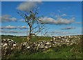
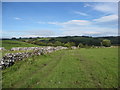
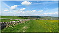
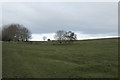
Nearby Images from Geograph Britain and Ireland:
©2017(licence)
©2008(licence)
©2023(licence)
©2019(licence)
©2010(licence)
The above images may not be of the site on this page, they are loaded from Geograph.
Please Submit an Image of this site or go out and take one for us!
Click here to see more info for this site
Nearby sites
Key: Red: member's photo, Blue: 3rd party photo, Yellow: other image, Green: no photo - please go there and take one, Grey: site destroyed
Download sites to:
KML (Google Earth)
GPX (GPS waypoints)
CSV (Garmin/Navman)
CSV (Excel)
To unlock full downloads you need to sign up as a Contributory Member. Otherwise downloads are limited to 50 sites.
Turn off the page maps and other distractions
Nearby sites listing. In the following links * = Image available
963m SSE 168° Hands Well* Holy Well or Sacred Spring (SK1742752487)
986m SSW 200° Boars Low* Round Barrow(s) (SK169525)
1.0km SSE 167° Children's Well* Holy Well or Sacred Spring (SK1746052426)
1.1km SSW 203° Sharplow Farm* Standing Stone (Menhir) (SK168524)
1.2km SSE 164° Hall Well (Tissington)* Holy Well or Sacred Spring (SK1756052321)
1.2km WSW 243° Sharp Low* Round Barrow(s) (SK16135286)
1.3km SSE 165° Yew Tree Well* Holy Well or Sacred Spring (SK1756252201)
1.3km SSE 153° Coffin Well* Holy Well or Sacred Spring (SK1782252270)
1.3km W 276° Stand Low* Round Barrow(s) (SK15915357)
1.3km SSE 157° Town Well* Holy Well or Sacred Spring (SK1774852209)
1.6km SW 217° Hollington Barn* Round Barrow(s) (SK1627552175)
1.8km WNW 288° Moat Low* Round Barrow(s) (SK15515399)
2.0km WSW 248° Cromwell's Low* Round Barrow(s) (SK15345266)
2.1km W 269° Bostern Grange Bowl Barrow* Round Barrow(s) (SK15145337)
2.3km NNE 25° Foufinside stones* Standing Stones (SK1818655507)
2.3km NNW 334° Cross Low 1* Round Barrow(s) (SK16185552)
2.5km NNW 330° Cross Low 2* Round Barrow(s) (SK15965561)
2.8km SSW 201° Lids Lowe Round Barrow(s) (SK16235078)
2.9km NW 313° Green Low (Alsop)* Round Barrow(s) (SK151554)
3.3km NW 323° Nettly Knowe* Round Barrow(s) (SK15225610)
3.4km W 274° Ravens Tor Bowl Barrow* Round Barrow(s) (SK13855368)
3.7km ESE 102° All Saints (Bradbourne)* Ancient Cross (SK2082052660)
3.7km E 97° Bradbourne Stone* Standing Stone (Menhir) (SK209530)
3.8km WNW 282° Stanshope Cairn 2* Cairn (SK135542)
3.8km ESE 122° Wigber Low* Round Barrow(s) (SK205514)
View more nearby sites and additional images


 We would like to know more about this location. Please feel free to add a brief description and any relevant information in your own language.
 Wir möchten mehr über diese Stätte erfahren. Bitte zögern Sie nicht, eine kurze Beschreibung und relevante Informationen in Deutsch hinzuzufügen.
 Nous aimerions en savoir encore un peu sur les lieux. S'il vous plaît n'hesitez pas à ajouter une courte description et tous les renseignements pertinents dans votre propre langue.
 Quisieramos informarnos un poco más de las lugares. No dude en añadir una breve descripción y otros datos relevantes en su propio idioma.