<< Image Pages >> White House Cists - Cist in England in Northumberland
Submitted by durhamnature on Friday, 31 August 2012 Page Views: 2524
Neolithic and Bronze AgeSite Name: White House CistsCountry: England County: Northumberland Type: Cist
Nearest Town: Alnwick
Map Ref: NU16051780
Latitude: 55.453798N Longitude: 1.747784W
Condition:
| 5 | Perfect |
| 4 | Almost Perfect |
| 3 | Reasonable but with some damage |
| 2 | Ruined but still recognisable as an ancient site |
| 1 | Pretty much destroyed, possibly visible as crop marks |
| 0 | No data. |
| -1 | Completely destroyed |
| 5 | Superb |
| 4 | Good |
| 3 | Ordinary |
| 2 | Not Good |
| 1 | Awful |
| 0 | No data. |
| 5 | Can be driven to, probably with disabled access |
| 4 | Short walk on a footpath |
| 3 | Requiring a bit more of a walk |
| 2 | A long walk |
| 1 | In the middle of nowhere, a nightmare to find |
| 0 | No data. |
| 5 | co-ordinates taken by GPS or official recorded co-ordinates |
| 4 | co-ordinates scaled from a detailed map |
| 3 | co-ordinates scaled from a bad map |
| 2 | co-ordinates of the nearest village |
| 1 | co-ordinates of the nearest town |
| 0 | no data |
Internal Links:
External Links:
I have visited· I would like to visit
Modern-Neolithic visited (still working on) on 20th Apr 2013 - their rating: Amb: 4 Access: 2 The Portal marker points to some stones in a small clearing in a plantation on the western part of the hill top.
")
N4423
Group of three cists on a hilltop, opened 1833 to 1863. Two urns, a flint arrowhead and skeletal remains were found.
In private woodland.
You may be viewing yesterday's version of this page. To see the most up to date information please register for a free account.
")
")
Do not use the above information on other web sites or publications without permission of the contributor.
Nearby Images from Geograph Britain and Ireland:
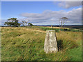
©2007(licence)
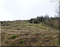
©2013(licence)
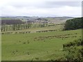
©2013(licence)
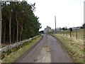
©2013(licence)
©2013(licence)
The above images may not be of the site on this page, they are loaded from Geograph.
Please Submit an Image of this site or go out and take one for us!
Click here to see more info for this site
Nearby sites
Key: Red: member's photo, Blue: 3rd party photo, Yellow: other image, Green: no photo - please go there and take one, Grey: site destroyed
Download sites to:
KML (Google Earth)
GPX (GPS waypoints)
CSV (Garmin/Navman)
CSV (Excel)
To unlock full downloads you need to sign up as a Contributory Member. Otherwise downloads are limited to 50 sites.
Turn off the page maps and other distractions
Nearby sites listing. In the following links * = Image available
1.1km SSW 196° Hulne Abbey Standing Stone* Standing Stone (Menhir) (NU15761678)
1.8km SE 138° Chesters Camp* Hillfort (NU17251647)
2.3km SE 138° Black Bog Dean 1* Rock Art (NU1764016074)
4.3km WSW 239° Midstead 5 Rock Art (NU1240115583)
4.3km WSW 257° Hunterheugh 4* Rock Art (NU1189516801)
4.3km WSW 257° Hunterheugh 5* Rock Art (NU1189216800)
4.3km WSW 237° Midstead 1* Rock Art (NU1242115460)
4.4km WSW 257° Hunterheugh 1.* Rock Art (NU1175016787)
4.4km WSW 257° Hunterheugh Excavation Portable Panels Rock Art (NU1175016780)
4.4km WSW 258° Hunterheugh 7 Rock Art (NU1171116882)
4.4km WSW 258° Hunterheugh 2* Rock Art (NU1169216841)
4.5km WSW 257° Hunterheugh 3* Rock Art (NU1168316811)
4.5km WSW 257° Hunterheugh 12 Rock Art (NU1167116754)
4.5km WSW 256° Hunterheugh 8h Rock Art (NU1163016708)
4.5km WSW 256° Hunterheugh 8b Rock Art (NU1162316709)
4.6km WSW 256° Hunterheugh 8c Rock Art (NU1161516693)
4.6km WSW 256° Hunterheugh 8g Rock Art (NU1161216692)
4.6km WSW 256° Hunterheugh 8d Rock Art (NU1160916689)
4.6km WSW 256° Hunterheugh 8e Rock Art (NU1160716690)
4.6km WSW 256° Hunterheugh 8f Rock Art (NU1160516688)
4.6km WSW 256° Hunterheugh 8a Rock Art (NU1160516686)
4.6km WSW 258° Hunterheugh 13* Rock Art (NU1156116863)
4.6km WSW 258° Hunterheugh 14* Rock Art (NU1156016866)
4.6km WSW 256° Hunterheugh 9 Rock Art (NU1152616691)
4.7km WSW 259° Hunterheugh 11 Rock Art (NU1147216873)
View more nearby sites and additional images


 We would like to know more about this location. Please feel free to add a brief description and any relevant information in your own language.
 Wir möchten mehr über diese Stätte erfahren. Bitte zögern Sie nicht, eine kurze Beschreibung und relevante Informationen in Deutsch hinzuzufügen.
 Nous aimerions en savoir encore un peu sur les lieux. S'il vous plaît n'hesitez pas à ajouter une courte description et tous les renseignements pertinents dans votre propre langue.
 Quisieramos informarnos un poco más de las lugares. No dude en añadir una breve descripción y otros datos relevantes en su propio idioma.