<< Text Pages >> Knighton Down - Long Barrow in England in Wiltshire
Submitted by akhen3sir on Wednesday, 14 February 2018 Page Views: 1262
Neolithic and Bronze AgeSite Name: Knighton DownCountry: England County: Wiltshire Type: Long Barrow
Map Ref: SU12784535
Latitude: 51.207218N Longitude: 1.818441W
Condition:
| 5 | Perfect |
| 4 | Almost Perfect |
| 3 | Reasonable but with some damage |
| 2 | Ruined but still recognisable as an ancient site |
| 1 | Pretty much destroyed, possibly visible as crop marks |
| 0 | No data. |
| -1 | Completely destroyed |
| 5 | Superb |
| 4 | Good |
| 3 | Ordinary |
| 2 | Not Good |
| 1 | Awful |
| 0 | No data. |
| 5 | Can be driven to, probably with disabled access |
| 4 | Short walk on a footpath |
| 3 | Requiring a bit more of a walk |
| 2 | A long walk |
| 1 | In the middle of nowhere, a nightmare to find |
| 0 | No data. |
| 5 | co-ordinates taken by GPS or official recorded co-ordinates |
| 4 | co-ordinates scaled from a detailed map |
| 3 | co-ordinates scaled from a bad map |
| 2 | co-ordinates of the nearest village |
| 1 | co-ordinates of the nearest town |
| 0 | no data |
Be the first person to rate this site - see the 'Contribute!' box in the right hand menu.
Internal Links:
External Links:
Long Barrow in Wiltshire
Knighton Down long barrow, north of Larkhill Camp, just off the stone track at SU 1278 4535 (51.207N 1.818W)
You may be viewing yesterday's version of this page. To see the most up to date information please register for a free account.
Do not use the above information on other web sites or publications without permission of the contributor.
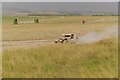
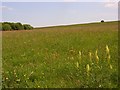
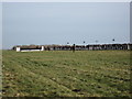
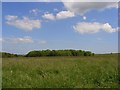
Nearby Images from Geograph Britain and Ireland:
©2021(licence)
©2007(licence)
©2010(licence)
©2007(licence)
©2007(licence)
The above images may not be of the site on this page, they are loaded from Geograph.
Please Submit an Image of this site or go out and take one for us!
Click here to see more info for this site
Nearby sites
Key: Red: member's photo, Blue: 3rd party photo, Yellow: other image, Green: no photo - please go there and take one, Grey: site destroyed
Download sites to:
KML (Google Earth)
GPX (GPS waypoints)
CSV (Garmin/Navman)
CSV (Excel)
To unlock full downloads you need to sign up as a Contributory Member. Otherwise downloads are limited to 50 sites.
Turn off the page maps and other distractions
Nearby sites listing. In the following links * = Image available
1.0km SSW 198° Long Barrow alongside The Packway, Larkhill* Long Barrow (SU12474438)
1.6km SE 126° Larkhill Causewayed Enclosure* Causewayed Enclosure (SU14084440)
2.3km WNW 294° Robin Hood Ball Clump Barrow Round Barrow(s) (SU10674630)
2.3km SSE 157° Amesbury Cursus (E)* Cursus (SU137432)
2.3km S 191° Great Cursus W Barrow* Round Barrow(s) (SU1235143043)
2.5km SSW 197° Great Cursus, Stonehenge* Cursus (SU12064296)
2.6km WNW 285° Robin Hood's Ball Causewayed Enclosure (SU103460)
2.7km SSE 162° Old King Barrows* Barrow Cemetery (SU13604280)
2.7km SW 230° Winterbourne Stoke Cursus (E) Cursus (SU107436)
2.7km SSW 199° Great Cursus Barrows, Stonehenge* Round Barrow(s) (SU11894278)
2.7km S 182° The Avenue* Ancient Trackway (SU12694262)
2.7km SE 126° Durrington Walls* Henge (SU15014375)
2.7km SE 137° Cuckoo Stone (Wiltshire)* Standing Stone (Menhir) (SU1466443353)
2.8km W 281° Shrewton 4 Round Barrow(s) (SU09994588)
2.9km SE 126° Durrington Walls South Circle* Timber Circle (SU1515043641)
3.0km SSW 207° Bowl and Bell Barrow* Barrow Cemetery (SU11454270)
3.0km SE 131° Woodhenge (Wiltshire)* Henge (SU15054338)
3.1km SSW 195° Stonehenge Car Park Postholes* Timber Circle (SU120424)
3.1km SSW 212° Fargo Disk Barrow* Round Barrow(s) (SU11154275)
3.1km SW 218° Amesbury Cursus (W)* Cursus (SU109429)
3.1km SE 132° Durrington 68 Timber Circle (SU151433)
3.1km SW 232° The Lesser Cursus* Cursus (SU10354343)
3.1km S 189° Heel Stone* Standing Stone (Menhir) (SU1229142244)
3.1km SW 232° Winterbourne Stoke Cursus (W) Cursus (SU103434)
3.2km SSE 163° The King Barrows Ridge* Barrow Cemetery (SU137423)
View more nearby sites and additional images


 We would like to know more about this location. Please feel free to add a brief description and any relevant information in your own language.
 Wir möchten mehr über diese Stätte erfahren. Bitte zögern Sie nicht, eine kurze Beschreibung und relevante Informationen in Deutsch hinzuzufügen.
 Nous aimerions en savoir encore un peu sur les lieux. S'il vous plaît n'hesitez pas à ajouter une courte description et tous les renseignements pertinents dans votre propre langue.
 Quisieramos informarnos un poco más de las lugares. No dude en añadir una breve descripción y otros datos relevantes en su propio idioma.