


<< Our Photo Pages >> Musden Low Cemetery - Barrow Cemetery in England in Staffordshire
Submitted by vicky on Monday, 14 October 2002 Page Views: 6984
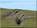
Neolithic and Bronze AgeSite Name: Musden Low CemeteryCountry: England
NOTE: This site is 0.2 km away from the location you searched for.
County: Staffordshire Type: Barrow Cemetery
Map Ref: SK117501 Landranger Map Number: 119
Latitude: 53.048038N Longitude: 1.826922W
Condition:
| 5 | Perfect |
| 4 | Almost Perfect |
| 3 | Reasonable but with some damage |
| 2 | Ruined but still recognisable as an ancient site |
| 1 | Pretty much destroyed, possibly visible as crop marks |
| 0 | No data. |
| -1 | Completely destroyed |
| 5 | Superb |
| 4 | Good |
| 3 | Ordinary |
| 2 | Not Good |
| 1 | Awful |
| 0 | No data. |
| 5 | Can be driven to, probably with disabled access |
| 4 | Short walk on a footpath |
| 3 | Requiring a bit more of a walk |
| 2 | A long walk |
| 1 | In the middle of nowhere, a nightmare to find |
| 0 | No data. |
| 5 | co-ordinates taken by GPS or official recorded co-ordinates |
| 4 | co-ordinates scaled from a detailed map |
| 3 | co-ordinates scaled from a bad map |
| 2 | co-ordinates of the nearest village |
| 1 | co-ordinates of the nearest town |
| 0 | no data |
Internal Links:
External Links:
I have visited· I would like to visit
BrownEdger would like to visit
")
Have you visited this site? Please add a comment below.
You may be viewing yesterday's version of this page. To see the most up to date information please register for a free account.
")
Do not use the above information on other web sites or publications without permission of the contributor.
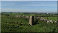
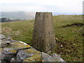
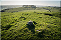
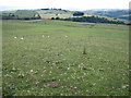
Nearby Images from Geograph Britain and Ireland:
©2016(licence)
©2006(licence)
©2024(licence)
©2010(licence)
©2017(licence)
The above images may not be of the site on this page, they are loaded from Geograph.
Please Submit an Image of this site or go out and take one for us!
Click here to see more info for this site
Nearby sites
Key: Red: member's photo, Blue: 3rd party photo, Yellow: other image, Green: no photo - please go there and take one, Grey: site destroyed
Download sites to:
KML (Google Earth)
GPX (GPS waypoints)
CSV (Garmin/Navman)
CSV (Excel)
To unlock full downloads you need to sign up as a Contributory Member. Otherwise downloads are limited to 50 sites.
Turn off the page maps and other distractions
Nearby sites listing. In the following links * = Image available
670m SSW 207° Calton Round Barrow* Round Barrow(s) (SK114495)
728m SSE 164° Dun Low* Round Barrow(s) (SK119494)
852m ESE 111° Hazleton Clump Cairn (SK125498)
1.3km ENE 68° The Battle Stone (Ilam)* Ancient Cross (SK1286950579)
1.5km SSW 204° Caltonmoor* Round Barrow(s) (SK11084868)
1.6km SE 130° Top Low 1 Round Barrow(s) (SK129491)
1.6km ENE 73° St Bertram's Well (Ilam)* Holy Well or Sacred Spring (SK13275059)
1.7km ENE 69° Church of the Holy Cross (Ilam)* Ancient Cross (SK1326950697)
1.9km ESE 122° Top Low 2 Round Barrow(s) (SK133491)
2.1km E 101° Lady Low Round Barrow(s) (SK138497)
2.1km E 101° Barrow near Lady Low Round Barrow(s) (SK138497)
2.4km ENE 56° St Bertram's Well (Bunster Hill)* Holy Well or Sacred Spring (SK13725145)
2.8km NNE 19° Beechenhill Cairns* Cairn (SK126528)
2.9km S 190° Thorswood* Barrow Cemetery (SK112472)
3.0km NNE 33° Ilamptops Low* Cairn (SK133526)
3.1km WNW 284° Lamber Low* Round Barrow(s) (SK08735085)
3.2km NNE 13° Damgate Cairn 1* Cairn (SK124532)
3.2km N 353° Cheshire Wood Cave Cave or Rock Shelter (SK113533)
3.2km NNE 28° Beechenhill Barrow 2* Round Barrow(s) (SK13205296)
3.3km W 277° Stonesteads* Round Barrow(s) (SK08405052)
3.4km NNW 337° Falcon Low Cave Cave or Rock Shelter (SK104532)
3.5km N 6° Highfields Bowl Barrow* Round Barrow(s) (SK12035354)
3.8km NNE 17° Damgate Cairns 2* Cairn (SK128537)
3.8km NW 306° Waterfall Low* Round Barrow(s) (SK08615231)
3.8km N 8° Long Low* Long Barrow (SK122539)
View more nearby sites and additional images


 We would like to know more about this location. Please feel free to add a brief description and any relevant information in your own language.
 Wir möchten mehr über diese Stätte erfahren. Bitte zögern Sie nicht, eine kurze Beschreibung und relevante Informationen in Deutsch hinzuzufügen.
 Nous aimerions en savoir encore un peu sur les lieux. S'il vous plaît n'hesitez pas à ajouter une courte description et tous les renseignements pertinents dans votre propre langue.
 Quisieramos informarnos un poco más de las lugares. No dude en añadir una breve descripción y otros datos relevantes en su propio idioma.