


<< Our Photo Pages >> Green Gates 04 - Rock Art in England in Yorkshire (West)
Submitted by Anne T on Monday, 05 February 2018 Page Views: 1070
Rock ArtSite Name: Green Gates 04 Alternative Name: ERA-2340; Boughey & Vickerman (255); SAM 25371; PRN190Country: England County: Yorkshire (West) Type: Rock Art
Nearest Town: Ilkley
Map Ref: SE1141746040
Latitude: 53.910391N Longitude: 1.82769W
Condition:
| 5 | Perfect |
| 4 | Almost Perfect |
| 3 | Reasonable but with some damage |
| 2 | Ruined but still recognisable as an ancient site |
| 1 | Pretty much destroyed, possibly visible as crop marks |
| 0 | No data. |
| -1 | Completely destroyed |
| 5 | Superb |
| 4 | Good |
| 3 | Ordinary |
| 2 | Not Good |
| 1 | Awful |
| 0 | No data. |
| 5 | Can be driven to, probably with disabled access |
| 4 | Short walk on a footpath |
| 3 | Requiring a bit more of a walk |
| 2 | A long walk |
| 1 | In the middle of nowhere, a nightmare to find |
| 0 | No data. |
| 5 | co-ordinates taken by GPS or official recorded co-ordinates |
| 4 | co-ordinates scaled from a detailed map |
| 3 | co-ordinates scaled from a bad map |
| 2 | co-ordinates of the nearest village |
| 1 | co-ordinates of the nearest town |
| 0 | no data |
Be the first person to rate this site - see the 'Contribute!' box in the right hand menu.
Internal Links:
External Links:
")
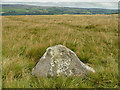
This rock art panel is recorded by the Ilkley Archaeology Group as having six cups, three with single rings around them. The England's Rock Art entry for ERA-2340 Green Gates 04 adds there is a groove with a further cup at ground level on the northern side of the stone, and includes a description, photographs, a plan of the stone and its motifs, plus photogrammetry and a 3D model.
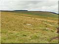
This rock art panel is located on Open Access land.
Note: Have you seen this rock art panel? Do you have any photographs or information to add?
You may be viewing yesterday's version of this page. To see the most up to date information please register for a free account.
Do not use the above information on other web sites or publications without permission of the contributor.
Nearby Images from Geograph Britain and Ireland:

©2025(licence)
©2020(licence)
©2020(licence)

©2025(licence)

©2025(licence)
The above images may not be of the site on this page, they are loaded from Geograph.
Please Submit an Image of this site or go out and take one for us!
Click here to see more info for this site
Nearby sites
Key: Red: member's photo, Blue: 3rd party photo, Yellow: other image, Green: no photo - please go there and take one, Grey: site destroyed
Download sites to:
KML (Google Earth)
GPX (GPS waypoints)
CSV (Garmin/Navman)
CSV (Excel)
To unlock full downloads you need to sign up as a Contributory Member. Otherwise downloads are limited to 50 sites.
Turn off the page maps and other distractions
Nearby sites listing. In the following links * = Image available
81m E 87° Green Gates 05* Rock Art (SE1149846045)
82m E 84° Green Gates 06* Rock Art (SE1149946049)
112m NW 309° Green Gates 03* Rock Art (SE1133046111)
283m WNW 289° Green Gates 02* Rock Art (SE1114946132)
323m WNW 286° Green Gates 01.* Rock Art (SE1110546127)
342m W 272° Badger Stone* Rock Art (SE1107446050)
440m NNW 330° Barmishaw Stone* Rock Art (SE1119246419)
527m NW 323° Barmishaw 01* Rock Art (SE1109746460)
576m SSE 165° White Crag Moss 02* Rock Art (SE1157045484)
576m NNE 17° Willy Hall's Wood Stone* Rock Art (SE1158446592)
580m NW 315° Graining's Head 02* Rock Art (SE1100746451)
625m NE 37° White Wells 01* Rock Art (SE1179446540)
629m ESE 113° Ilkley Moor Labyrinth* Modern Stone Circle etc (SE120458)
636m NE 38° White Wells 02* Rock Art (SE1180746544)
637m NE 39° White Wells 06* Rock Art (SE1182246533)
638m NE 38° Pepperpot Rock* Rock Art (SE1180746546)
643m NE 38° White Wells 04 Rock Art (SE1181046550)
656m NE 37° White Wells 05* Rock Art (SE1181646562)
784m WSW 248° Green Gates 01a* Rock Art (SE1068845745)
790m NW 305° Graining's Head 01* Rock Art (SE1076746492)
808m S 175° White Crag Moss 01* Rock Art (SE1148445234)
821m S 176° Rombalds Moor Cairn* Cairn (SE11474522)
827m NE 36° White Wells 07 Rock Art (SE1189846714)
828m WNW 285° Weary Hill 02* Rock Art (SE1061446251)
828m NNE 28° White Wells (Ilkley)* Holy Well or Sacred Spring (SE11814677)
View more nearby sites and additional images

")
 We would like to know more about this location. Please feel free to add a brief description and any relevant information in your own language.
 Wir möchten mehr über diese Stätte erfahren. Bitte zögern Sie nicht, eine kurze Beschreibung und relevante Informationen in Deutsch hinzuzufügen.
 Nous aimerions en savoir encore un peu sur les lieux. S'il vous plaît n'hesitez pas à ajouter une courte description et tous les renseignements pertinents dans votre propre langue.
 Quisieramos informarnos un poco más de las lugares. No dude en añadir una breve descripción y otros datos relevantes en su propio idioma.