<< Our Photo Pages >> St Alkelda's Holy Well - Holy Well or Sacred Spring in England in Yorkshire (North)
Submitted by Sunny100 on Thursday, 27 May 2010 Page Views: 7353
Springs and Holy WellsSite Name: St Alkelda's Holy Well Alternative Name: St Alkelda's SpringCountry: England
NOTE: This site is 3.6 km away from the location you searched for.
County: Yorkshire (North) Type: Holy Well or Sacred Spring
Nearest Town: Leyburn Nearest Village: Middleham
Map Ref: SE124879
Latitude: 54.286583N Longitude: 1.811027W
Condition:
| 5 | Perfect |
| 4 | Almost Perfect |
| 3 | Reasonable but with some damage |
| 2 | Ruined but still recognisable as an ancient site |
| 1 | Pretty much destroyed, possibly visible as crop marks |
| 0 | No data. |
| -1 | Completely destroyed |
| 5 | Superb |
| 4 | Good |
| 3 | Ordinary |
| 2 | Not Good |
| 1 | Awful |
| 0 | No data. |
| 5 | Can be driven to, probably with disabled access |
| 4 | Short walk on a footpath |
| 3 | Requiring a bit more of a walk |
| 2 | A long walk |
| 1 | In the middle of nowhere, a nightmare to find |
| 0 | No data. |
| 5 | co-ordinates taken by GPS or official recorded co-ordinates |
| 4 | co-ordinates scaled from a detailed map |
| 3 | co-ordinates scaled from a bad map |
| 2 | co-ordinates of the nearest village |
| 1 | co-ordinates of the nearest town |
| 0 | no data |
Internal Links:
External Links:
I have visited· I would like to visit
Anne T visited on 27th Apr 2017 - their rating: Cond: 2 Amb: 1 Access: 4 St. Alkelda's Well, Middleham: How tragic – a now dried up well, completely uncared for.
From St. Mary’s and St. Alkeld’s church, I was determined to find St. Alkeld’s Well. Armed only with the mobile phone, OS maps and the grid reference from Pastscape, we set off westwards across the fields, through the gate in the churchyard across a grassy field with a play area at the far end, through a gate leading into where St. Alkeld’s Road and The Springs meet, then through a stile into a grassy field. Measuring the distance between the church porch and the well, the distance is just under 250 metres.
We walked past the well without realising it, thinking it was only a pile of stones and rubble that someone had tossed over their garden wall. On checking the grid reference, we walked back to it.
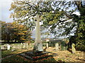
Having seen the image of the trough by the roadside on both the Portal and Yorkshire Holy Wells, we searched in vain, eventually walking back to The Springs and looking down the driveways. The well is sited at the bottom of the gardens of the two small houses, one called ‘Well Cottage’. Having taken some photographs, we followed the footpaths back into the town centre, ending up at a medieval cross at SE 12607 87679 (see on a previous visit).
")
Long ago the well, close to Middleham House and St Alkelda's Road, flowed through a square opening in the wall and then went underground only to surface close by and run into a 3 foot deep square-shaped stone structure or tank. Local people and visiting pilgrims would partake of the curative water, which according to legend, was good for healing poor eyesight and general health conditions. A sort of tonic perhaps.
St Alkelda or Alcelda was a Saxon princess who became a nun. However, she was murdered beside the spring by two Viking women who detested her Christian beliefs. Legend says they used a long length of cloth or something similar to carry out the terrible deed. After her death on the 28th March 800 AD she was proclaimed a martyr. Her bones, if they were hers, were discovered along with a Saxon stone (part of her shrine) in the church last century. A stainedglass window (partly14th century) depicts the saint's martyrdom.
You may be viewing yesterday's version of this page. To see the most up to date information please register for a free account.
")
")
")
Do not use the above information on other web sites or publications without permission of the contributor.
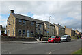
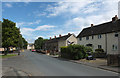
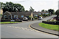
Nearby Images from Geograph Britain and Ireland:
©2019(licence)
©2019(licence)
©2021(licence)
©2021(licence)
©2022(licence)
The above images may not be of the site on this page, they are loaded from Geograph.
Please Submit an Image of this site or go out and take one for us!
Click here to see more info for this site
Nearby sites
Key: Red: member's photo, Blue: 3rd party photo, Yellow: other image, Green: no photo - please go there and take one, Grey: site destroyed
Download sites to:
KML (Google Earth)
GPX (GPS waypoints)
CSV (Garmin/Navman)
CSV (Excel)
To unlock full downloads you need to sign up as a Contributory Member. Otherwise downloads are limited to 50 sites.
Turn off the page maps and other distractions
Nearby sites listing. In the following links * = Image available
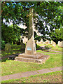
228m E 96° St Mary and St Alkelda* Ancient Cross (SE1262887878)
1.8km N 1° Fairy Well (Harmby)* Holy Well or Sacred Spring (SE12448969)
3.6km WNW 297° Holy Trinity (Wensley)* Ancient Cross (SE09228954)
4.6km E 98° Richard Wood South (Thornton Steward) Rock Art (SE1694087301)
5.6km S 169° Agra Moor Standing Stone* Standing Stone (Menhir) (SE1349982440)
6.4km SSE 164° West Agra* Rock Art (SE14248175)
6.5km SSE 165° West Agra Carving 2b Rock Art (SE1412681669)
6.5km SSE 164° West Agra 3a and 3b* Rock Art (SE1423681675)
6.5km SSE 165° West Agra Carving 1 Rock Art (SE1406981627)
6.7km SSE 158° Gollinglith Foot (West Agra) Standing Stone (Menhir) (SE149817)
7.3km NE 37° St Oswald (East Hauxwell)* Ancient Cross (SE168937)
8.3km SSE 147° Healey Stone Circles (Masham) Stone Circle (SE170810)
9.4km W 259° Burton Moor* Ancient Village or Settlement (SE03118604)
9.9km SE 132° Fearby Cross (Masham) Ancient Cross (SE1984081273)
10.3km SE 142° Fearby, Masham* Stone Circle (SE188798)
10.5km SSE 151° Swinton Druid's Temple* Modern Stone Circle etc (SE1746478713)
11.1km ESE 104° St Mary (Thornton Watlass)* Ancient Cross (SE2324585265)
11.7km SSE 147° Skew Skell Well* Holy Well or Sacred Spring (SE1876078084)
11.9km W 279° St Matthew's Well (Carperby)* Holy Well or Sacred Spring (SE0065689756)
11.9km W 279° Carperby Cross* Ancient Cross (SE0063189729)
12.2km SE 133° Berry Well* Holy Well or Sacred Spring (SE2140479628)
12.5km SE 125° St Mary (Masham)* Ancient Cross (SE2266080651)
13.1km NW 318° Harkerside Moor circle* Stone Circle (SE035976)
13.5km W 280° Carperby Stone Circle* Stone Circle (SD99009013)
13.6km NNW 339° Forty Acres 03 (Stelling) Rock Art (NZ07580058)
View more nearby sites and additional images


 We would like to know more about this location. Please feel free to add a brief description and any relevant information in your own language.
 Wir möchten mehr über diese Stätte erfahren. Bitte zögern Sie nicht, eine kurze Beschreibung und relevante Informationen in Deutsch hinzuzufügen.
 Nous aimerions en savoir encore un peu sur les lieux. S'il vous plaît n'hesitez pas à ajouter une courte description et tous les renseignements pertinents dans votre propre langue.
 Quisieramos informarnos un poco más de las lugares. No dude en añadir una breve descripción y otros datos relevantes en su propio idioma.