<< Our Photo Pages >> Weary Hill 01 - Rock Art in England in Yorkshire (West)
Submitted by Anne T on Wednesday, 21 February 2018 Page Views: 889
Rock ArtSite Name: Weary Hill 01 Alternative Name: ERA-2319; Boughey & Vickerman (242); SAM 25397; PRN7236Country: England County: Yorkshire (West) Type: Rock Art
Nearest Town: Ilkley
Map Ref: SE1057246336
Latitude: 53.913069N Longitude: 1.840543W
Condition:
| 5 | Perfect |
| 4 | Almost Perfect |
| 3 | Reasonable but with some damage |
| 2 | Ruined but still recognisable as an ancient site |
| 1 | Pretty much destroyed, possibly visible as crop marks |
| 0 | No data. |
| -1 | Completely destroyed |
| 5 | Superb |
| 4 | Good |
| 3 | Ordinary |
| 2 | Not Good |
| 1 | Awful |
| 0 | No data. |
| 5 | Can be driven to, probably with disabled access |
| 4 | Short walk on a footpath |
| 3 | Requiring a bit more of a walk |
| 2 | A long walk |
| 1 | In the middle of nowhere, a nightmare to find |
| 0 | No data. |
| 5 | co-ordinates taken by GPS or official recorded co-ordinates |
| 4 | co-ordinates scaled from a detailed map |
| 3 | co-ordinates scaled from a bad map |
| 2 | co-ordinates of the nearest village |
| 1 | co-ordinates of the nearest town |
| 0 | no data |
Be the first person to rate this site - see the 'Contribute!' box in the right hand menu.
Internal Links:
External Links:
")
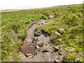
This rock art panel is recorded as having a complicated and unusual design with three main groups of designs. The Ilkley Archaeology Group description from 2003 reads: "cup joined by groove to inner component of large double ring, which is not complete, but has the double rings turning into double parallel grooves and running off the rock; 5 or 6 more cups, 1 with at least half a ring and others with more complex ring and groove arrangements." For more information see England's Rock Art entry for ERA-2329 Weary Hill 01, which includes a detailed description, photographs, a panoramic photographs, a plan of the rock and its motifs, plus photogrammetry, a 3D model, an RTI model and an Mp4 model.
This rock art panel is located on Open Access land.
Note: Have you seen this rock art panel? Do you have any photographs or information to add?
You may be viewing yesterday's version of this page. To see the most up to date information please register for a free account.
")
Do not use the above information on other web sites or publications without permission of the contributor.
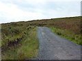
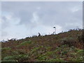
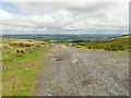
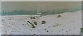
Nearby Images from Geograph Britain and Ireland:
©2010(licence)
©2010(licence)
©2020(licence)
©2005(licence)
©2020(licence)
The above images may not be of the site on this page, they are loaded from Geograph.
Please Submit an Image of this site or go out and take one for us!
Click here to see more info for this site
Nearby sites
Key: Red: member's photo, Blue: 3rd party photo, Yellow: other image, Green: no photo - please go there and take one, Grey: site destroyed
Download sites to:
KML (Google Earth)
GPX (GPS waypoints)
CSV (Garmin/Navman)
CSV (Excel)
To unlock full downloads you need to sign up as a Contributory Member. Otherwise downloads are limited to 50 sites.
Turn off the page maps and other distractions
Nearby sites listing. In the following links * = Image available
95m SSE 154° Weary Hill 02* Rock Art (SE1061446251)
189m WNW 289° Coarse Stone Edge 03* Rock Art (SE1039246396)
189m WNW 287° Neb Stone* Rock Art (SE10394639)
189m WNW 287° Coarse Stone Edge 04* Rock Art (SE1039046390)
198m WNW 295° Coarse Stone Edge 02a* Rock Art (SE1039246419)
214m WNW 289° Coarse Stone Edge 01a* Rock Art (SE1036946404)
249m NE 51° Graining's Head 01* Rock Art (SE1076746492)
253m N 10° Weary Hill 03* Rock Art (SE1061546585)
253m N 10° Weary Hill Stone* Rock Art (SE1061546585)
283m N 351° Silver Well 05* Rock Art (SE1052746616)
299m NNW 344° Silver Well 04* Rock Art (SE1048946623)
314m NNW 342° Silver Well 02* Rock Art (SE1047446635)
356m NNW 347° Silver Well 03* Rock Art (SE1048946682)
401m NW 307° Silver Well 01* Rock Art (SE1025246579)
442m WNW 292° Course Stone Edge Ark* Rock Art (SE10164650)
449m ENE 75° Graining's Head 02* Rock Art (SE1100746451)
538m ENE 77° Barmishaw 01* Rock Art (SE1109746460)
553m W 273° Coarse Stone Edge 01.* Rock Art (SE1001846364)
571m ESE 112° Green Gates 01.* Rock Art (SE1110546127)
572m WNW 296° Black Beck Hole 05* Rock Art (SE1005646585)
576m ESE 120° Badger Stone* Rock Art (SE1107446050)
580m WNW 293° Black Beck Hole 04* Rock Art (SE1003746563)
602m S 169° Green Gates 01a* Rock Art (SE1068845745)
610m ESE 110° Green Gates 02* Rock Art (SE1114946132)
624m E 82° Barmishaw Stone* Rock Art (SE1119246419)
View more nearby sites and additional images


 We would like to know more about this location. Please feel free to add a brief description and any relevant information in your own language.
 Wir möchten mehr über diese Stätte erfahren. Bitte zögern Sie nicht, eine kurze Beschreibung und relevante Informationen in Deutsch hinzuzufügen.
 Nous aimerions en savoir encore un peu sur les lieux. S'il vous plaît n'hesitez pas à ajouter une courte description et tous les renseignements pertinents dans votre propre langue.
 Quisieramos informarnos un poco más de las lugares. No dude en añadir una breve descripción y otros datos relevantes en su propio idioma.