<< Text Pages >> Falcon Low Cave - Cave or Rock Shelter in England in Staffordshire
Submitted by vicky on Sunday, 18 May 2003 Page Views: 4431
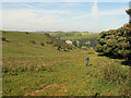
Natural PlacesSite Name: Falcon Low CaveCountry: England County: Staffordshire Type: Cave or Rock Shelter
Map Ref: SK104532 Landranger Map Number: 119
Latitude: 53.075930N Longitude: 1.846215W
Condition:
| 5 | Perfect |
| 4 | Almost Perfect |
| 3 | Reasonable but with some damage |
| 2 | Ruined but still recognisable as an ancient site |
| 1 | Pretty much destroyed, possibly visible as crop marks |
| 0 | No data. |
| -1 | Completely destroyed |
| 5 | Superb |
| 4 | Good |
| 3 | Ordinary |
| 2 | Not Good |
| 1 | Awful |
| 0 | No data. |
| 5 | Can be driven to, probably with disabled access |
| 4 | Short walk on a footpath |
| 3 | Requiring a bit more of a walk |
| 2 | A long walk |
| 1 | In the middle of nowhere, a nightmare to find |
| 0 | No data. |
| 5 | co-ordinates taken by GPS or official recorded co-ordinates |
| 4 | co-ordinates scaled from a detailed map |
| 3 | co-ordinates scaled from a bad map |
| 2 | co-ordinates of the nearest village |
| 1 | co-ordinates of the nearest town |
| 0 | no data |
Be the first person to rate this site - see the 'Contribute!' box in the right hand menu.
Internal Links:
External Links:
I have visited· I would like to visit
BrownEdger would like to visit
Have you visited this site? Please add a comment below.
You may be viewing yesterday's version of this page. To see the most up to date information please register for a free account.
Do not use the above information on other web sites or publications without permission of the contributor.
Nearby Images from Geograph Britain and Ireland:
©2016(licence)
©2020(licence)
©2017(licence)
©2012(licence)
©2012(licence)
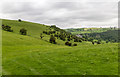
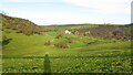
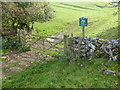
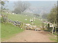
The above images may not be of the site on this page, they are loaded from Geograph.
Please Submit an Image of this site or go out and take one for us!
Click here to see more info for this site
Nearby sites
Key: Red: member's photo, Blue: 3rd party photo, Yellow: other image, Green: no photo - please go there and take one, Grey: site destroyed
Download sites to:
KML (Google Earth)
GPX (GPS waypoints)
CSV (Garmin/Navman)
CSV (Excel)
To unlock full downloads you need to sign up as a Contributory Member. Otherwise downloads are limited to 50 sites.
Turn off the page maps and other distractions
Nearby sites listing. In the following links * = Image available
903m E 84° Cheshire Wood Cave Cave or Rock Shelter (SK113533)
948m NNE 19° Saint Bertram's Cave* Cave or Rock Shelter (SK107541)
1.5km ENE 56° Bincliff Bowl Barrows* Round Barrow(s) (SK11635402)
1.7km ENE 78° Highfields Bowl Barrow* Round Barrow(s) (SK12035354)
1.7km W 277° Mouse Low Round Barrow(s) (SK087534)
1.7km NNE 31° Wetton Low* Round Barrow(s) (SK113547)
1.8km NNW 341° Sevenways Cave* Cave or Rock Shelter (SK098549)
1.8km NNW 341° Elder Bush Cave* Cave or Rock Shelter (SK09805490)
1.9km NNW 342° Thor's Cave* Cave or Rock Shelter (SK098550)
1.9km ENE 69° Long Low* Long Barrow (SK122539)
2.0km E 90° Damgate Cairn 1* Cairn (SK124532)
2.0km WSW 244° Waterfall Low* Round Barrow(s) (SK08615231)
2.2km NW 306° All Saints (Grindon) Early Christian Sculptured Stone (SK086545)
2.2km E 100° Beechenhill Cairns* Cairn (SK126528)
2.4km WSW 255° Grub Low* Round Barrow(s) (SK08045255)
2.4km ENE 78° Damgate Cairns 2* Cairn (SK128537)
2.5km N 349° Old Hannah’s Hole Cave or Rock Shelter (SK099557)
2.7km NNW 343° Ossom's Crag Shelter* Cave or Rock Shelter (SK096558)
2.8km NNW 348° Darfar Ridge Cave Cave or Rock Shelter (SK098559)
2.8km E 95° Beechenhill Barrow 2* Round Barrow(s) (SK13205296)
2.9km SW 215° Lamber Low* Round Barrow(s) (SK08735085)
3.0km ESE 102° Ilamptops Low* Cairn (SK133526)
3.0km ENE 70° Stanshope Cairn 1* Cairn (SK132542)
3.0km NNW 347° Mill Pot Cave Cave or Rock Shelter (SK097561)
3.0km N 0° Wetton Hill* Round Barrow(s) (SK104562)
View more nearby sites and additional images


 We would like to know more about this location. Please feel free to add a brief description and any relevant information in your own language.
 Wir möchten mehr über diese Stätte erfahren. Bitte zögern Sie nicht, eine kurze Beschreibung und relevante Informationen in Deutsch hinzuzufügen.
 Nous aimerions en savoir encore un peu sur les lieux. S'il vous plaît n'hesitez pas à ajouter une courte description et tous les renseignements pertinents dans votre propre langue.
 Quisieramos informarnos un poco más de las lugares. No dude en añadir una breve descripción y otros datos relevantes en su propio idioma.