<< Other Photo Pages >> Newton Barrow - Round Barrow(s) in England in Wiltshire
Submitted by coldrum on Monday, 05 October 2009 Page Views: 4279
Neolithic and Bronze AgeSite Name: Newton BarrowCountry: England County: Wiltshire Type: Round Barrow(s)
Map Ref: SU10273556
Latitude: 51.119237N Longitude: 1.854647W
Condition:
| 5 | Perfect |
| 4 | Almost Perfect |
| 3 | Reasonable but with some damage |
| 2 | Ruined but still recognisable as an ancient site |
| 1 | Pretty much destroyed, possibly visible as crop marks |
| 0 | No data. |
| -1 | Completely destroyed |
| 5 | Superb |
| 4 | Good |
| 3 | Ordinary |
| 2 | Not Good |
| 1 | Awful |
| 0 | No data. |
| 5 | Can be driven to, probably with disabled access |
| 4 | Short walk on a footpath |
| 3 | Requiring a bit more of a walk |
| 2 | A long walk |
| 1 | In the middle of nowhere, a nightmare to find |
| 0 | No data. |
| 5 | co-ordinates taken by GPS or official recorded co-ordinates |
| 4 | co-ordinates scaled from a detailed map |
| 3 | co-ordinates scaled from a bad map |
| 2 | co-ordinates of the nearest village |
| 1 | co-ordinates of the nearest town |
| 0 | no data |
Be the first person to rate this site - see the 'Contribute!' box in the right hand menu.
Internal Links:
External Links:
Round Barrow(s) in Wiltshire
"A Bronze Age bowl barrow defined by a mound, 24m in diameter and 1.5m high, surrounded by a ditch. The barrow was excavated by Colt Hoare in 1805 who found it had previously been disturbed. A primary skeleton in a deep grave, with amber bead, and eighteen perforated wolves' and dogs' teeth, which probably formed a bangle, anklet, or necklace were recovered. Wessex grave 69, South Newton 1. The barrow has also been recorded on aerial photographs."
The above from Pastscape site:
http://www.pastscape.org.uk/hob.aspx?hob_id=218321
You may be viewing yesterday's version of this page. To see the most up to date information please register for a free account.
Do not use the above information on other web sites or publications without permission of the contributor.
coldrum has found this location on Google Street View:
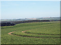
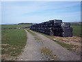
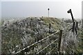
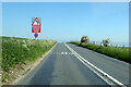
Nearby Images from Geograph Britain and Ireland:
©2007(licence)
©2007(licence)
©2023(licence)
©2021(licence)
©2007(licence)
The above images may not be of the site on this page, they are loaded from Geograph.
Please Submit an Image of this site or go out and take one for us!
Click here to see more info for this site
Nearby sites
Key: Red: member's photo, Blue: 3rd party photo, Yellow: other image, Green: no photo - please go there and take one, Grey: site destroyed
Download sites to:
KML (Google Earth)
GPX (GPS waypoints)
CSV (Garmin/Navman)
CSV (Excel)
To unlock full downloads you need to sign up as a Contributory Member. Otherwise downloads are limited to 50 sites.
Turn off the page maps and other distractions
Nearby sites listing. In the following links * = Image available
180m WSW 251° South Newton Round Barrow(s) (SU101355)
1.1km N 4° Heale Hill Round Barrow(s) (SU10343670)
1.3km NNE 32° Woodford Round Barrow(s) (SU10983670)
2.9km NNW 333° Druids Head Farm Barrows Round Barrow(s) (SU08933815)
3.4km SE 129° North Hill Down* Barrow Cemetery (SU12953343)
3.6km ENE 59° Little Down Barrow Group* Barrow Cemetery (SU13333738)
4.0km NNE 21° Lake Down Barrow Cemetery Barrow Cemetery (SU117393)
4.2km W 267° Ebsbury* Hillfort (SU061353)
4.3km NE 44° Wilsford Cum Lake Bowl Barrow* Round Barrow(s) (SU13213866)
4.5km NNE 20° Wilsford Barrow Cemetery Barrow Cemetery (SU118398)
4.5km SE 130° Old Sarum* Hillfort (SU13783266)
4.7km N 8° Lake Barrow Cemetery* Barrow Cemetery (SU109402)
4.9km NE 56° Ogbury Camp* Hillfort (SU143383)
5.0km NW 321° Berwick St James* Standing Stones (SU071394)
5.6km NNE 12° Normanton Down Long Barrow* Long Barrow (SU1141341071)
5.8km ESE 105° Hand Barrows* Barrow Cemetery (SU1588034050)
5.8km NNE 15° Normanton Down* Barrow Cemetery (SU118412)
5.9km NNE 14° Bush Barrow* Round Barrow(s) (SU11644126)
5.9km N 358° Long Barrow Cross* Ancient Cross (SU1005441499)
5.9km N 6° Pond Barrow and Wilsford Shaft Round Barrow(s) (SU1086441475)
6.0km NE 50° Amesbury Down Triple Bell Barrow Round Barrow(s) (SU14833944)
6.1km NE 41° Amesbury Down Bowl Barrows Barrow Cemetery (SU14314020)
6.2km N 359° Winterbourne Stoke* Barrow Cemetery (SU10174171)
6.3km NNE 12° North of Normanton Gorse Barrows* Barrow Cemetery (SU1154441754)
6.5km E 81° Downbarn West Enclosure* Ancient Village or Settlement (SU16713654)
View more nearby sites and additional images


 We would like to know more about this location. Please feel free to add a brief description and any relevant information in your own language.
 Wir möchten mehr über diese Stätte erfahren. Bitte zögern Sie nicht, eine kurze Beschreibung und relevante Informationen in Deutsch hinzuzufügen.
 Nous aimerions en savoir encore un peu sur les lieux. S'il vous plaît n'hesitez pas à ajouter une courte description et tous les renseignements pertinents dans votre propre langue.
 Quisieramos informarnos un poco más de las lugares. No dude en añadir una breve descripción y otros datos relevantes en su propio idioma.