<< Our Photo Pages >> Winterbourne Bassett - Stone Circle in England in Wiltshire
Submitted by Anonymous on Wednesday, 08 August 2007 Page Views: 18779
Neolithic and Bronze AgeSite Name: Winterbourne BassettCountry: England County: Wiltshire Type: Stone Circle
Map Ref: SU094755 Landranger Map Number: 173
Latitude: 51.478382N Longitude: 1.866037W
Condition:
| 5 | Perfect |
| 4 | Almost Perfect |
| 3 | Reasonable but with some damage |
| 2 | Ruined but still recognisable as an ancient site |
| 1 | Pretty much destroyed, possibly visible as crop marks |
| 0 | No data. |
| -1 | Completely destroyed |
| 5 | Superb |
| 4 | Good |
| 3 | Ordinary |
| 2 | Not Good |
| 1 | Awful |
| 0 | No data. |
| 5 | Can be driven to, probably with disabled access |
| 4 | Short walk on a footpath |
| 3 | Requiring a bit more of a walk |
| 2 | A long walk |
| 1 | In the middle of nowhere, a nightmare to find |
| 0 | No data. |
| 5 | co-ordinates taken by GPS or official recorded co-ordinates |
| 4 | co-ordinates scaled from a detailed map |
| 3 | co-ordinates scaled from a bad map |
| 2 | co-ordinates of the nearest village |
| 1 | co-ordinates of the nearest town |
| 0 | no data |
Internal Links:
External Links:
I have visited· I would like to visit
woodini254 visited on 29th Dec 1993 - their rating: Cond: 2 Amb: 3 Access: 5 There is not much that remains of this stone circle which is a pity. There are remains of recumbent stones but that's about it really.
NickyD have visited here
")
Have you visited this site? Please contribute a description or any thoughts by adding a comment.
You may be viewing yesterday's version of this page. To see the most up to date information please register for a free account.
")
")
")
Do not use the above information on other web sites or publications without permission of the contributor.
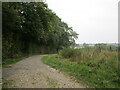
Nearby Images from Geograph Britain and Ireland:
©2024(licence)
©2022(licence)
©2022(licence)
©2008(licence)
©2022(licence)
The above images may not be of the site on this page, they are loaded from Geograph.
Please Submit an Image of this site or go out and take one for us!
Click here to see more info for this site
Nearby sites
Key: Red: member's photo, Blue: 3rd party photo, Yellow: other image, Green: no photo - please go there and take one, Grey: site destroyed
Download sites to:
KML (Google Earth)
GPX (GPS waypoints)
CSV (Garmin/Navman)
CSV (Excel)
To unlock full downloads you need to sign up as a Contributory Member. Otherwise downloads are limited to 50 sites.
![]()
Turn off the page maps and other distractions
Nearby sites listing. In the following links * = Image available
2.3km E 85° Fiddler's Hill (Wiltshire)* Standing Stone (Menhir) (SU117757)
3.6km S 174° Winterbourne Monkton* Chambered Tomb (SU09797197)
3.7km E 94° Hackpen Hill Standing Stone* Standing Stone (Menhir) (SU13067526)
3.7km SE 138° Monkton Down N* Barrow Cemetery (SU11937274)
3.9km SE 145° Monkton Down Long Barrow* Long Barrow (SU1163272303)
3.9km SE 143° Monkton Down* Barrow Cemetery (SU1176472347)
4.1km NNE 19° Bincknoll Castle* Hillfort (SU10747933)
4.1km S 190° Windmill Hill (Avebury)* Causewayed Enclosure (SU08677144)
4.2km S 191° Windmill Hill Barrows* Round Barrow(s) (SU08637135)
4.3km S 191° Picket Barrow* Round Barrow(s) (SU086713)
4.4km SE 127° Old Chapel.* Long Barrow (SU12907290)
4.5km E 100° Preshute Down Enclosure Ancient Village or Settlement (SU13857470)
4.7km SSE 155° Avebury Down Stone Circle* Stone Circle (SU11437127)
4.7km SSE 162° Avebury Down Earthwork Misc. Earthwork (SU10837102)
4.8km SE 137° Ridgeway* Ancient Trackway (SU127720)
4.8km SSE 160° Avebury Down Bell Barrow* Barrow Cemetery (SU11047094)
4.9km SSE 158° Avebury Downs Barn Tumuli* Barrow Cemetery (SU1125170971)
4.9km ESE 121° Rough Hill barrow cemetery Barrow Cemetery (SU1359172953)
5.1km S 189° Horslip Long Barrow* Long Barrow (SU0858970503)
5.1km SSW 208° Yatesbury Field Barrows* Round Barrow(s) (SU0703171000)
5.2km SE 144° Monkton Down Bowl Barrow Round Barrow(s) (SU12487134)
5.2km SSE 147° Overton Down* Barrow Cemetery (SU12307113)
5.3km SE 140° The Polisher (Fyfield Down)* Polissoir (SU12837150)
5.3km SE 139° Holed Stone (West Overton)* Ancient Village or Settlement (SU12857151)
5.3km E 81° Barbury Castle Barrows* Barrow Cemetery (SU14687634)
View more nearby sites and additional images


 We would like to know more about this location. Please feel free to add a brief description and any relevant information in your own language.
 Wir möchten mehr über diese Stätte erfahren. Bitte zögern Sie nicht, eine kurze Beschreibung und relevante Informationen in Deutsch hinzuzufügen.
 Nous aimerions en savoir encore un peu sur les lieux. S'il vous plaît n'hesitez pas à ajouter une courte description et tous les renseignements pertinents dans votre propre langue.
 Quisieramos informarnos un poco más de las lugares. No dude en añadir una breve descripción y otros datos relevantes en su propio idioma.