<< Text Pages >> Whinney Hill 2 - Rock Art in England in Northumberland
Submitted by Anne T on Friday, 06 April 2018 Page Views: 668
Rock ArtSite Name: Whinney Hill 2 Alternative Name: ERA-1004; Beckensall 278Country: England County: Northumberland Type: Rock Art
Nearest Town: Berwick upon Tweed / Wooler Nearest Village: Chatton / Chillingham
Map Ref: NU0929727526
Latitude: 55.541363N Longitude: 1.854234W
Condition:
| 5 | Perfect |
| 4 | Almost Perfect |
| 3 | Reasonable but with some damage |
| 2 | Ruined but still recognisable as an ancient site |
| 1 | Pretty much destroyed, possibly visible as crop marks |
| 0 | No data. |
| -1 | Completely destroyed |
| 5 | Superb |
| 4 | Good |
| 3 | Ordinary |
| 2 | Not Good |
| 1 | Awful |
| 0 | No data. |
| 5 | Can be driven to, probably with disabled access |
| 4 | Short walk on a footpath |
| 3 | Requiring a bit more of a walk |
| 2 | A long walk |
| 1 | In the middle of nowhere, a nightmare to find |
| 0 | No data. |
| 5 | co-ordinates taken by GPS or official recorded co-ordinates |
| 4 | co-ordinates scaled from a detailed map |
| 3 | co-ordinates scaled from a bad map |
| 2 | co-ordinates of the nearest village |
| 1 | co-ordinates of the nearest town |
| 0 | no data |
Be the first person to rate this site - see the 'Contribute!' box in the right hand menu.
Internal Links:
External Links:
I have visited· I would like to visit
Modern-neolithic visited - their rating: Cond: 4 Amb: 4 Access: 2
This rock art panel is recorded by NADRAP as having three well-defined cups and four small possible cups on a small sandstone panel, well bedded into the earth and almost level with ground surface. NADRAP notes that the adjacent rock has very impressive natural weathering patterns.
For more information see England's Rock Art entry for ERA-1004 Whinney Hill 2, which includes NADRAP's notes, photographs, a sketch of the rock and its motifs, plus photogrammetry, a VRML model and media from the Beckensall Archive.
The original Beckensall record can be found at Internet Archive: Beckensall 278 Whinney Hill 2.
This rock art panel is located on Open Access land.
Note: Have you seen this rock art panel? Do you have any photographs or information to add?
You may be viewing yesterday's version of this page. To see the most up to date information please register for a free account.
")
")
")
Do not use the above information on other web sites or publications without permission of the contributor.
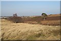
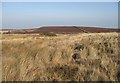
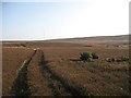
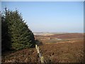
Nearby Images from Geograph Britain and Ireland:
©2008(licence)
©2008(licence)
©2008(licence)

©2015(licence)
©2008(licence)
The above images may not be of the site on this page, they are loaded from Geograph.
Please Submit an Image of this site or go out and take one for us!
Click here to see more info for this site
Nearby sites
Key: Red: member's photo, Blue: 3rd party photo, Yellow: other image, Green: no photo - please go there and take one, Grey: site destroyed
Download sites to:
KML (Google Earth)
GPX (GPS waypoints)
CSV (Garmin/Navman)
CSV (Excel)
To unlock full downloads you need to sign up as a Contributory Member. Otherwise downloads are limited to 50 sites.
Turn off the page maps and other distractions
Nearby sites listing. In the following links * = Image available
53m E 94° Whinny Hill Stone Circle* Stone Circle (NU0935027522)
103m SSE 161° Whinney Hill 1 Rock Art (NU0933127429)
199m ESE 112° Whinney Hill 4 Rock Art (NU0948227452)
263m NE 36° Whinny Hill Robbed Cairn* Round Cairn (NU09452774)
455m NE 43° Whinney Hill 3* Rock Art (NU0961027858)
461m NE 44° Whinney Hill 5 Rock Art (NU0961827858)
541m NE 35° Whinny Hill Enclosed Cremation Cemetery.* Cairn (NU0960427973)
673m NNE 32° Whinny Hill Cairn Cairn (NU09652810)
728m ESE 113° Whitehill Head/Chatton Sandyford 1 Rock Art (NU0997127245)
735m ESE 112° Whitehill Head/Chatton Sandyford 2 Rock Art (NU0998327257)
775m ESE 124° Chatton Sandyford 7 Rock Art (NU0994527098)
799m ESE 122° Chatton Sandyford 6 Rock Art (NU0997927107)
801m ESE 111° Whitehill Head/Chatton Sandyford 3 Rock Art (NU1004827242)
805m ESE 120° Camp Hill 2 Rock Art (NU1000027130)
810m ESE 120° Camp Hill 3 Rock Art (NU1000027120)
820m ESE 121° Camp Hill 1 Rock Art (NU1000027100)
868m SE 124° Chatton Sandyford 5 Rock Art (NU1001627036)
932m SE 131° Chatton Sandyford 8 Rock Art (NU1000326914)
966m SE 131° Chatton Sandyford 9 Rock Art (NU1002726891)
995m SE 140° Chatton Sandyford N01 Rock Art (NU0994326767)
998m ENE 77° Lamb's Knowe 1 Rock Art (NU1027327747)
1.1km SE 143° Chatton Sandyford 10 Rock Art (NU0993326685)
1.1km SSW 204° Millstone Hill Portable Rock Art (NU0885026500)
1.1km SSW 204° Millstone Hill.* Rock Art (NU0884726501)
1.1km SE 141° Camp Hilll Round Cairn* Round Cairn (NU10012666)
View more nearby sites and additional images


 We would like to know more about this location. Please feel free to add a brief description and any relevant information in your own language.
 Wir möchten mehr über diese Stätte erfahren. Bitte zögern Sie nicht, eine kurze Beschreibung und relevante Informationen in Deutsch hinzuzufügen.
 Nous aimerions en savoir encore un peu sur les lieux. S'il vous plaît n'hesitez pas à ajouter une courte description et tous les renseignements pertinents dans votre propre langue.
 Quisieramos informarnos un poco más de las lugares. No dude en añadir una breve descripción y otros datos relevantes en su propio idioma.