<< Text Pages >> Robin Hood Ball Clump Barrow - Round Barrow(s) in England in Wiltshire
Submitted by coldrum on Monday, 18 October 2010 Page Views: 4844
Neolithic and Bronze AgeSite Name: Robin Hood Ball Clump BarrowCountry: England
NOTE: This site is 3.1 km away from the location you searched for.
County: Wiltshire Type: Round Barrow(s)
Map Ref: SU10674630
Latitude: 51.215803N Longitude: 1.848616W
Condition:
| 5 | Perfect |
| 4 | Almost Perfect |
| 3 | Reasonable but with some damage |
| 2 | Ruined but still recognisable as an ancient site |
| 1 | Pretty much destroyed, possibly visible as crop marks |
| 0 | No data. |
| -1 | Completely destroyed |
| 5 | Superb |
| 4 | Good |
| 3 | Ordinary |
| 2 | Not Good |
| 1 | Awful |
| 0 | No data. |
| 5 | Can be driven to, probably with disabled access |
| 4 | Short walk on a footpath |
| 3 | Requiring a bit more of a walk |
| 2 | A long walk |
| 1 | In the middle of nowhere, a nightmare to find |
| 0 | No data. |
| 5 | co-ordinates taken by GPS or official recorded co-ordinates |
| 4 | co-ordinates scaled from a detailed map |
| 3 | co-ordinates scaled from a bad map |
| 2 | co-ordinates of the nearest village |
| 1 | co-ordinates of the nearest town |
| 0 | no data |
Be the first person to rate this site - see the 'Contribute!' box in the right hand menu.
Internal Links:
External Links:
Round Barrows in Wiltshire
"Bronze Age bowl barrow in Robin Hood Ball Clump. The barrow mound is 26m in diameter and 1.5m high. Surrounding the mound is a quarry ditch which has become infilled over the years and survives as a buried feature. The earthwork remains of this barrow were mapped from aerial photographs as part of the RCHME: Salisbury Plain Training Area NMP project, and subsequently revised for the English Heritage Stonehenge WHS Mapping Project."
Source: Pastscape
You may be viewing yesterday's version of this page. To see the most up to date information please register for a free account.
Do not use the above information on other web sites or publications without permission of the contributor.
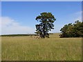
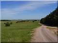
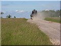
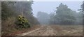
Nearby Images from Geograph Britain and Ireland:
©2007(licence)
©2007(licence)
©2007(licence)
©2021(licence)
©2007(licence)
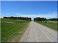
The above images may not be of the site on this page, they are loaded from Geograph.
Please Submit an Image of this site or go out and take one for us!
Click here to see more info for this site
Nearby sites
Key: Red: member's photo, Blue: 3rd party photo, Yellow: other image, Green: no photo - please go there and take one, Grey: site destroyed
Download sites to:
KML (Google Earth)
GPX (GPS waypoints)
CSV (Garmin/Navman)
CSV (Excel)
To unlock full downloads you need to sign up as a Contributory Member. Otherwise downloads are limited to 50 sites.
Turn off the page maps and other distractions
Nearby sites listing. In the following links * = Image available
476m SW 231° Robin Hood's Ball Causewayed Enclosure (SU103460)
798m WSW 238° Shrewton 4 Round Barrow(s) (SU09994588)
2.3km ESE 114° Knighton Down Long Barrow (SU12784535)
2.3km SW 233° Shrewton 5d I Timber Circle (SU088449)
2.6km SE 137° Long Barrow alongside The Packway, Larkhill* Long Barrow (SU12474438)
2.7km S 179° Winterbourne Stoke Cursus (E) Cursus (SU107436)
2.9km S 186° The Lesser Cursus* Cursus (SU10354343)
2.9km S 187° Winterbourne Stoke Cursus (W) Cursus (SU103434)
3.4km S 176° Amesbury Cursus (W)* Cursus (SU109429)
3.5km S 189° Stonehenge Visitor Centre* Museum (SU101428)
3.6km S 172° Fargo Disk Barrow* Round Barrow(s) (SU11154275)
3.6km SSE 158° Great Cursus, Stonehenge* Cursus (SU12064296)
3.7km SSE 153° Great Cursus W Barrow* Round Barrow(s) (SU1235143043)
3.7km SSE 168° Bowl and Bell Barrow* Barrow Cemetery (SU11454270)
3.7km SSE 161° Great Cursus Barrows, Stonehenge* Round Barrow(s) (SU11894278)
3.9km ESE 119° Larkhill Causewayed Enclosure* Causewayed Enclosure (SU14084440)
4.0km S 189° North of Winterbourne Stoke Crossroads* Barrow Cemetery (SU1004742378)
4.1km SSE 161° Stonehenge Car Park Postholes* Timber Circle (SU120424)
4.2km NE 36° Netheravon Cursus Cursus (SU131497)
4.2km SSE 151° The Avenue* Ancient Trackway (SU12694262)
4.3km SE 136° Amesbury Cursus (E)* Cursus (SU137432)
4.4km SSE 158° Heel Stone* Standing Stone (Menhir) (SU1229142244)
4.4km SSE 159° Stonehenge.* Stone Circle (SU1224742194)
4.5km SSE 157° Stonehenge Bowl Barrow* Round Barrow(s) (SU12424217)
4.6km SE 140° Old King Barrows* Barrow Cemetery (SU13604280)
View more nearby sites and additional images


 We would like to know more about this location. Please feel free to add a brief description and any relevant information in your own language.
 Wir möchten mehr über diese Stätte erfahren. Bitte zögern Sie nicht, eine kurze Beschreibung und relevante Informationen in Deutsch hinzuzufügen.
 Nous aimerions en savoir encore un peu sur les lieux. S'il vous plaît n'hesitez pas à ajouter une courte description et tous les renseignements pertinents dans votre propre langue.
 Quisieramos informarnos un poco más de las lugares. No dude en añadir una breve descripción y otros datos relevantes en su propio idioma.