<< Our Photo Pages >> Shortflatt Barrow - Round Barrow(s) in England in Northumberland
Submitted by ringpaw on Tuesday, 27 November 2012 Page Views: 2057
Neolithic and Bronze AgeSite Name: Shortflatt BarrowCountry: England County: Northumberland Type: Round Barrow(s)
Nearest Town: Morpeth Nearest Village: Bolam
Map Ref: NZ08518057
Latitude: 55.119447N Longitude: 1.868111W
Condition:
| 5 | Perfect |
| 4 | Almost Perfect |
| 3 | Reasonable but with some damage |
| 2 | Ruined but still recognisable as an ancient site |
| 1 | Pretty much destroyed, possibly visible as crop marks |
| 0 | No data. |
| -1 | Completely destroyed |
| 5 | Superb |
| 4 | Good |
| 3 | Ordinary |
| 2 | Not Good |
| 1 | Awful |
| 0 | No data. |
| 5 | Can be driven to, probably with disabled access |
| 4 | Short walk on a footpath |
| 3 | Requiring a bit more of a walk |
| 2 | A long walk |
| 1 | In the middle of nowhere, a nightmare to find |
| 0 | No data. |
| 5 | co-ordinates taken by GPS or official recorded co-ordinates |
| 4 | co-ordinates scaled from a detailed map |
| 3 | co-ordinates scaled from a bad map |
| 2 | co-ordinates of the nearest village |
| 1 | co-ordinates of the nearest town |
| 0 | no data |
Internal Links:
External Links:
")
Diameter of 20m with a maximum height of 2m with an accessible protective fence around it. Thought to contain significant archaeological remains, the barrow is situated in an atmospheric landscape with a plethora of historical interest, including the nearby Shortflatt Tower and extensive ridge and furrow field systems. National Monument number 25144.
You may be viewing yesterday's version of this page. To see the most up to date information please register for a free account.
Do not use the above information on other web sites or publications without permission of the contributor.
Nearby Images from Geograph Britain and Ireland:
©2015(licence)
©2016(licence)

©2008(licence)
©2016(licence)
©2015(licence)
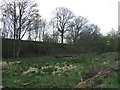
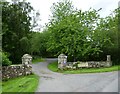
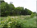
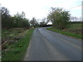
The above images may not be of the site on this page, they are loaded from Geograph.
Please Submit an Image of this site or go out and take one for us!
Click here to see more info for this site
Nearby sites
Key: Red: member's photo, Blue: 3rd party photo, Yellow: other image, Green: no photo - please go there and take one, Grey: site destroyed
Download sites to:
KML (Google Earth)
GPX (GPS waypoints)
CSV (Garmin/Navman)
CSV (Excel)
To unlock full downloads you need to sign up as a Contributory Member. Otherwise downloads are limited to 50 sites.
Turn off the page maps and other distractions
Nearby sites listing. In the following links * = Image available
162m W 281° Shortflatt b & d Rock Art (NZ08358060)
230m WSW 250° Shortflatt c Rock Art (NZ0829380491)
726m NW 306° Shortflatt a Rock Art (NZ0792080995)
929m N 359° Bolam Rock Art Panel Rock Art (NZ0850081500)
1.9km NNE 28° Bolam Round Cairn (Northumberland)* Round Cairn (NZ0940082226)
2.0km S 176° Belsay Tower Cross (Northumberland)* Ancient Cross (NZ0867178552)
2.2km NNE 20° St Andrew's Church (Bolam)* Ancient Cross (NZ0924482601)
2.4km NW 312° The Poind and Man Rock Art Rock Art (NZ0673282136)
2.4km WNW 285° Devil's Causeway (Belsay) Rock Art (NZ0615081200)
2.5km NW 308° The Poind And His Man* Standing Stone (Menhir) (NZ06578210)
2.7km NW 304° Poind and Man (West)* Rock Art (NZ0629582043)
3.4km W 281° Ferney Chesters N05 Rock Art (NZ0521281215)
3.4km WNW 300° Salters Nick Rock Shelter Rock Art (NZ0557582243)
3.5km WNW 281° Ferney Chesters N04 Rock Art (NZ0510981250)
3.5km WNW 282° Ferney Chesters N02 Ring Cairn (NZ0510081261)
3.5km WNW 282° Ferney Chesters N01 Rock Art (NZ0509981263)
3.5km WNW 289° Shaftoe Crag Camp* Hillfort (NZ05158170)
3.5km W 281° Ferney Chesters N03 Rock Art (NZ0502581233)
3.5km W 281° Ferney Chesters N06 Rock Art (NZ0502681251)
3.6km NW 312° Middleton Bank Top 1c Rock Art (NZ0583882943)
3.6km NW 312° Middleton Bank Top 1a* Rock Art (NZ0583682943)
3.6km NW 312° Middleton Bank Top 1b & N1b* Rock Art (NZ0583582945)
3.6km WNW 300° Salters Nick Settlement* Ancient Village or Settlement (NZ05358235)
3.7km WNW 299° Shaftoe (Shaftoe Crags) Rock Art (NZ0528782365)
3.7km WNW 302° Shaftoe Jubilee Stone A Rock Art (NZ0536382497)
View more nearby sites and additional images


 We would like to know more about this location. Please feel free to add a brief description and any relevant information in your own language.
 Wir möchten mehr über diese Stätte erfahren. Bitte zögern Sie nicht, eine kurze Beschreibung und relevante Informationen in Deutsch hinzuzufügen.
 Nous aimerions en savoir encore un peu sur les lieux. S'il vous plaît n'hesitez pas à ajouter une courte description et tous les renseignements pertinents dans votre propre langue.
 Quisieramos informarnos un poco más de las lugares. No dude en añadir una breve descripción y otros datos relevantes en su propio idioma.