<< Our Photo Pages >> Parley Barrow - Round Barrow(s) in England in Dorset
Submitted by coldrum on Tuesday, 11 August 2009 Page Views: 4056
Neolithic and Bronze AgeSite Name: Parley BarrowCountry: England County: Dorset Type: Round Barrow(s)
Map Ref: SZ07909865
Latitude: 50.787368N Longitude: 1.889297W
Condition:
| 5 | Perfect |
| 4 | Almost Perfect |
| 3 | Reasonable but with some damage |
| 2 | Ruined but still recognisable as an ancient site |
| 1 | Pretty much destroyed, possibly visible as crop marks |
| 0 | No data. |
| -1 | Completely destroyed |
| 5 | Superb |
| 4 | Good |
| 3 | Ordinary |
| 2 | Not Good |
| 1 | Awful |
| 0 | No data. |
| 5 | Can be driven to, probably with disabled access |
| 4 | Short walk on a footpath |
| 3 | Requiring a bit more of a walk |
| 2 | A long walk |
| 1 | In the middle of nowhere, a nightmare to find |
| 0 | No data. |
| 5 | co-ordinates taken by GPS or official recorded co-ordinates |
| 4 | co-ordinates scaled from a detailed map |
| 3 | co-ordinates scaled from a bad map |
| 2 | co-ordinates of the nearest village |
| 1 | co-ordinates of the nearest town |
| 0 | no data |
Internal Links:
External Links:
")
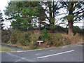
Bowl barrow on the corner of Ellesfield Drive and Druid's Close.
More at Pastscape
You may be viewing yesterday's version of this page. To see the most up to date information please register for a free account.
Do not use the above information on other web sites or publications without permission of the contributor.
coldrum has found this location on Google Street View:
Nearby Images from Geograph Britain and Ireland:
©2010(licence)
©2009(licence)
©2009(licence)
©2005(licence)
©2005(licence)
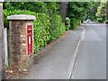
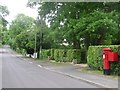
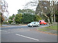
The above images may not be of the site on this page, they are loaded from Geograph.
Please Submit an Image of this site or go out and take one for us!
Click here to see more info for this site
Nearby sites
Key: Red: member's photo, Blue: 3rd party photo, Yellow: other image, Green: no photo - please go there and take one, Grey: site destroyed
Download sites to:
KML (Google Earth)
GPX (GPS waypoints)
CSV (Garmin/Navman)
CSV (Excel)
To unlock full downloads you need to sign up as a Contributory Member. Otherwise downloads are limited to 50 sites.
Turn off the page maps and other distractions
Nearby sites listing. In the following links * = Image available
714m ENE 78° Ralph's Barrow* Round Barrow(s) (SZ086988)
714m WSW 258° Dudsbury Hill Tumuli* Round Barrow(s) (SZ072985)
776m SSW 195° Dudsbury Camp* Hillfort (SZ077979)
1.4km WNW 299° Ferndown Town Common* Round Barrow(s) (SZ067993)
2.6km NE 38° Trickett's Cross Barrow* Round Barrow(s) (SU095007)
3.0km SSW 205° Two Barrow Heath Barrow Cemetery (SZ0663495924)
3.5km WNW 299° Bowl round barrow just outside Stapehill community centre Dorset Barrow Cemetery (SU0482700373)
4.4km E 82° Hurn Forest Barrow* Round Barrow(s) (SZ123993)
4.8km SSW 207° Poole Timber Circle Timber Circle (SZ057944)
5.5km SE 138° Holdenhurst Long Barrow* Long Barrow (SZ116946)
5.5km ESE 105° Sopley Common Tumulus* Round Barrow(s) (SZ132972)
5.6km ESE 108° Ramsdown Plantation / Sopley Common* Round Barrow(s) (SZ132969)
5.7km S 189° Talbot Heath Misc. Earthwork (SZ070930)
5.8km NNE 25° Lions Hill Enclosure* Misc. Earthwork (SU103039)
5.8km NE 55° Barnsfield Heath (North)* Round Barrow(s) (SU127020)
6.1km S 180° Robin Hood's Barrow (Bournemouth) Round Barrow(s) (SZ07939256)
6.1km S 189° Fern Barrow* Round Barrow(s) (SZ069926)
6.7km NNW 339° Holt Heath* Round Barrow(s) (SU055049)
7.1km SSW 204° Parkstone Standing Stone (Menhir) (SZ050922)
7.1km ESE 116° St Catherine's Hill (Christchurch)* Barrow Cemetery (SZ143955)
8.0km WNW 298° Bakers Dozen* Modern Stone Circle etc (SU008024)
8.0km ESE 103° St Michael's Well (Sopley)* Holy Well or Sacred Spring (SZ1573596865)
8.4km NNW 327° Colebarrow* Hillfort (SU033057)
8.5km NE 38° Watchmoor Wood* Round Barrow(s) (SU131054)
8.5km W 281° Pamphill* Natural Stone / Erratic / Other Natural Feature (ST995003)
View more nearby sites and additional images


 We would like to know more about this location. Please feel free to add a brief description and any relevant information in your own language.
 Wir möchten mehr über diese Stätte erfahren. Bitte zögern Sie nicht, eine kurze Beschreibung und relevante Informationen in Deutsch hinzuzufügen.
 Nous aimerions en savoir encore un peu sur les lieux. S'il vous plaît n'hesitez pas à ajouter une courte description et tous les renseignements pertinents dans votre propre langue.
 Quisieramos informarnos un poco más de las lugares. No dude en añadir una breve descripción y otros datos relevantes en su propio idioma.