


<< Our Photo Pages >> High Green (407) - Rock Art in England in Yorkshire (North)
Submitted by Anne T on Monday, 13 November 2017 Page Views: 972
Rock ArtSite Name: High Green (407) Alternative Name: Boughey & Vickerman (407)Country: England County: Yorkshire (North) Type: Rock Art
Nearest Town: Grassington Nearest Village: Skyreholme
Map Ref: SE0751062601
Latitude: 54.059306N Longitude: 1.886763W
Condition:
| 5 | Perfect |
| 4 | Almost Perfect |
| 3 | Reasonable but with some damage |
| 2 | Ruined but still recognisable as an ancient site |
| 1 | Pretty much destroyed, possibly visible as crop marks |
| 0 | No data. |
| -1 | Completely destroyed |
| 5 | Superb |
| 4 | Good |
| 3 | Ordinary |
| 2 | Not Good |
| 1 | Awful |
| 0 | No data. |
| 5 | Can be driven to, probably with disabled access |
| 4 | Short walk on a footpath |
| 3 | Requiring a bit more of a walk |
| 2 | A long walk |
| 1 | In the middle of nowhere, a nightmare to find |
| 0 | No data. |
| 5 | co-ordinates taken by GPS or official recorded co-ordinates |
| 4 | co-ordinates scaled from a detailed map |
| 3 | co-ordinates scaled from a bad map |
| 2 | co-ordinates of the nearest village |
| 1 | co-ordinates of the nearest town |
| 0 | no data |
Be the first person to rate this site - see the 'Contribute!' box in the right hand menu.
Internal Links:
External Links:
I have visited· I would like to visit
drolaf visited on 14th Sep 2022 - their rating: Cond: 3 Amb: 3 Access: 2
 (PID:237119)")
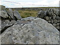
This recumbent standing-stone shaped boulder with cup marks features on The Northern Antiquarian (TNA) - see their entry for High Green (407), Skyreholme, North Yorkshire. TNA give us directions for finding the boulder together with a photograph, a sketch and a brief archaeology and history.
TNA add: "in Boughey & Vickerman’s (2003) survey they give it the wrong grid reference, though describe it correctly as a “long flat rock of irregular outline (with) fourteen to sixteen cups.” A cluster of other carvings are nearby, though some have been destroyed through mining operations."
This stone is also recorded as Pastscape Monument No. 1080864, which says: "Cup marked gritstone rock 26m north of the track from New Dam to Black Hill Road. The carving consists of 14 to 16 cups, It is part of a larger group of cup and ring marked rocks. "
The boulder is also scheduled - see Historic England List ID 1015102, which adds: "The monument includes a carved gritstone rock, 1.7m x 0.8m x 0.2m."
Note: Have you visited this site? Do you have any photographs or information to add?
You may be viewing yesterday's version of this page. To see the most up to date information please register for a free account.
Do not use the above information on other web sites or publications without permission of the contributor.
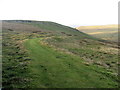
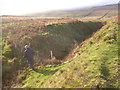
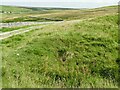
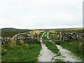
Nearby Images from Geograph Britain and Ireland:
©2008(licence)
©2014(licence)
©2021(licence)
©2022(licence)
©2022(licence)
The above images may not be of the site on this page, they are loaded from Geograph.
Please Submit an Image of this site or go out and take one for us!
Click here to see more info for this site
Nearby sites
Key: Red: member's photo, Blue: 3rd party photo, Yellow: other image, Green: no photo - please go there and take one, Grey: site destroyed
Download sites to:
KML (Google Earth)
GPX (GPS waypoints)
CSV (Garmin/Navman)
CSV (Excel)
To unlock full downloads you need to sign up as a Contributory Member. Otherwise downloads are limited to 50 sites.
Turn off the page maps and other distractions
Nearby sites listing. In the following links * = Image available
134m WSW 243° Nussey Green (404)* Rock Art (SE07396254)
210m WSW 244° Skyreholme (401)* Rock Art (SE07326251)
349m SE 143° Skyreholme Wall Stone (413) Rock Art (SE0772062322)
815m SSE 160° Burhill Kiln (Appletreewick) Rock Art (SE0778761834)
851m SSE 160° Skyreholme Rock Art* Rock Art (SE078618)
1.2km WNW 293° Appletreewick* Stone Circle (SE0642863048)
1.2km SSE 152° Burnett's Ridge (Appletreewick)* Rock Art (SE0810361500)
1.8km SE 127° Eller Edge (424) Rock Art (SE0897361487)
1.8km SE 127° Eller Edge (426) Rock Art (SE0899161486)
1.9km SE 126° Eller Edge (429) Rock Art (SE09026150)
1.9km SE 125° Ellers Edge (431) Rock Art (SE0905961506)
1.9km SE 126° Ellers Edge (432) Rock Art (SE0907861479)
2.8km S 173° Simon's Seat (Skyreholme) Natural Stone / Erratic / Other Natural Feature (SE07885981)
3.0km WNW 292° Hartlington Pasture 02* Rock Art (SE04676373)
3.2km WNW 284° Hartlington Pasture 01* Rock Art (SE04396338)
3.2km S 180° The Devil's Apronful Cairn (SE0748759351)
4.2km NW 322° Blea Gill* Ancient Village or Settlement (SE04946588)
4.4km WSW 256° Burnsall Crosses* Ancient Cross (SE032615)
4.7km WNW 288° Dumpit Hill B (Hebden) Stone Circle (SE03076406)
4.7km WNW 287° Dumpit Hill* Stone Circle (SE02996399)
4.8km WNW 288° Dumpit Hill Enclosure Ancient Village or Settlement (SE0288464062)
4.9km WNW 290° Mossy Moor Reservoir* Ring Cairn (SE02866432)
6.3km SE 137° Raven Stones (559) Rock Art (SE1183558006)
6.3km SE 136° Rocking Moor Rock Art (SE1193458081)
6.4km E 101° Abbot's Hand* Marker Stone (SE138614)
View more nearby sites and additional images


 We would like to know more about this location. Please feel free to add a brief description and any relevant information in your own language.
 Wir möchten mehr über diese Stätte erfahren. Bitte zögern Sie nicht, eine kurze Beschreibung und relevante Informationen in Deutsch hinzuzufügen.
 Nous aimerions en savoir encore un peu sur les lieux. S'il vous plaît n'hesitez pas à ajouter une courte description et tous les renseignements pertinents dans votre propre langue.
 Quisieramos informarnos un poco más de las lugares. No dude en añadir una breve descripción y otros datos relevantes en su propio idioma.