<< Our Photo Pages >> Ketley Crag Rock Shelter 1 - Rock Art in England in Northumberland
Submitted by stu on Monday, 27 April 2015 Page Views: 14443
Rock ArtSite Name: Ketley Crag Rock Shelter 1 Alternative Name: ERA-97; Beckensall 235; SAM ND147A; SMR/HER N3434Country: England County: Northumberland Type: Rock Art
Nearest Town: Alnwick Nearest Village: Chatton
Map Ref: NU0746229804 Landranger Map Number: 75
Latitude: 55.561863N Longitude: 1.883252W
Condition:
| 5 | Perfect |
| 4 | Almost Perfect |
| 3 | Reasonable but with some damage |
| 2 | Ruined but still recognisable as an ancient site |
| 1 | Pretty much destroyed, possibly visible as crop marks |
| 0 | No data. |
| -1 | Completely destroyed |
| 5 | Superb |
| 4 | Good |
| 3 | Ordinary |
| 2 | Not Good |
| 1 | Awful |
| 0 | No data. |
| 5 | Can be driven to, probably with disabled access |
| 4 | Short walk on a footpath |
| 3 | Requiring a bit more of a walk |
| 2 | A long walk |
| 1 | In the middle of nowhere, a nightmare to find |
| 0 | No data. |
| 5 | co-ordinates taken by GPS or official recorded co-ordinates |
| 4 | co-ordinates scaled from a detailed map |
| 3 | co-ordinates scaled from a bad map |
| 2 | co-ordinates of the nearest village |
| 1 | co-ordinates of the nearest town |
| 0 | no data |
Internal Links:
External Links:
I have visited· I would like to visit
Modern-Neolithic kenhedges GeraniumCat SumDoood quantumpoet would like to visit
bishop_pam visited on 19th Aug 2017 - their rating: Cond: 4 Amb: 5 Access: 3 Easy enough to find but a bit of a scramble through bracken which partially obscures its position. Well worth the scramble!
Anne T couldn't find on 27th Jul 2014 - their rating: Access: 1 We went to seek this magnificent example of rock art, well armed with map, compass and camera, and parked outside South Lyham farm. At the adjacent cottages, one of the residents came out to speak to us, and pointed out the way to the permissive footpath across to Ketley Crag and Chattonpark Hill, telling us how to find the Ketley Stone. It had rained heavily the night before, and following the footpath across the first field from the farm, we remained undeterred by boggy ground and wet feet in the dip where the permissive path splits off right from the farm track. After a search, we found the wooden footbridge across the stream and the permissive footpath sign.
The bracken was shoulder high, and 50 feet further up the path, we were confronted by a high wall of bracken, which proved impossible to get through. So sadly we retraced our steps. Apparently we missed a sheep track through the bracken, which the resident, talking to us on our way back, told us had been there a month before.
We then tried again from the access track from the B6349, at grid reference NU 06362 30614. This was easy walking for the first kilometre or so, but just past the ford, the trackway became very overgrown, with deep ruts and it was very hard work to make progress through the weeds, and despite waterproofs, we were soggy. We did try walking along the edges of the fields rather than on the trackway, but there were no gates between fields, so sadly we had to give up.
I had been really looking forward to seeing this rocky crag; there is a third option, which is from this same trackway, but from Chatton Park Farm, which takes us up over the top of Chattonpark Hill, so we'll try this another day.
We then went in search of some rock art at Doddington, to see if this was more accessible
SolarMegalith visited on 17th Mar 2013 - their rating: Cond: 5 Amb: 4 Access: 3
anaxa visited on 30th Oct 2011 - their rating: Cond: 4 Amb: 5 Access: 3 Best visited in the early autumn when the bracken has died back a bit
coin visited - their rating: Cond: 5 Amb: 5 Access: 4
Bladup have visited here
Average ratings for this site from all visit loggers: Condition: 4.5 Ambience: 4.75 Access: 2.8
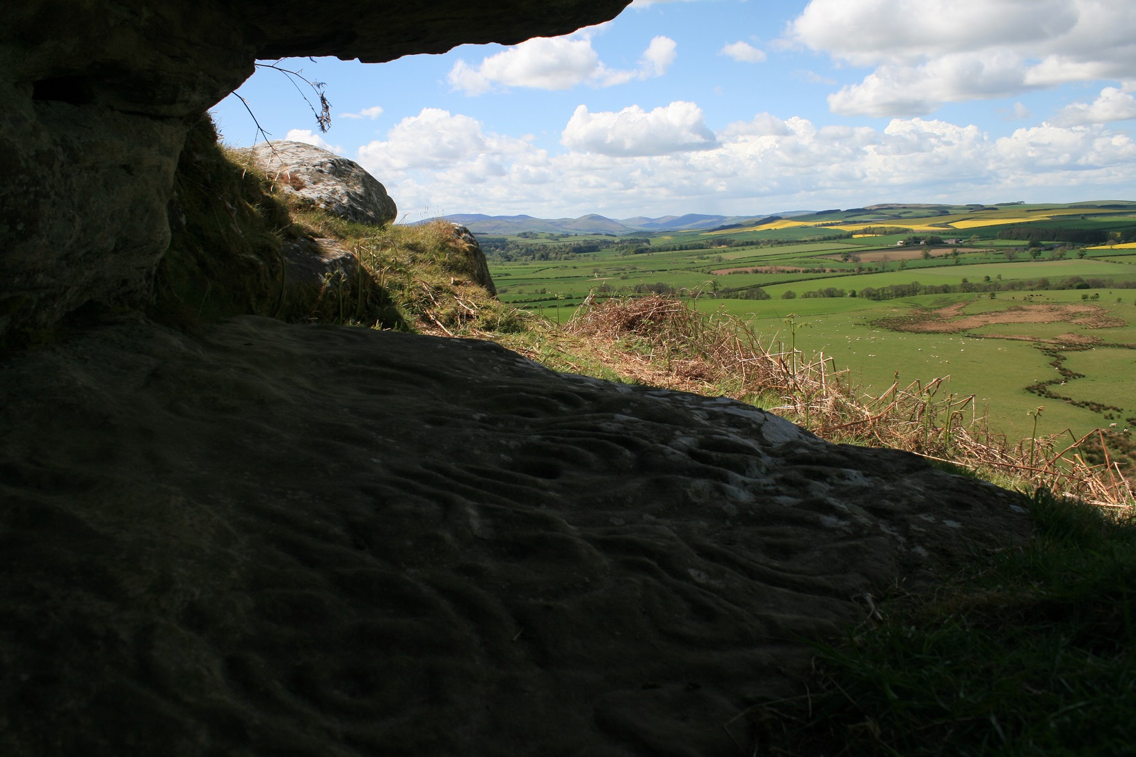
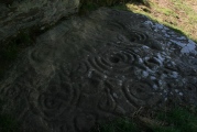
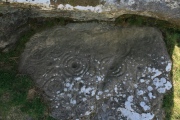
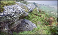
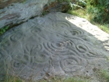
The floor of the overhang is 2.5m long and 1.60 m at its widest. There is certainly a prime case for calling the decoration of this outcrop ‘art', for the people who pecked the motifs onto the rock were sensitive to the whole surface that they wished to use, taking into account all the slight variations that were presented to them.
There is nothing better looking than this... lots of other impressive cup and ring carvings on the walk over from Chatton Hill.
See also article on their discovery.
Also see Beckensall's entry on Ketley Crag [please note this link does not work at present; we hope to update it shortly].
This rock art is also recorded as England's Rock Art entry for ERA-97 Ketley Rock Shelter 1, which includes a description, photographs, photogrammetry and media from the Beckensall Archive.
The original Beckensall record can be found at Internet Archive: Beckensall 235 Ketley Crag Rock Shelter.
Please note this rock shelter is located on private land.
You may be viewing yesterday's version of this page. To see the most up to date information please register for a free account.







Do not use the above information on other web sites or publications without permission of the contributor.
Click here to see more info for this site
Nearby sites
Key: Red: member's photo, Blue: 3rd party photo, Yellow: other image, Green: no photo - please go there and take one, Grey: site destroyed
Download sites to:
KML (Google Earth)
GPX (GPS waypoints)
CSV (Garmin/Navman)
CSV (Excel)
To unlock full downloads you need to sign up as a Contributory Member. Otherwise downloads are limited to 50 sites.
Turn off the page maps and other distractions
Nearby sites listing. In the following links * = Image available
41m NNE 22° Kettley Crags N01 Rock Art (NU0747729842)
233m S 189° Chatton 6c Rock Art (NU0742629574)
234m S 188° Chatton 6b Rock Art (NU0743129572)
238m S 188° Chatton 6a* Rock Art (NU0742829568)
262m S 180° Chatton 6d Rock Art (NU0746429542)
310m SSW 192° Chatton 6e Rock Art (NU0740029500)
402m SSW 192° Chatton 8a & 8b Rock Art (NU0738029410)
407m SSW 210° Chatton 14 Rock Art (NU0725829451)
474m S 184° Chatton 7 Rock Art (NU0742729331)
475m SSW 212° Chatton Camp* Hillfort (NU07212940)
482m SSW 210° Chatton 4* Rock Art (NU0722329385)
492m SE 145° Chatton 9a* Rock Art (NU0774229399)
527m SSW 191° Chatton 12* Rock Art (NU0735829287)
566m S 187° Chatton 13* Rock Art (NU0739129242)
571m SSE 163° Chatton 5* Rock Art (NU0762929257)
575m SE 145° Chatton 9b* Rock Art (NU0779529334)
661m S 182° Chatton 15b Rock Art (NU0743829143)
664m S 181° Chatton 15a Rock Art (NU0744729140)
682m S 174° Chatton 11 Rock Art (NU0753529125)
687m S 174° Chatton 10 Rock Art (NU0753029120)
713m SSE 149° Chatton 16 Rock Art (NU0783429194)
720m S 173° Chatton 2* Rock Art (NU0755329089)
727m S 172° Chatton 3* Rock Art (NU0756629084)
734m S 172° Chatton 1c Rock Art (NU0756129076)
744m S 173° Chatton 1b Rock Art (NU0755529065)
View more nearby sites and additional images


 We would like to know more about this location. Please feel free to add a brief description and any relevant information in your own language.
 Wir möchten mehr über diese Stätte erfahren. Bitte zögern Sie nicht, eine kurze Beschreibung und relevante Informationen in Deutsch hinzuzufügen.
 Nous aimerions en savoir encore un peu sur les lieux. S'il vous plaît n'hesitez pas à ajouter une courte description et tous les renseignements pertinents dans votre propre langue.
 Quisieramos informarnos un poco más de las lugares. No dude en añadir una breve descripción y otros datos relevantes en su propio idioma.