<< Our Photo Pages >> The Poind And His Man - Standing Stone (Menhir) in England in Northumberland
Submitted by Bladup on Wednesday, 16 March 2022 Page Views: 5644
Neolithic and Bronze AgeSite Name: The Poind And His ManCountry: England County: Northumberland Type: Standing Stone (Menhir)
Nearest Town: Morpeth Nearest Village: Bolam
Map Ref: NZ06578210
Latitude: 55.133225N Longitude: 1.898493W
Condition:
| 5 | Perfect |
| 4 | Almost Perfect |
| 3 | Reasonable but with some damage |
| 2 | Ruined but still recognisable as an ancient site |
| 1 | Pretty much destroyed, possibly visible as crop marks |
| 0 | No data. |
| -1 | Completely destroyed |
| 5 | Superb |
| 4 | Good |
| 3 | Ordinary |
| 2 | Not Good |
| 1 | Awful |
| 0 | No data. |
| 5 | Can be driven to, probably with disabled access |
| 4 | Short walk on a footpath |
| 3 | Requiring a bit more of a walk |
| 2 | A long walk |
| 1 | In the middle of nowhere, a nightmare to find |
| 0 | No data. |
| 5 | co-ordinates taken by GPS or official recorded co-ordinates |
| 4 | co-ordinates scaled from a detailed map |
| 3 | co-ordinates scaled from a bad map |
| 2 | co-ordinates of the nearest village |
| 1 | co-ordinates of the nearest town |
| 0 | no data |
Internal Links:
External Links:
I have visited· I would like to visit
elad13 would like to visit
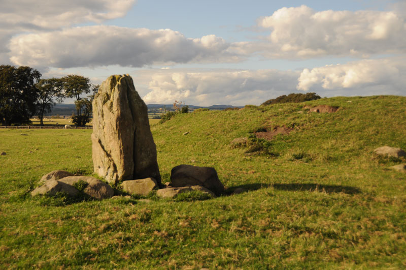
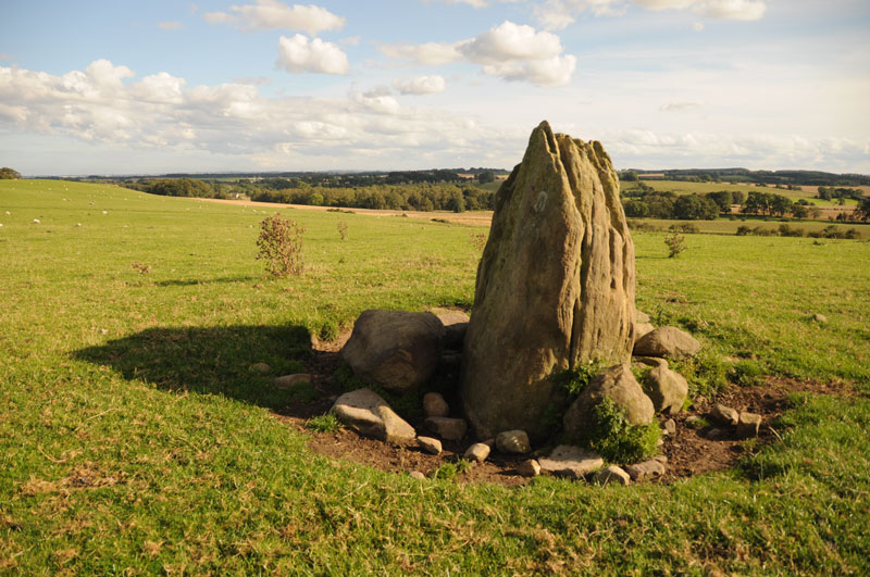
Anne T visited I didn’t expect this site to be as atmospheric as it was. We parked on the road that runs just south of Bolam Lake, in a small layby about 100 yards to the south west of Craig Hall, approx. grid reference: NZ 07126 82266 (only a couple of kilometres from the busy A696). We walked down the gravelled footpath past which turns left from this road through Bolam West Houses; in the second field to our left hand side past the houses, the tumulus came into view on the horizon. Whilst it is marked on the map as being just a tumulus, it is actually a tumulus with standing stone on its southern side.
Being on a slight hill, the tumulus stood out well against the surrounding terrain. There was no sign of the standing stone from this point, although some stones were poking up from the grass at the left hand (eastern) side of the tumulus.
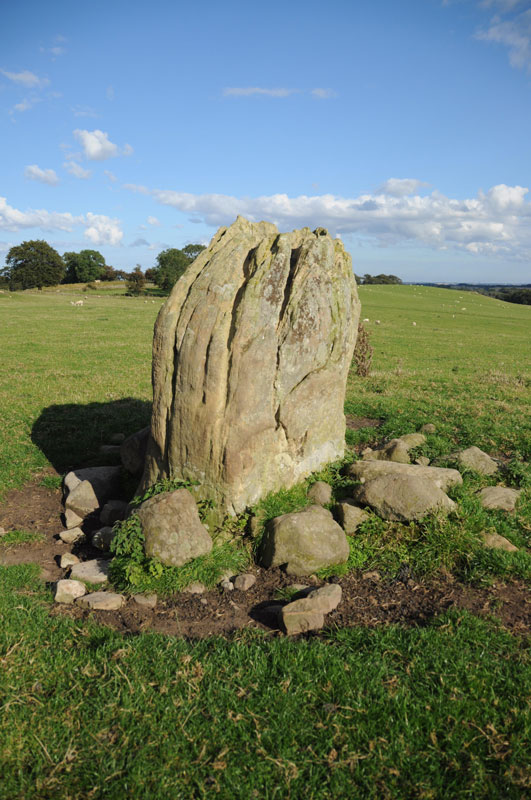
We found out afterwards that there was actually no public access to this tumulus and standing stone, so I felt guilty about walking up to it, although it was a short distance from the main footpath. The field was full of the most beautiful sheep, all kinds of different breeds. As we approached the tumulus, the standing stone is on its southern side appeared - much larger than I anticipated.
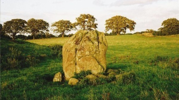
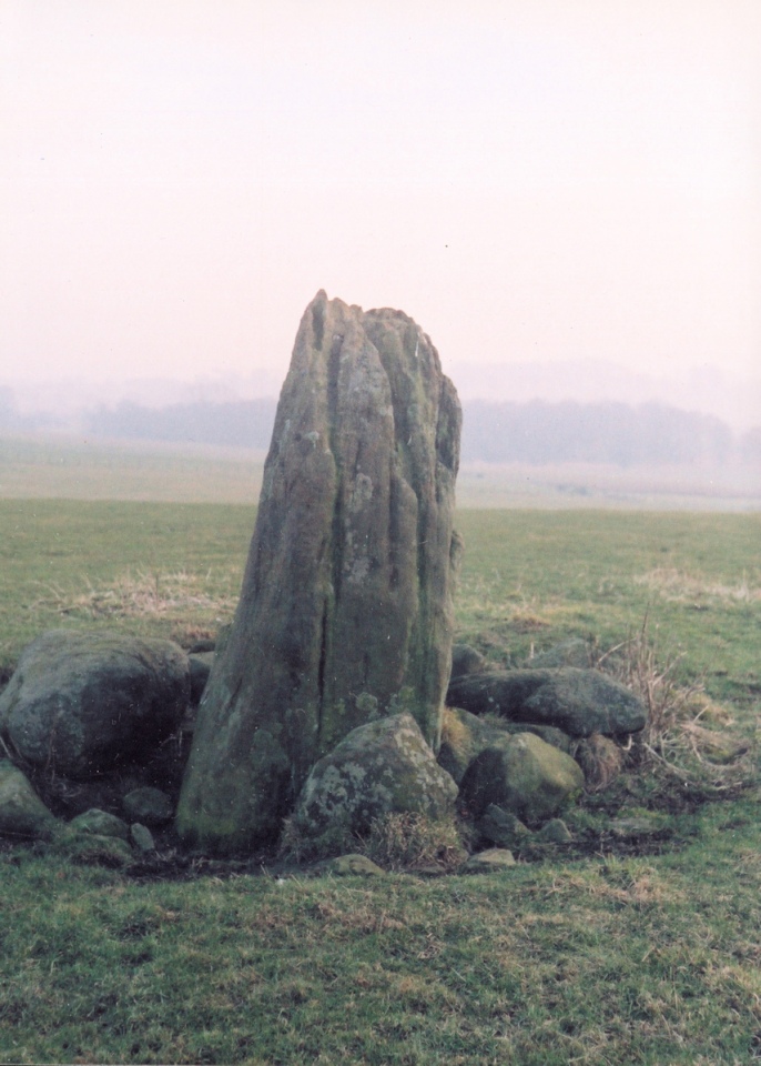
I got the tape measure out, and husband Andrew helped me take the approximate dimensions of the standing stone: 2 metres from the current ground height, width on widest faces: 1.50 and 1.54m, and on the narrowest faces 0.6 metres each.
There were stunning views across the fields to the hills in the far distance to the east, south and west. The views to the north were blocked by the trees of the North Plantation. The sun was also very strong, and I didn’t manage to take photographs of the most spectacular views across to the south west and west.
There appeared to be another small circular mound slightly to the south west of the tumulus, and we wondered if this might be another tumulus.
Similar to the standing stone at Newtown Mill (which we saw on 17th August), the Devil’s Causeway Roman Road, which runs within a few yards to the east of Newtown Mill standing stone, runs immediately to the west of this tumulus, although this is no sign of the road in the landscape that we could spot.
There is a Northumberland County Council leaflet (Exploring Bolam, walk number 3, Bolam Lake to Shaftoe Crags) describing the tumulus: (this) “barrow or burial mound is in a prominent position and is 28m in circumference and 1.5m high. It was excavated in 1718 by Warburton, an Excise Officer with a keen interest in antiquities. Writing to a friend Warburton described that he - “found a stone coffin about 3ft in length and 2ft in breadth and 2ft deep which was black inside with smoke, and in it several lumps of glutinous matter….pieces of the dead heroes flesh” It is likely that that the main burial may be intact as Warburton did not dig deep enough. Such mounds were frequently re-used and may have many burials of different ages. The mound was important in Medieval times when Watches were set to warn of Scottish raids. In 1552 Wharton, Warden of the English East March stipulated that Watches should be set at “the two stones the Poind and his Man with two men nightly the inhibitors of Bolam”. The second stone is at Wallington Hall and was probably moved there by William Blackett. The Devil’s Causeway runs just to the west of the mound.”
In the same field, about 100 yards to the east of the Poind and His Man, there was an outcrop of rock, similar to the formation at West Agra, and we wandered over. The strong sunlight brought out what might be cup marks; in particular, there was a line of deep cup marks against a ledge in a crack in the middle of the rock, and what appeared to be a grouping of heavily weathered cup marks to the eastern edge. We need to research if Stan Beckensall has listed any marks on the ERA site.
The missing stone is to be found next to the lake at Wallington Hall - see SID 37366, just over 4 km away. Please note this mound and standing stone are on private land. (Anne T)
Note: Detailed report of this atmospheric site from Anne T, see the visit log section on our page.
You may be viewing yesterday's version of this page. To see the most up to date information please register for a free account.

Do not use the above information on other web sites or publications without permission of the contributor.
Click here to see more info for this site
Nearby sites
Key: Red: member's photo, Blue: 3rd party photo, Yellow: other image, Green: no photo - please go there and take one, Grey: site destroyed
Download sites to:
KML (Google Earth)
GPX (GPS waypoints)
CSV (Garmin/Navman)
CSV (Excel)
To unlock full downloads you need to sign up as a Contributory Member. Otherwise downloads are limited to 50 sites.
Turn off the page maps and other distractions
Nearby sites listing. In the following links * = Image available
165m ENE 78° The Poind and Man Rock Art Rock Art (NZ0673282136)
280m WSW 258° Poind and Man (West)* Rock Art (NZ0629582043)
992m SSW 205° Devil's Causeway (Belsay) Rock Art (NZ0615081200)
1.0km W 278° Salters Nick Rock Shelter Rock Art (NZ0557582243)
1.1km NW 319° Middleton Bank Top 1c Rock Art (NZ0583882943)
1.1km NW 319° Middleton Bank Top 1a* Rock Art (NZ0583682943)
1.1km NW 319° Middleton Bank Top 1b & N1b* Rock Art (NZ0583582945)
1.2km NW 316° Middleton Bank Top 2a* Rock Art (NZ0571582994)
1.2km NW 317° Middleton Bank Top 2b* Rock Art (NZ0572183000)
1.2km WNW 282° Salters Nick Settlement* Ancient Village or Settlement (NZ05358235)
1.3km WNW 289° Shaftoe Jubilee Stone B* Rock Art (NZ0537082515)
1.3km WNW 288° Shaftoe Jubilee Stone A Rock Art (NZ0536382497)
1.3km WNW 282° Shaftoe (Shaftoe Crags) Rock Art (NZ0528782365)
1.5km WSW 254° Shaftoe Crag Camp* Hillfort (NZ05158170)
1.6km WSW 237° Ferney Chesters N05 Rock Art (NZ0521281215)
1.7km WSW 240° Ferney Chesters N04 Rock Art (NZ0510981250)
1.7km WSW 240° Ferney Chesters N01 Rock Art (NZ0509981263)
1.7km WSW 240° Ferney Chesters N02 Ring Cairn (NZ0510081261)
1.7km SE 129° Shortflatt a Rock Art (NZ0792080995)
1.8km WSW 241° Ferney Chesters N06 Rock Art (NZ0502681251)
1.8km WSW 241° Ferney Chesters N03 Rock Art (NZ0502581233)
1.9km WSW 252° West Shaftoe Farm N02 Rock Art (NZ0474381522)
1.9km WSW 252° West Shaftoe Farm N01 Rock Art (NZ0473681493)
1.9km WSW 251° West Shaftoe Farm 2b Rock Art (NZ0473581483)
1.9km WSW 251° West Shaftoe Farm 2a Rock Art (NZ0473481482)
View more nearby sites and additional images


 We would like to know more about this location. Please feel free to add a brief description and any relevant information in your own language.
 Wir möchten mehr über diese Stätte erfahren. Bitte zögern Sie nicht, eine kurze Beschreibung und relevante Informationen in Deutsch hinzuzufügen.
 Nous aimerions en savoir encore un peu sur les lieux. S'il vous plaît n'hesitez pas à ajouter une courte description et tous les renseignements pertinents dans votre propre langue.
 Quisieramos informarnos un poco más de las lugares. No dude en añadir una breve descripción y otros datos relevantes en su propio idioma.