 with our Megalithic Portal iPhone app")


<< Our Photo Pages >> Easton Down Long Barrow - Long Barrow in England in Wiltshire
Submitted by dooclay on Tuesday, 24 September 2002 Page Views: 7578
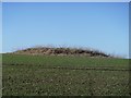
Neolithic and Bronze AgeSite Name: Easton Down Long BarrowCountry: England County: Wiltshire Type: Long Barrow
Map Ref: SU064661 Landranger Map Number: 173
Latitude: 51.393903N Longitude: 1.909402W
Condition:
| 5 | Perfect |
| 4 | Almost Perfect |
| 3 | Reasonable but with some damage |
| 2 | Ruined but still recognisable as an ancient site |
| 1 | Pretty much destroyed, possibly visible as crop marks |
| 0 | No data. |
| -1 | Completely destroyed |
| 5 | Superb |
| 4 | Good |
| 3 | Ordinary |
| 2 | Not Good |
| 1 | Awful |
| 0 | No data. |
| 5 | Can be driven to, probably with disabled access |
| 4 | Short walk on a footpath |
| 3 | Requiring a bit more of a walk |
| 2 | A long walk |
| 1 | In the middle of nowhere, a nightmare to find |
| 0 | No data. |
| 5 | co-ordinates taken by GPS or official recorded co-ordinates |
| 4 | co-ordinates scaled from a detailed map |
| 3 | co-ordinates scaled from a bad map |
| 2 | co-ordinates of the nearest village |
| 1 | co-ordinates of the nearest town |
| 0 | no data |
Internal Links:
External Links:
I have visited· I would like to visit
TheCaptain visited on 4th Oct 1998 Visit lots of ancient sites on a long off road cycle tour from Avebury to Windmill Hill, along the Wansdyke and back up Kennet Avenue
")
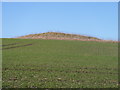
Fragments of sarsen found at the eastern end of this long mound suggest that it may once have had a chamber.
Page originally by Vicky
You may be viewing yesterday's version of this page. To see the most up to date information please register for a free account.
")
Do not use the above information on other web sites or publications without permission of the contributor.
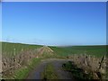
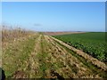
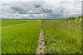
Nearby Images from Geograph Britain and Ireland:
©2017(licence)
©2017(licence)
©2017(licence)
©2019(licence)
©2017(licence)
The above images may not be of the site on this page, they are loaded from Geograph.
Please Submit an Image of this site or go out and take one for us!
Click here to see more info for this site
Nearby sites
Key: Red: member's photo, Blue: 3rd party photo, Yellow: other image, Green: no photo - please go there and take one, Grey: site destroyed
Download sites to:
KML (Google Earth)
GPX (GPS waypoints)
CSV (Garmin/Navman)
CSV (Excel)
To unlock full downloads you need to sign up as a Contributory Member. Otherwise downloads are limited to 50 sites.
Turn off the page maps and other distractions
Nearby sites listing. In the following links * = Image available
172m NE 36° Easton Down Bell Barrow* Round Barrow(s) (SU06506624)
342m SSW 195° Easton Down Bowl Barrow Round Barrow(s) (SU06316577)
447m NW 309° Bishop's Cannings Down 4 Round Barrow(s) (SU06056638)
459m W 269° Easton Down Round Barrow Round Barrow(s) (SU05946609)
496m WSW 255° Bishop's Cannings Down 2 Round Barrow(s) (SU05926597)
529m NW 306° Bishop's Cannings Down 1 Round Barrow(s) (SU05976641)
546m NNW 346° Bishop's Cannings Down 3 Round Barrow(s) (SU06276663)
703m E 84° Horton Down Bowl barrow Round Barrow(s) (SU07106618)
803m N 5° Beckhampton Firs Ancient Village or Settlement (SU06476690)
926m ENE 60° Horton Down Enclosures Ancient Village or Settlement (SU07206657)
984m NNE 21° Beckhampton Buildings Enclosure 2 Misc. Earthwork (SU06756702)
991m WSW 251° Roughridge Hill Long Barrow* Long Barrow (SU05466578)
1.2km NE 52° Hemp Knoll Enclosures 1 Misc. Earthwork (SU07326682)
1.2km NNE 27° Beckhampton Buildings Enclosure 1 Misc. Earthwork (SU06936714)
1.3km ESE 103° Horton Down Chambered Tomb (SU077658)
1.3km SSE 167° Kitchen Barrow Chambered Tomb (SU067648)
1.5km NE 47° Hemp Knoll Enclosures 2 Misc. Earthwork (SU07496713)
1.5km NNW 339° Three Barrows (North Down)* Barrow Cemetery (SU05866750)
1.5km NNE 17° Beckhampton Firs Tumulus* Round Barrow(s) (SU06846754)
1.5km WNW 299° Bishops Cannings 53 Bowl Barrow Round Barrow(s) (SU05056683)
1.6km N 359° Down Barn Tumuli* Round Barrow(s) (SU06366766)
1.6km NNE 12° Beckhampton Buildings Barrows Round Barrow(s) (SU06736766)
1.7km NNE 13° Beckhampton Firs Long Barrow* Long Barrow (SU0678267707)
1.7km W 280° Shepherds Shore Barrows Round Barrow(s) (SU04746640)
1.8km NW 316° North Down Tumuli Round Barrow(s) (SU05186737)
View more nearby sites and additional images


 We would like to know more about this location. Please feel free to add a brief description and any relevant information in your own language.
 Wir möchten mehr über diese Stätte erfahren. Bitte zögern Sie nicht, eine kurze Beschreibung und relevante Informationen in Deutsch hinzuzufügen.
 Nous aimerions en savoir encore un peu sur les lieux. S'il vous plaît n'hesitez pas à ajouter une courte description et tous les renseignements pertinents dans votre propre langue.
 Quisieramos informarnos un poco más de las lugares. No dude en añadir una breve descripción y otros datos relevantes en su propio idioma.