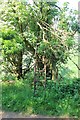
<< Our Photo Pages >> Farmcote gatepost - Standing Stone (Menhir) in England in Gloucestershire
Submitted by h_fenton on Sunday, 24 January 2010 Page Views: 5366
Neolithic and Bronze AgeSite Name: Farmcote gatepostCountry: England
NOTE: This site is 0.3 km away from the location you searched for.
County: Gloucestershire Type: Standing Stone (Menhir)
Map Ref: SP0624828468
Latitude: 51.954667N Longitude: 1.910492W
Condition:
| 5 | Perfect |
| 4 | Almost Perfect |
| 3 | Reasonable but with some damage |
| 2 | Ruined but still recognisable as an ancient site |
| 1 | Pretty much destroyed, possibly visible as crop marks |
| 0 | No data. |
| -1 | Completely destroyed |
| 5 | Superb |
| 4 | Good |
| 3 | Ordinary |
| 2 | Not Good |
| 1 | Awful |
| 0 | No data. |
| 5 | Can be driven to, probably with disabled access |
| 4 | Short walk on a footpath |
| 3 | Requiring a bit more of a walk |
| 2 | A long walk |
| 1 | In the middle of nowhere, a nightmare to find |
| 0 | No data. |
| 5 | co-ordinates taken by GPS or official recorded co-ordinates |
| 4 | co-ordinates scaled from a detailed map |
| 3 | co-ordinates scaled from a bad map |
| 2 | co-ordinates of the nearest village |
| 1 | co-ordinates of the nearest town |
| 0 | no data |
Be the first person to rate this site - see the 'Contribute!' box in the right hand menu.
Internal Links:
External Links:
I have visited· I would like to visit
4clydesdale7 visited on 31st Aug 2011 - their rating: Cond: 2 Amb: 4 Access: 5 Farmcote is a tiny hamlet not often visited - the local farmer's sister runs a Chilli Garden with some superb relishes
h_fenton have visited here
")
You may be viewing yesterday's version of this page. To see the most up to date information please register for a free account.
")
")
")
Do not use the above information on other web sites or publications without permission of the contributor.
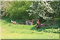
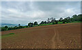
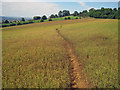
Nearby Images from Geograph Britain and Ireland:
©2012(licence)
©2021(licence)
©2011(licence)
©2012(licence)
©2021(licence)
The above images may not be of the site on this page, they are loaded from Geograph.
Please Submit an Image of this site or go out and take one for us!
Click here to see more info for this site
Nearby sites
Key: Red: member's photo, Blue: 3rd party photo, Yellow: other image, Green: no photo - please go there and take one, Grey: site destroyed
Download sites to:
KML (Google Earth)
GPX (GPS waypoints)
CSV (Garmin/Navman)
CSV (Excel)
To unlock full downloads you need to sign up as a Contributory Member. Otherwise downloads are limited to 50 sites.
Turn off the page maps and other distractions
Nearby sites listing. In the following links * = Image available
1.4km N 6° Beckbury Camp* Hillfort (SP06392988)
1.7km NNW 340° Hailes Wood Earthworks Misc. Earthwork (SP05663009)
1.9km NNE 29° Campden Lane gatepost* Marker Stone (SP07153009)
2.0km WSW 250° St. Kenelm's Well* Holy Well or Sacred Spring (SP0435827795)
2.1km SSE 156° Guiting Wood Bowl Barrow* Round Barrow(s) (SP0710826545)
2.3km NNE 31° Stanway Bowl Barrows* Round Barrow(s) (SP07413044)
3.6km ENE 58° Cutsdean Henge (SP09263038)
4.4km SSW 201° Roel Camp* Hillfort (SP04682434)
4.5km SSE 165° Roel Farm Bowl Barrow* Round Barrow(s) (SP0740324085)
4.6km SSE 151° Greenfield Hill Barn Round Barrow* Round Barrow(s) (SP0844224465)
5.1km NW 311° The Warren Hillfort (SP024318)
5.1km SW 234° Belas Knap* Long Barrow (SP02092545)
5.2km SE 140° Guiting Power Round Barrow 3* Timber Circle (SP096245)
5.3km NNE 20° Shenberrow Hillfort* Hillfort (SP08043344)
5.7km NNE 31° Snowshill* Round Barrow(s) (SP09153335)
6.6km S 174° Slade Barn Chambered Cairn (SP069219)
7.1km WNW 300° Alderton Cursus Cursus (SP00023199)
7.1km E 87° Oak Piece Chambered Tomb (SP134289)
7.2km ESE 113° Huntsmans Quarry Timber Circle (SP129257)
7.3km ESE 107° Cow Common Barrow Cemetery* Barrow Cemetery (SP132263)
7.4km W 264° Cleeve Hill Barrows Round Barrow(s) (SO98872767)
7.5km ESE 105° Cow Common Long Barrow* Chambered Cairn (SP135266)
7.5km W 269° Nottingham Hill Carving (Gotherington)* Rock Art (SO98752835)
7.8km W 270° Nottingham Hill* Hillfort (SO984284)
7.9km W 276° Odo and Dodo* Standing Stones (SO98402935)
View more nearby sites and additional images


 We would like to know more about this location. Please feel free to add a brief description and any relevant information in your own language.
 Wir möchten mehr über diese Stätte erfahren. Bitte zögern Sie nicht, eine kurze Beschreibung und relevante Informationen in Deutsch hinzuzufügen.
 Nous aimerions en savoir encore un peu sur les lieux. S'il vous plaît n'hesitez pas à ajouter une courte description et tous les renseignements pertinents dans votre propre langue.
 Quisieramos informarnos un poco más de las lugares. No dude en añadir una breve descripción y otros datos relevantes en su propio idioma.