<< Text Pages >> Garleigh Moor East 2 - Rock Art in England in Northumberland
Submitted by Anne T on Friday, 27 April 2018 Page Views: 746
Rock ArtSite Name: Garleigh Moor East 2 Alternative Name: ERA-1346; Beckensall 623Country: England
NOTE: This site is 0.3 km away from the location you searched for.
County: Northumberland Type: Rock Art
Nearest Town: Rothbury Nearest Village: Forestburn Gate
Map Ref: NZ0598598902
Latitude: 55.284212N Longitude: 1.90732W
Condition:
| 5 | Perfect |
| 4 | Almost Perfect |
| 3 | Reasonable but with some damage |
| 2 | Ruined but still recognisable as an ancient site |
| 1 | Pretty much destroyed, possibly visible as crop marks |
| 0 | No data. |
| -1 | Completely destroyed |
| 5 | Superb |
| 4 | Good |
| 3 | Ordinary |
| 2 | Not Good |
| 1 | Awful |
| 0 | No data. |
| 5 | Can be driven to, probably with disabled access |
| 4 | Short walk on a footpath |
| 3 | Requiring a bit more of a walk |
| 2 | A long walk |
| 1 | In the middle of nowhere, a nightmare to find |
| 0 | No data. |
| 5 | co-ordinates taken by GPS or official recorded co-ordinates |
| 4 | co-ordinates scaled from a detailed map |
| 3 | co-ordinates scaled from a bad map |
| 2 | co-ordinates of the nearest village |
| 1 | co-ordinates of the nearest town |
| 0 | no data |
Be the first person to rate this site - see the 'Contribute!' box in the right hand menu.
Internal Links:
External Links:
Rock Art in Northumberland
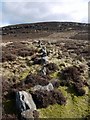
This rock art panel is recorded by NADRAP as being on a large bedrock outcrop with a flat surface and steep, undercut eastern face. Beckensall had previously described this panel as having only one cup as being artificial; NADRAP notes that there seems to be a profusion of seemingly naturally eroded cups scattered across a wide surface of the rock, interlaced by cracks.
For more information see England's Rock Art entry for ERA-1346 Garleigh Moor East 2, which includes NADRAP's notes, Beckensall's description and archive notes, photographs, a sketch of the rock and its motifs, plus photogrammetry, a VRML model and media from the Beckensall Archive.
The original Beckensall record can be found at Internet Archive: Beckensall 623 Garleigh Moor East 2.
This rock art panel is located on Open Access land.
Note: Have you seen this rock art panel? Do you have any photographs or information to add?
You may be viewing yesterday's version of this page. To see the most up to date information please register for a free account.
Do not use the above information on other web sites or publications without permission of the contributor.
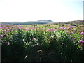
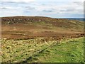
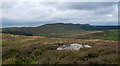
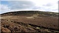
Nearby Images from Geograph Britain and Ireland:
©2014(licence)
©2017(licence)
©2016(licence)
©2009(licence)
©2009(licence)
The above images may not be of the site on this page, they are loaded from Geograph.
Please Submit an Image of this site or go out and take one for us!
Click here to see more info for this site
Nearby sites
Key: Red: member's photo, Blue: 3rd party photo, Yellow: other image, Green: no photo - please go there and take one, Grey: site destroyed
Download sites to:
KML (Google Earth)
GPX (GPS waypoints)
CSV (Garmin/Navman)
CSV (Excel)
To unlock full downloads you need to sign up as a Contributory Member. Otherwise downloads are limited to 50 sites.
Turn off the page maps and other distractions
Nearby sites listing. In the following links * = Image available
55m SW 219° Garleigh Moor East 1 Rock Art (NZ0595098859)
224m W 275° East Lordenshaw AL1 Rock Art (NZ0576198921)
326m WNW 284° East Lordenshaw AL2 Rock Art (NZ0566798979)
349m WNW 286° East Lordenshaw N02 Rock Art (NZ0564898996)
355m WNW 287° East Lordenshaw 3c Rock Art (NZ0564599008)
374m WNW 288° East Lordenshaw 3b* Rock Art (NZ0562899016)
407m WNW 290° East Lordenshaw 3d Rock Art (NZ0560299044)
419m WNW 290° East Lordenshaw 3e Rock Art (NZ0559199048)
421m WNW 290° East Lordenshaw 3f Rock Art (NZ0558999047)
425m W 270° East Lordenshaw 3a* Rock Art (NZ0555998903)
447m WNW 304° East Lordenshaw 3i* Rock Art (NZ0561199149)
456m WNW 303° East Lordenshaw 3n* Rock Art (NZ0560199150)
458m WNW 294° East Lordenshaw 3g Rock Art (NZ0556599087)
459m WNW 297° East Lordenshaw 3h Rock Art (NZ0557499109)
462m WNW 303° East Lordenshaw 3j* Rock Art (NZ0559899156)
463m WNW 303° East Lordenshaw 3k* Rock Art (NZ0559499152)
469m NW 310° East Lordenshaw 3o Rock Art (NZ0562399201)
470m NW 309° EastLordenshaw 3r Rock Art (NZ0562099200)
471m NW 310° East Lordenshaw 3m* Rock Art (NZ0562199203)
483m NW 304° East Lordenshaw 3l* Rock Art (NZ0558499174)
496m NW 323° East Lordenshaw 3p Rock Art (NZ0568399297)
500m W 276° South Lordenshaw 6 Rock Art (NZ0548698952)
537m WNW 298° Lordenshaw 7e* Rock Art (NZ0551099156)
538m WNW 298° Lordenshaw Hillfort 7f Rock Art (NZ0550799151)
543m WNW 300° Lordenshaw 7c Rock Art (NZ0551199169)
View more nearby sites and additional images


 We would like to know more about this location. Please feel free to add a brief description and any relevant information in your own language.
 Wir möchten mehr über diese Stätte erfahren. Bitte zögern Sie nicht, eine kurze Beschreibung und relevante Informationen in Deutsch hinzuzufügen.
 Nous aimerions en savoir encore un peu sur les lieux. S'il vous plaît n'hesitez pas à ajouter une courte description et tous les renseignements pertinents dans votre propre langue.
 Quisieramos informarnos un poco más de las lugares. No dude en añadir una breve descripción y otros datos relevantes en su propio idioma.