<< Text Pages >> Cartington Carriageway Rock Art 2 - Rock Art in England in Northumberland
Submitted by vicky on Sunday, 21 July 2002 Page Views: 4109
Rock ArtSite Name: Cartington Carriageway Rock Art 2Country: England County: Northumberland Type: Rock Art
Map Ref: NU047042 Landranger Map Number: 81
Latitude: 55.331832N Longitude: 1.927464W
Condition:
| 5 | Perfect |
| 4 | Almost Perfect |
| 3 | Reasonable but with some damage |
| 2 | Ruined but still recognisable as an ancient site |
| 1 | Pretty much destroyed, possibly visible as crop marks |
| 0 | No data. |
| -1 | Completely destroyed |
| 5 | Superb |
| 4 | Good |
| 3 | Ordinary |
| 2 | Not Good |
| 1 | Awful |
| 0 | No data. |
| 5 | Can be driven to, probably with disabled access |
| 4 | Short walk on a footpath |
| 3 | Requiring a bit more of a walk |
| 2 | A long walk |
| 1 | In the middle of nowhere, a nightmare to find |
| 0 | No data. |
| 5 | co-ordinates taken by GPS or official recorded co-ordinates |
| 4 | co-ordinates scaled from a detailed map |
| 3 | co-ordinates scaled from a bad map |
| 2 | co-ordinates of the nearest village |
| 1 | co-ordinates of the nearest town |
| 0 | no data |
Be the first person to rate this site - see the 'Contribute!' box in the right hand menu.
Internal Links:
External Links:
Cup and Ring Marks in Northumberland
Have you visited this site? Please add a comment below.
You may be viewing yesterday's version of this page. To see the most up to date information please register for a free account.
Do not use the above information on other web sites or publications without permission of the contributor.
Nearby Images from Geograph Britain and Ireland:
©2013(licence)
©2013(licence)
©2009(licence)
©2007(licence)
©2013(licence)
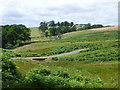
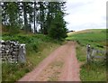
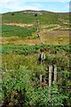
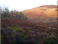
The above images may not be of the site on this page, they are loaded from Geograph.
Please Submit an Image of this site or go out and take one for us!
Click here to see more info for this site
Nearby sites
Key: Red: member's photo, Blue: 3rd party photo, Yellow: other image, Green: no photo - please go there and take one, Grey: site destroyed
Download sites to:
KML (Google Earth)
GPX (GPS waypoints)
CSV (Garmin/Navman)
CSV (Excel)
To unlock full downloads you need to sign up as a Contributory Member. Otherwise downloads are limited to 50 sites.
Turn off the page maps and other distractions
Nearby sites listing. In the following links * = Image available
671m ESE 116° Crocky's Heugh B* Rock Art (NU0530703909)
707m ESE 112° Crocky's Heugh A* Rock Art (NU0535903940)
791m NNE 15° Cartington Hill Cairn 1* Cairn (NU0490204966)
861m E 82° Debdon Farm (west) Cairn 1* Cairn (NU0555604317)
942m N 11° Cartington Hill Cairn 2* Cairn (NU0487605126)
963m ENE 72° Debdon Farm (west) Cairn 2* Cairn (NU0561704502)
982m ENE 66° Cartington Stone Circle (NU056046)
1.0km S 178° Football Cairn E* Rock Art (NU0473603158)
1.1km S 178° Football Cairn D* Rock Art (NU0474703118)
1.1km S 178° Football Cairn C Rock Art (NU0474003110)
1.2km S 185° Football Cairn F* Rock Art (NU0460903043)
1.2km S 184° Football Cairn B* Rock Art (NU0462903039)
1.2km S 185° Football Cairn A* Rock Art (NU0460103031)
1.2km S 186° Football Cairn (Northumberland)* Cairn (NU04580303)
1.2km N 5° Cartington Hill Cairn 3* Cairn (NU0479705399)
1.2km S 188° Football Cairn G Rock Art (NU0453803005)
1.4km SSW 195° Chirnells Moor M* Rock Art (NU0434002892)
1.4km SSW 203° Chirnells Moor N03 Rock Art (NU0417202939)
1.4km SSW 193° Chirnells Moor N.* Rock Art (NU0440202856)
1.4km SSW 199° Chirnells Moor I Rock Art (NU0423402881)
1.4km SE 141° Debdon Cairnfield Standing Stone (a)* Standing Stones (NU056031)
1.5km SE 145° Debdon Cairnfield. Cairn (NU0553703010)
1.5km SSW 198° Chirnells Moor C Rock Art (NU0423902817)
1.5km SSW 199° Chirnells Moor B* Rock Art (NU0422802820)
1.5km SSW 198° Chirnells Moor D* Rock Art (NU0423702812)
View more nearby sites and additional images


 We would like to know more about this location. Please feel free to add a brief description and any relevant information in your own language.
 Wir möchten mehr über diese Stätte erfahren. Bitte zögern Sie nicht, eine kurze Beschreibung und relevante Informationen in Deutsch hinzuzufügen.
 Nous aimerions en savoir encore un peu sur les lieux. S'il vous plaît n'hesitez pas à ajouter une courte description et tous les renseignements pertinents dans votre propre langue.
 Quisieramos informarnos un poco más de las lugares. No dude en añadir una breve descripción y otros datos relevantes en su propio idioma.