


<< Text Pages >> Bilbury Rings - Hillfort in England in Wiltshire
Submitted by SolarMegalith on Thursday, 08 March 2012 Page Views: 5355
Iron Age and Later PrehistorySite Name: Bilbury Rings Alternative Name: Wylyle CampCountry: England
NOTE: This site is 2.0 km away from the location you searched for.
County: Wiltshire Type: Hillfort
Nearest Town: Salisbury
Map Ref: SU01013620
Latitude: 51.125081N Longitude: 1.986946W
Condition:
| 5 | Perfect |
| 4 | Almost Perfect |
| 3 | Reasonable but with some damage |
| 2 | Ruined but still recognisable as an ancient site |
| 1 | Pretty much destroyed, possibly visible as crop marks |
| 0 | No data. |
| -1 | Completely destroyed |
| 5 | Superb |
| 4 | Good |
| 3 | Ordinary |
| 2 | Not Good |
| 1 | Awful |
| 0 | No data. |
| 5 | Can be driven to, probably with disabled access |
| 4 | Short walk on a footpath |
| 3 | Requiring a bit more of a walk |
| 2 | A long walk |
| 1 | In the middle of nowhere, a nightmare to find |
| 0 | No data. |
| 5 | co-ordinates taken by GPS or official recorded co-ordinates |
| 4 | co-ordinates scaled from a detailed map |
| 3 | co-ordinates scaled from a bad map |
| 2 | co-ordinates of the nearest village |
| 1 | co-ordinates of the nearest town |
| 0 | no data |
Internal Links:
External Links:
Hillfort in Wiltshire
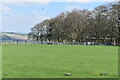
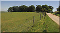
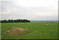
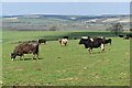
Remains of an Iron Age multivallate hillfort covering area of 17 acres, possibly occupied in Roman period.
Read More at Pastscape.
You may be viewing yesterday's version of this page. To see the most up to date information please register for a free account.
Do not use the above information on other web sites or publications without permission of the contributor.
Nearby Images from Geograph Britain and Ireland:
©2023(licence)
©2018(licence)
©2007(licence)
©2023(licence)
©2018(licence)
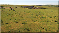
The above images may not be of the site on this page, they are loaded from Geograph.
Please Submit an Image of this site or go out and take one for us!
Click here to see more info for this site
Nearby sites
Key: Red: member's photo, Blue: 3rd party photo, Yellow: other image, Green: no photo - please go there and take one, Grey: site destroyed
Download sites to:
KML (Google Earth)
GPX (GPS waypoints)
CSV (Garmin/Navman)
CSV (Excel)
To unlock full downloads you need to sign up as a Contributory Member. Otherwise downloads are limited to 50 sites.
Turn off the page maps and other distractions
Nearby sites listing. In the following links * = Image available
4.1km SW 216° Spring Head Holy Well or Sacred Spring (ST9855732867)
4.4km SSW 209° Teffont Magna - St. Edwards Church* Ancient Cross (ST98923237)
4.9km NNE 31° Yarnbury Castle* Hillfort (SU035404)
5.1km NW 306° Sherrington Long Barrow* Long Barrow (ST9687239179)
5.2km E 100° Ebsbury* Hillfort (SU061353)
5.2km NNW 328° Codford Circle Hillfort (ST98254056)
5.4km NNE 26° Berwick Down Bowl Barrow Round Barrow(s) (SU03404100)
5.6km NNE 26° Berwick Down Enclosure Misc. Earthwork (SU03484120)
5.8km NW 310° Codford St Peter Cross* Ancient Cross (ST96583993)
5.8km WNW 301° Sherrington Motte Artificial Mound (ST96003923)
6.9km ENE 62° Berwick St James* Standing Stones (SU071394)
7.7km WNW 301° Golden Barrow Round Barrow(s) (ST944401)
7.9km W 269° Grim's Ditch 3 (Wiltshire) Misc. Earthwork (ST931361)
8.1km ENE 76° Druids Head Farm Barrows Round Barrow(s) (SU08933815)
8.1km S 174° Chiselbury* Hillfort (SU018281)
8.2km NW 318° Upton Great Barrow* Round Barrow(s) (ST955423)
8.6km SW 223° Tisbury Circle* Stone Circle (ST951299)
8.9km WNW 298° Corton Long Barrow Long Barrow (ST9307740336)
9.1km E 94° South Newton Round Barrow(s) (SU101355)
9.2km SSW 211° Castle Ditches (Wiltshire)* Hillfort (ST963283)
9.3km E 94° Newton Barrow* Round Barrow(s) (SU10273556)
9.3km NNW 327° Knook Castle Hillfort (ST96004400)
9.3km E 87° Heale Hill Round Barrow(s) (SU10343670)
9.5km NE 49° Fore Down Tumuli* Barrow Cemetery (SU0823942372)
9.7km SSW 196° Buxbury Hill* Round Barrow(s) (ST984269)
View more nearby sites and additional images


 We would like to know more about this location. Please feel free to add a brief description and any relevant information in your own language.
 Wir möchten mehr über diese Stätte erfahren. Bitte zögern Sie nicht, eine kurze Beschreibung und relevante Informationen in Deutsch hinzuzufügen.
 Nous aimerions en savoir encore un peu sur les lieux. S'il vous plaît n'hesitez pas à ajouter une courte description et tous les renseignements pertinents dans votre propre langue.
 Quisieramos informarnos un poco más de las lugares. No dude en añadir una breve descripción y otros datos relevantes en su propio idioma.