<< Our Photo Pages >> Mossy Moor Reservoir - Ring Cairn in England in Yorkshire (North)
Submitted by rich32 on Saturday, 14 August 2004 Page Views: 6062
Neolithic and Bronze AgeSite Name: Mossy Moor ReservoirCountry: England
NOTE: This site is 0.3 km away from the location you searched for.
County: Yorkshire (North) Type: Ring Cairn
Nearest Town: Skipton Nearest Village: Hebden
Map Ref: SE02866432
Latitude: 54.074801N Longitude: 1.957785W
Condition:
| 5 | Perfect |
| 4 | Almost Perfect |
| 3 | Reasonable but with some damage |
| 2 | Ruined but still recognisable as an ancient site |
| 1 | Pretty much destroyed, possibly visible as crop marks |
| 0 | No data. |
| -1 | Completely destroyed |
| 5 | Superb |
| 4 | Good |
| 3 | Ordinary |
| 2 | Not Good |
| 1 | Awful |
| 0 | No data. |
| 5 | Can be driven to, probably with disabled access |
| 4 | Short walk on a footpath |
| 3 | Requiring a bit more of a walk |
| 2 | A long walk |
| 1 | In the middle of nowhere, a nightmare to find |
| 0 | No data. |
| 5 | co-ordinates taken by GPS or official recorded co-ordinates |
| 4 | co-ordinates scaled from a detailed map |
| 3 | co-ordinates scaled from a bad map |
| 2 | co-ordinates of the nearest village |
| 1 | co-ordinates of the nearest town |
| 0 | no data |
Internal Links:
External Links:
")
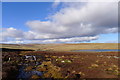
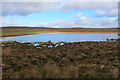
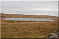
Possible stone circle or ring cairn next to Mossy Moor reservoir.
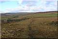
A number of small stones covered by grass are set in an arc, one stone is inset & still upright. The site lies directly south of Grassington A and B stone circles and is a quarter of a mile north of Dumpit Hill stones circle. The site is 100 meters away from a nearby footpath.
This site does not appear to be on the scheduled monument list.
You may be viewing yesterday's version of this page. To see the most up to date information please register for a free account.
")
")
Do not use the above information on other web sites or publications without permission of the contributor.
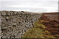
Nearby Images from Geograph Britain and Ireland:
©2008(licence)
©2015(licence)
©2020(licence)
©2020(licence)
©2008(licence)
The above images may not be of the site on this page, they are loaded from Geograph.
Please Submit an Image of this site or go out and take one for us!
Click here to see more info for this site
Nearby sites
Key: Red: member's photo, Blue: 3rd party photo, Yellow: other image, Green: no photo - please go there and take one, Grey: site destroyed
Download sites to:
KML (Google Earth)
GPX (GPS waypoints)
CSV (Garmin/Navman)
CSV (Excel)
To unlock full downloads you need to sign up as a Contributory Member. Otherwise downloads are limited to 50 sites.
Turn off the page maps and other distractions
Nearby sites listing. In the following links * = Image available
259m S 175° Dumpit Hill Enclosure Ancient Village or Settlement (SE0288464062)
334m SE 141° Dumpit Hill B (Hebden) Stone Circle (SE03076406)
354m SSE 159° Dumpit Hill* Stone Circle (SE02996399)
1.8km ESE 122° Hartlington Pasture 01* Rock Art (SE04396338)
1.8km NW 307° Yarnbury Henge* Henge (SE0140665415)
1.9km ESE 108° Hartlington Pasture 02* Rock Art (SE04676373)
2.0km NW 306° Yarnbury Settlement (Grassington) Ancient Village or Settlement (SE012655)
2.3km N 351° Grassington A* Stone Circle (SE025666)
2.4km N 351° Grassington B* Stone Circle (SE025667)
2.6km WSW 245° Linton Churchyard Cross* Ancient Cross (SE0053963220)
2.6km NE 53° Blea Gill* Ancient Village or Settlement (SE04946588)
2.7km WSW 245° The Linton Stones* Natural Stone / Erratic / Other Natural Feature (SE0042763177)
2.7km WNW 290° Grassington Settlement Ancient Village or Settlement (SE0027765259)
2.8km S 173° Burnsall Crosses* Ancient Cross (SE032615)
3.0km WNW 283° Cove Hole* Cave or Rock Shelter (SD99896499)
3.4km SW 217° Ebolton Cave* Cave or Rock Shelter (SE008616)
3.6km NNW 335° Green Hill Pasture Stone Circle* Stone Circle (SE013676)
3.8km ESE 110° Appletreewick* Stone Circle (SE0642863048)
3.9km WNW 301° Lea Green cairn Cairn (SD995663)
4.6km W 270° Little Wood* Ancient Village or Settlement (SD98266429)
4.8km ESE 112° Skyreholme (401)* Rock Art (SE07326251)
4.9km ESE 112° Nussey Green (404)* Rock Art (SE07396254)
4.9km ESE 110° High Green (407)* Rock Art (SE0751062601)
5.0km W 278° Brazen Gate* Round Cairn (SD9785964995)
5.2km ESE 112° Skyreholme Wall Stone (413) Rock Art (SE0772062322)
View more nearby sites and additional images


 We would like to know more about this location. Please feel free to add a brief description and any relevant information in your own language.
 Wir möchten mehr über diese Stätte erfahren. Bitte zögern Sie nicht, eine kurze Beschreibung und relevante Informationen in Deutsch hinzuzufügen.
 Nous aimerions en savoir encore un peu sur les lieux. S'il vous plaît n'hesitez pas à ajouter une courte description et tous les renseignements pertinents dans votre propre langue.
 Quisieramos informarnos un poco más de las lugares. No dude en añadir una breve descripción y otros datos relevantes en su propio idioma.