


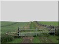
<< Our Photo Pages >> The Way to Wooler 1 - Rock Art in England in Northumberland
Submitted by SolarMegalith on Monday, 20 May 2013 Page Views: 3962
Rock ArtSite Name: The Way to Wooler 1 Alternative Name: Way to Wooler 1; ERA-204; Beckensall 212Country: England County: Northumberland Type: Rock Art
Nearest Town: Wooler Nearest Village: Lilburn
Map Ref: NU0234026452
Latitude: 55.531794N Longitude: 1.964486W
Condition:
| 5 | Perfect |
| 4 | Almost Perfect |
| 3 | Reasonable but with some damage |
| 2 | Ruined but still recognisable as an ancient site |
| 1 | Pretty much destroyed, possibly visible as crop marks |
| 0 | No data. |
| -1 | Completely destroyed |
| 5 | Superb |
| 4 | Good |
| 3 | Ordinary |
| 2 | Not Good |
| 1 | Awful |
| 0 | No data. |
| 5 | Can be driven to, probably with disabled access |
| 4 | Short walk on a footpath |
| 3 | Requiring a bit more of a walk |
| 2 | A long walk |
| 1 | In the middle of nowhere, a nightmare to find |
| 0 | No data. |
| 5 | co-ordinates taken by GPS or official recorded co-ordinates |
| 4 | co-ordinates scaled from a detailed map |
| 3 | co-ordinates scaled from a bad map |
| 2 | co-ordinates of the nearest village |
| 1 | co-ordinates of the nearest town |
| 0 | no data |
Internal Links:
External Links:
I have visited· I would like to visit
SolarMegalith visited on 14th May 2013 - their rating: Cond: 4 Amb: 3 Access: 4
")
This square stone is incorporated in a field wall. A cup-mark with clearly defined arc is obvious.
For more information see England's Rock Art entry for ERA-204 Way to Wooler 1, which includes both Beckensall's and NADRAP's descriptions, photographs, a sketch of the rock and its motifs, plus photogrammetry and media from the Beckensall Archive..
The original Beckensall record can be found at Internet Archive: Beckensall 212 The Way to Wooler 1.
Access to this rock art panel is "Access by Right of Way".
You may be viewing yesterday's version of this page. To see the most up to date information please register for a free account.
")
Do not use the above information on other web sites or publications without permission of the contributor.
Nearby Images from Geograph Britain and Ireland:
©2017(licence)
©2008(licence)
©2009(licence)
©2015(licence)
©2015(licence)
The above images may not be of the site on this page, they are loaded from Geograph.
Please Submit an Image of this site or go out and take one for us!
Click here to see more info for this site
Nearby sites
Key: Red: member's photo, Blue: 3rd party photo, Yellow: other image, Green: no photo - please go there and take one, Grey: site destroyed
Download sites to:
KML (Google Earth)
GPX (GPS waypoints)
CSV (Garmin/Navman)
CSV (Excel)
To unlock full downloads you need to sign up as a Contributory Member. Otherwise downloads are limited to 50 sites.
Turn off the page maps and other distractions
Nearby sites listing. In the following links * = Image available
28m SE 137° The Way to Wooler 2* Rock Art (NU0235926432)
206m SW 223° Lilburn Cist* Cist (NU022263)
276m NE 53° Fowberry Moor Cairn Excavation Panels Rock Art (NU0256026620)
287m ENE 56° Fowberry Moor Settlement* Ancient Village or Settlement (NU0258026611)
450m ESE 109° Fowberry Enclosure 1* Rock Art (NU0276726307)
455m ESE 109° Fowberry Enclosure 2* Rock Art (NU0277126301)
646m ESE 122° Fowberry Enclosure 3* Rock Art (NU0289226113)
660m ESE 122° Fowberry Moor Farm (Wooler) Rock Art (NU029261)
924m NNW 337° Fowberry Moor Farm (Island/Deershed Plantation)* Rock Art (NU0197027300)
1.3km NNE 21° Fowberry Park J* Rock Art (NU0281327662)
1.3km SW 231° Lilburn Rock Art* Rock Art (NU013256)
1.3km NNE 20° Fowberry Park I* Rock Art (NU0281227715)
1.4km NNE 20° Fowberry Park B* Rock Art (NU0281327719)
1.4km NNE 20° Fowberry Park A* Rock Art (NU0281427725)
1.4km NNE 20° Fowberry Park C* Rock Art (NU0281427725)
1.4km NNE 20° Fowberry Park E* Rock Art (NU0281627727)
1.4km SW 229° Clover Bank (Lilburn Hill Farm) Rock Art (NU01312556)
1.4km N 350° Crowbar Stone (Weetwood Moor) Rock Art (NU021278)
1.4km NNE 20° Fowberry Park D* Rock Art (NU0281827743)
1.4km NNE 20° Fowbery Mains/Fowberry Park G Rock Art (NU0281727745)
1.4km NNE 20° Fowberry Park H* Rock Art (NU0282227750)
1.4km N 349° North Plantation A* Rock Art (NU0207327825)
1.4km NNE 20° Fowberry Park F* Rock Art (NU0282027769)
1.4km N 350° North Plantation c Rock Art (NU0210027840)
1.4km N 350° North Plantation B* Rock Art (NU0210527845)
View more nearby sites and additional images


 We would like to know more about this location. Please feel free to add a brief description and any relevant information in your own language.
 Wir möchten mehr über diese Stätte erfahren. Bitte zögern Sie nicht, eine kurze Beschreibung und relevante Informationen in Deutsch hinzuzufügen.
 Nous aimerions en savoir encore un peu sur les lieux. S'il vous plaît n'hesitez pas à ajouter une courte description et tous les renseignements pertinents dans votre propre langue.
 Quisieramos informarnos un poco más de las lugares. No dude en añadir una breve descripción y otros datos relevantes en su propio idioma.