 with our Megalithic Portal iPhone app")


<< Text Pages >> Fowberry Moor Cairn - Round Cairn in England in Northumberland
Submitted by vicky on Monday, 24 March 2003 Page Views: 6451
Neolithic and Bronze AgeSite Name: Fowberry Moor CairnCountry: England County: Northumberland Type: Round Cairn
Map Ref: NU020279 Landranger Map Number: 75
Latitude: 55.544806N Longitude: 1.969862W
Condition:
| 5 | Perfect |
| 4 | Almost Perfect |
| 3 | Reasonable but with some damage |
| 2 | Ruined but still recognisable as an ancient site |
| 1 | Pretty much destroyed, possibly visible as crop marks |
| 0 | No data. |
| -1 | Completely destroyed |
| 5 | Superb |
| 4 | Good |
| 3 | Ordinary |
| 2 | Not Good |
| 1 | Awful |
| 0 | No data. |
| 5 | Can be driven to, probably with disabled access |
| 4 | Short walk on a footpath |
| 3 | Requiring a bit more of a walk |
| 2 | A long walk |
| 1 | In the middle of nowhere, a nightmare to find |
| 0 | No data. |
| 5 | co-ordinates taken by GPS or official recorded co-ordinates |
| 4 | co-ordinates scaled from a detailed map |
| 3 | co-ordinates scaled from a bad map |
| 2 | co-ordinates of the nearest village |
| 1 | co-ordinates of the nearest town |
| 0 | no data |
Be the first person to rate this site - see the 'Contribute!' box in the right hand menu.
Internal Links:
External Links:
I have visited· I would like to visit
Modern-Neolithic would like to visit
Bronze Age burial cairn with double kerb.
You may be viewing yesterday's version of this page. To see the most up to date information please register for a free account.
Do not use the above information on other web sites or publications without permission of the contributor.
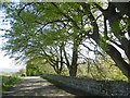
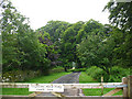
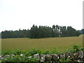
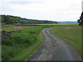
Nearby Images from Geograph Britain and Ireland:

©2009(licence)
©2017(licence)
©2009(licence)
©2009(licence)
©2010(licence)
The above images may not be of the site on this page, they are loaded from Geograph.
Please Submit an Image of this site or go out and take one for us!
Click here to see more info for this site
Nearby sites
Key: Red: member's photo, Blue: 3rd party photo, Yellow: other image, Green: no photo - please go there and take one, Grey: site destroyed
Download sites to:
KML (Google Earth)
GPX (GPS waypoints)
CSV (Garmin/Navman)
CSV (Excel)
To unlock full downloads you need to sign up as a Contributory Member. Otherwise downloads are limited to 50 sites.
Turn off the page maps and other distractions
Nearby sites listing. In the following links * = Image available
58m SSW 207° Fowberry Excavation Site 11 Rock Art (NU0197427848)
59m SSW 202° Fowberry Excavation Site 15 Rock Art (NU0197827845)
65m SSW 201° Fowberry Excavation Site 14 Rock Art (NU0197627839)
68m SSW 202° Fowberry Excavation Site 13 Rock Art (NU0197527837)
68m SSW 197° Fowberry Excavation Site Rock Art (NU0198027835)
69m SSW 202° Fowberry Excavation Site 12 Rock Art (NU0197427836)
69m SSW 200° Fowberry Excavation Site 10 Rock Art (NU0197627835)
71m SSW 194° Fowberry Excavation Site 8 Rock Art (NU0198327831)
73m SSW 198° Fowberry Excavation Site 6* Rock Art (NU0197727831)
73m SSW 196° Fowberry Cairn Excavation Site n Rock Art (NU0198027830)
74m SSW 201° Fowberry Excavation Site (N01, Kerbstone 1, Kerbstone 2) Rock Art (NU0197327831)
76m SSW 195° Fowberry Excavation Site 9* Rock Art (NU0198027827)
77m SSW 193° Fowberry Excavation Site 7* Rock Art (NU0198227825)
78m SSW 196° Fowberry Excavation Site 3* Rock Art (NU0197827825)
79m SSW 198° Fowberry Excavation Site 5 Rock Art (NU0197627825)
79m SSW 195° Fowberry Excavation Site 2* Rock Art (NU0197927824)
79m SSW 195° Fowberry Excavation Site 4 Rock Art (NU0198027823)
82m SSW 192° Fowberry Excavation Site 1* Rock Art (NU0198327820)
104m SE 136° North Plantation A* Rock Art (NU0207327825)
116m ESE 121° North Plantation c Rock Art (NU0210027840)
118m ESE 118° North Plantation B* Rock Art (NU0210527845)
140m WSW 256° Whitsunbank 2a* Rock Art (NU0186427867)
141m SE 135° Crowbar Stone (Weetwood Moor) Rock Art (NU021278)
143m W 263° Whitsunbank 2b* Rock Art (NU0185827883)
281m W 277° Whitsunbank 3* Rock Art (NU0172027935)
View more nearby sites and additional images


 We would like to know more about this location. Please feel free to add a brief description and any relevant information in your own language.
 Wir möchten mehr über diese Stätte erfahren. Bitte zögern Sie nicht, eine kurze Beschreibung und relevante Informationen in Deutsch hinzuzufügen.
 Nous aimerions en savoir encore un peu sur les lieux. S'il vous plaît n'hesitez pas à ajouter une courte description et tous les renseignements pertinents dans votre propre langue.
 Quisieramos informarnos un poco más de las lugares. No dude en añadir una breve descripción y otros datos relevantes en su propio idioma.