<< Our Photo Pages >> North Cerney 1 - Chambered Tomb in England in Gloucestershire
Submitted by 4clydesdale7 on Tuesday, 24 September 2002 Page Views: 7345
Neolithic and Bronze AgeSite Name: North Cerney 1 Alternative Name: North Cerney ICountry: England County: Gloucestershire Type: Chambered Tomb
Map Ref: SP01840752 Landranger Map Number: 160
Latitude: 51.766356N Longitude: 1.974739W
Condition:
| 5 | Perfect |
| 4 | Almost Perfect |
| 3 | Reasonable but with some damage |
| 2 | Ruined but still recognisable as an ancient site |
| 1 | Pretty much destroyed, possibly visible as crop marks |
| 0 | No data. |
| -1 | Completely destroyed |
| 5 | Superb |
| 4 | Good |
| 3 | Ordinary |
| 2 | Not Good |
| 1 | Awful |
| 0 | No data. |
| 5 | Can be driven to, probably with disabled access |
| 4 | Short walk on a footpath |
| 3 | Requiring a bit more of a walk |
| 2 | A long walk |
| 1 | In the middle of nowhere, a nightmare to find |
| 0 | No data. |
| 5 | co-ordinates taken by GPS or official recorded co-ordinates |
| 4 | co-ordinates scaled from a detailed map |
| 3 | co-ordinates scaled from a bad map |
| 2 | co-ordinates of the nearest village |
| 1 | co-ordinates of the nearest town |
| 0 | no data |
Internal Links:
External Links:
I have visited· I would like to visit
calger14 visited on 15th Apr 2012 - their rating: Cond: 3 Access: 5 Size and location does suggest that it is a Long Barrow but resistivity results so far shows no side ditches.
4clydesdale7 visited on 23rd Sep 2011 - their rating: Cond: 2 Amb: 4 Access: 4 Experts disagree on GLO 70 but I think it is far more likely to be a Long Barrow
Average ratings for this site from all visit loggers: Condition: 2.5 Access: 4.5
")
This site is referred to in the Daniel, Corcoran, Darvill and Grinsell County Gazeteer as GLO 70 North Cerney 1, but EH and the OS no longer list it as a barrow suggesting that it may be a medieval midden dump.
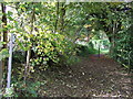
EH & OS concede (you might not credit this) that their only examination was by aerial photograph and 'the location was totally obscured by trees' (yes, that is a quotation from pastcape 327207 !!!). Your reporter not having a pilot's licence nor a kite camera thought it could be more profitable if a visit by car was made - such is the practicality of the older generation. On arrival I struggled with my seat belt and having released the same ventured forth to the barrow, I found the odd large stone close at hand. There was some damage to the barrow from ploughing, but there also seemed to be the alas ever present (these days) excavation crater. There is no excavation recorded as far as I can tell. The barrow is on a slight but prominent spur and it lies NE/SW. T. C. Darvill and A. Saville still think it could be a Long Barrow - anyone got a shovel? Well you might need it if it is a midden.
You may be viewing yesterday's version of this page. To see the most up to date information please register for a free account.
")
Do not use the above information on other web sites or publications without permission of the contributor.
Nearby Images from Geograph Britain and Ireland:
©2015(licence)
©2009(licence)
©2015(licence)
©2009(licence)
©2009(licence)
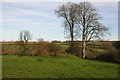
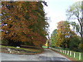
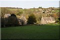
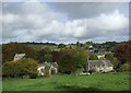
The above images may not be of the site on this page, they are loaded from Geograph.
Please Submit an Image of this site or go out and take one for us!
Click here to see more info for this site
Nearby sites
Key: Red: member's photo, Blue: 3rd party photo, Yellow: other image, Green: no photo - please go there and take one, Grey: site destroyed
Download sites to:
KML (Google Earth)
GPX (GPS waypoints)
CSV (Garmin/Navman)
CSV (Excel)
To unlock full downloads you need to sign up as a Contributory Member. Otherwise downloads are limited to 50 sites.
Turn off the page maps and other distractions
Nearby sites listing. In the following links * = Image available
1.1km S 182° Bagendon* Hillfort (SP018064)
1.3km NW 308° North Cerney Cursus Cursus (SP00800834)
2.0km NNW 328° North Cerney 2* Round Barrow(s) (SP00790919)
2.9km ENE 68° Calmsden spring* Holy Well or Sacred Spring (SP04540863)
2.9km NW 310° Ditches Hillfort Hillfort (SO996094)
4.1km NE 41° Pinkwell (Chedworth)* Chambered Cairn (SP04531058)
4.2km SSW 210° Wellhill Copse Barrow* Round Barrow(s) (SO99740387)
4.4km NNE 11° Shawswell Farm Long Barrow* Long Barrow (SP027118)
5.0km E 80° Colnpen* Chambered Tomb (SP068084)
5.2km SSE 166° Tar Barrow* Round Barrow(s) (SP03110252)
5.2km N 1° Monument Number 327710* Artificial Mound (SP0193712749)
5.4km W 260° Hoar Stone at Duntisbourne* Chambered Tomb (SO965066)
5.5km S 177° Corinium Museum* Museum (SP0212602059)
5.7km NE 37° Chedworth spring* Holy Well or Sacred Spring (SP053121)
6.0km WSW 255° College Plantation 1* Chambered Tomb (SO960060)
6.0km NW 313° Barrow Clump* Round Barrow(s) (SO974116)
6.0km S 179° Querns Barrow* Chambered Tomb (SP01980150)
6.1km WSW 256° College Plantation 2* Chambered Tomb (SO959060)
6.1km W 267° Jack Barrow Chambered Cairn (SO957072)
6.4km WSW 250° Pinbury Hillfort Hillfort (SO958053)
6.8km N 11° Withington Woods Chambered Tomb (SP031142)
6.8km NE 46° Woodbarrow (Glos)* Chambered Tomb (SP06731228)
6.9km NE 45° Royal Oak* Round Barrow(s) (SP06701239)
6.9km NNE 30° Chedworth Villa Nymphaeum* Holy Well or Sacred Spring (SP05241350)
6.9km N 5° Withington Woods Cross Dyke* Misc. Earthwork (SP025144)
View more nearby sites and additional images


 We would like to know more about this location. Please feel free to add a brief description and any relevant information in your own language.
 Wir möchten mehr über diese Stätte erfahren. Bitte zögern Sie nicht, eine kurze Beschreibung und relevante Informationen in Deutsch hinzuzufügen.
 Nous aimerions en savoir encore un peu sur les lieux. S'il vous plaît n'hesitez pas à ajouter une courte description et tous les renseignements pertinents dans votre propre langue.
 Quisieramos informarnos un poco más de las lugares. No dude en añadir una breve descripción y otros datos relevantes en su propio idioma.