<< Our Photo Pages >> Cortie Brae - Stone Circle in Scotland in Aberdeenshire
Submitted by golux on Monday, 15 July 2002 Page Views: 7085
Neolithic and Bronze AgeSite Name: Cortie Brae Alternative Name: CortesCountry: Scotland County: Aberdeenshire Type: Stone Circle
Nearest Town: Fraserburgh Nearest Village: Lonmay
Map Ref: NK01015924 Landranger Map Number: 30
Latitude: 57.623128N Longitude: 1.984751W
Condition:
| 5 | Perfect |
| 4 | Almost Perfect |
| 3 | Reasonable but with some damage |
| 2 | Ruined but still recognisable as an ancient site |
| 1 | Pretty much destroyed, possibly visible as crop marks |
| 0 | No data. |
| -1 | Completely destroyed |
| 5 | Superb |
| 4 | Good |
| 3 | Ordinary |
| 2 | Not Good |
| 1 | Awful |
| 0 | No data. |
| 5 | Can be driven to, probably with disabled access |
| 4 | Short walk on a footpath |
| 3 | Requiring a bit more of a walk |
| 2 | A long walk |
| 1 | In the middle of nowhere, a nightmare to find |
| 0 | No data. |
| 5 | co-ordinates taken by GPS or official recorded co-ordinates |
| 4 | co-ordinates scaled from a detailed map |
| 3 | co-ordinates scaled from a bad map |
| 2 | co-ordinates of the nearest village |
| 1 | co-ordinates of the nearest town |
| 0 | no data |
Internal Links:
External Links:
")
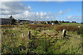
The New Statistical Account published in 1845 mentioned a "Druid temple on Cortes estate" which is probably this site. The Name Book (1867) said "All that remains of this stone circle are three large stones, two of which appear to be in situ, the third having been placed in the centre". The OS map of 1872 (surveyed 1870) shows the three stones. By 1904 there were only two stones, one 2ft 10in high, the other prostrate. In 1969 the OS found only "one large boulder".
This circle is not listed in Burl's gazetteer but he did mention (1970) "Cortes stone circle", citing a reference to a "Druid temple on the estate of Cortes" in the New Statistical Account (1845), and gave a grid reference of NJ9958. This appears to be a typo of NJ 99 59 which is the OS kilometre square surrounding Cortes House. The OS map of 1872 (surveyed 1870) shows no stones in this square. Burl probably meant this site (Cortie Brae), it being the only circle recorded in the vicinity of Cortes.
You may be viewing yesterday's version of this page. To see the most up to date information please register for a free account.
Do not use the above information on other web sites or publications without permission of the contributor.
Nearby Images from Geograph Britain and Ireland:
©2019(licence)
©2006(licence)
©2019(licence)
©2007(licence)
©2020(licence)
The above images may not be of the site on this page, they are loaded from Geograph.
Please Submit an Image of this site or go out and take one for us!
Click here to see more info for this site
Nearby sites
Key: Red: member's photo, Blue: 3rd party photo, Yellow: other image, Green: no photo - please go there and take one, Grey: site destroyed
Download sites to:
KML (Google Earth)
GPX (GPS waypoints)
CSV (Garmin/Navman)
CSV (Excel)
To unlock full downloads you need to sign up as a Contributory Member. Otherwise downloads are limited to 50 sites.
Turn off the page maps and other distractions
Nearby sites listing. In the following links * = Image available
2.7km SE 140° Berrybrae* Stone Circle (NK02765716)
3.9km ESE 121° Netherton* Stone Circle (NK04335722)
4.1km SE 129° Greengate* Standing Stone (Menhir) (NK04205662)
4.4km NW 310° Memsie Burial Cairn* Cairn (NJ97666205)
8.3km SSW 201° Gaval Standing Stone* Standing Stone (Menhir) (NJ9805651504)
8.6km W 273° Picts House* Misc. Earthwork (NJ92365963)
8.7km WSW 237° Strichen House* Stone Circle (NJ93675449)
8.9km WNW 296° Tyrie Class I Pictish Symbol Stone (NJ93006310)
9.1km SSW 198° Fetterangus* Class I Pictish Symbol Stone (NJ98135056)
9.7km SW 221° White Cow Wood* Chambered Cairn (NJ947519)
10.7km SSW 207° Loudon Wood* Stone Circle (NJ96104974)
10.9km SW 215° Auchmachar* Stone Circle (NJ948503)
10.9km NW 305° Gallows Hill (The Hanging Stone) Standing Stone (Menhir) (NJ9211465539)
11.0km SW 216° Auchmachar Long Cairn* Cairn (NJ9461850314)
11.0km SW 216° Knapperty Hill* Chambered Cairn (NJ946503)
11.2km SSW 212° Auchmachar Clump Ancient Village or Settlement (NJ950498)
11.9km SSW 200° Old Deer* Class I Pictish Symbol Stone (NJ96854810)
12.7km WNW 296° Dundarg Castle* Hillfort (NJ895648)
12.8km W 269° Law Cairn* Cairn (NJ88205911)
13.2km SSW 203° Aikey Brae* Stone Circle (NJ95884709)
13.4km WNW 294° St Drostan's Well* Holy Well or Sacred Spring (NJ887646)
13.9km WNW 294° Mess John's Well Holy Well or Sacred Spring (NJ882648)
15.4km SSW 193° East Crichie Stone Circle (NJ9751344269)
15.8km SSW 199° Upper Crichie Stone Circle (NJ9580344301)
16.9km W 277° Strath Howe Hillfort (NJ842614)
View more nearby sites and additional images


 We would like to know more about this location. Please feel free to add a brief description and any relevant information in your own language.
 Wir möchten mehr über diese Stätte erfahren. Bitte zögern Sie nicht, eine kurze Beschreibung und relevante Informationen in Deutsch hinzuzufügen.
 Nous aimerions en savoir encore un peu sur les lieux. S'il vous plaît n'hesitez pas à ajouter une courte description et tous les renseignements pertinents dans votre propre langue.
 Quisieramos informarnos un poco más de las lugares. No dude en añadir una breve descripción y otros datos relevantes en su propio idioma.