

<< Our Photo Pages >> Heddon Hill - Rock Art in England in Northumberland
Submitted by Anne T on Saturday, 17 March 2018 Page Views: 1224
Rock ArtSite Name: Heddon Hill Alternative Name: ERA-216; Beckensall 986Country: England
NOTE: This site is 0.6 km away from the location you searched for.
County: Northumberland Type: Rock Art
Nearest Town: Wooler Nearest Village: Earle / South Middleton
Map Ref: NT9964621794
Latitude: 55.489945N Longitude: 2.007157W
Condition:
| 5 | Perfect |
| 4 | Almost Perfect |
| 3 | Reasonable but with some damage |
| 2 | Ruined but still recognisable as an ancient site |
| 1 | Pretty much destroyed, possibly visible as crop marks |
| 0 | No data. |
| -1 | Completely destroyed |
| 5 | Superb |
| 4 | Good |
| 3 | Ordinary |
| 2 | Not Good |
| 1 | Awful |
| 0 | No data. |
| 5 | Can be driven to, probably with disabled access |
| 4 | Short walk on a footpath |
| 3 | Requiring a bit more of a walk |
| 2 | A long walk |
| 1 | In the middle of nowhere, a nightmare to find |
| 0 | No data. |
| 5 | co-ordinates taken by GPS or official recorded co-ordinates |
| 4 | co-ordinates scaled from a detailed map |
| 3 | co-ordinates scaled from a bad map |
| 2 | co-ordinates of the nearest village |
| 1 | co-ordinates of the nearest town |
| 0 | no data |
Internal Links:
External Links:
I have visited· I would like to visit
SolarMegalith visited on 11th Jan 2019 - their rating: Cond: 3 Amb: 5 Access: 3
")
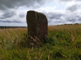
This rock art panel is described by NADRAP as having twelve single cups, one cup and ring, one cup and arc and three cups with grooves on its eastern side. On its top and western side, it has approximately twenty deep, but eroded cups with grooves. NADRAP notes that it was difficult to determine which cups were artificial as opposed to those formed by natural erosion. For more information see England's Rock Art entry for ERA-261 Heddon Hill, which includes Beckensall's description, photographs, a panoramic photograph, a sketch of the rock and its motifs, plus photogrammetry, a QTVR model and media from the Beckensall Archive.
The original Beckensall record can be found at Internet Archive: Beckensall 986 Heddon Hill.
This rock art panel is located on Open Access land.
Note: Have you seen this rock art panel? Do you have any photographs or information to add?
You may be viewing yesterday's version of this page. To see the most up to date information please register for a free account.
")
")
Do not use the above information on other web sites or publications without permission of the contributor.
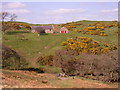
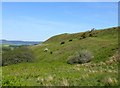
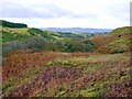
Nearby Images from Geograph Britain and Ireland:
©2007(licence)

©2008(licence)
©2015(licence)
©2012(licence)
©2007(licence)
The above images may not be of the site on this page, they are loaded from Geograph.
Please Submit an Image of this site or go out and take one for us!
Click here to see more info for this site
Nearby sites
Key: Red: member's photo, Blue: 3rd party photo, Yellow: other image, Green: no photo - please go there and take one, Grey: site destroyed
Download sites to:
KML (Google Earth)
GPX (GPS waypoints)
CSV (Garmin/Navman)
CSV (Excel)
To unlock full downloads you need to sign up as a Contributory Member. Otherwise downloads are limited to 50 sites.
Turn off the page maps and other distractions
Nearby sites listing. In the following links * = Image available
198m NE 42° Middleton Dean* Promontory Fort / Cliff Castle (NT99782194)
828m NW 318° South Middleton Cairn* Cairn (NT99092241)
958m NW 319° South Middleton Moor* Rock Art (NT9901722519)
1.2km NNW 331° South Ringles* Ancient Village or Settlement (NT99072285)
1.4km NNW 331° The Ringles* Hillfort (NT98982299)
1.5km NNE 33° Foxes Knoll* Hillfort (NU00492308)
2.7km NNW 327° Brands Hill* Ancient Village or Settlement (NT98162406)
2.8km WSW 243° Threestoneburn* Stone Circle (NT9714020502)
3.1km E 100° Roseden Standing Stone Standing Stone (Menhir) (NU0272221269)
3.3km SSE 164° Reaveley Hill Rock Art (NU0056018582)
3.6km ENE 70° Lilburn South Stead Farm Rock Art (NU0323)
3.8km SSW 195° Dunmore Hill* Modern Stone Circle etc (NT98671810)
3.9km W 276° Langleeford N01 Rock Art (NT9580222191)
3.9km W 275° Langleeford 1 Rock Art (NT9577522147)
4.0km NW 322° Carey Burn (Harthope Valley)* Ancient Village or Settlement (NT97172491)
4.1km NNE 24° Clover Bank (Lilburn Hill Farm) Rock Art (NU01312556)
4.1km NNE 23° Lilburn Rock Art* Rock Art (NU013256)
4.2km NE 50° Lilburn Portable* Rock Art (NU0290024500)
5.0km S 171° Ewe Hill Fort Hillfort (NU004168)
5.1km NW 326° Hart Heugh* Stone Circle (NT968260)
5.2km NNE 29° Lilburn Cist* Cist (NU022263)
5.2km NE 56° Hurl Stone* Standing Stone (Menhir) (NU03952471)
5.2km ENE 63° Newtown Mill* Standing Stone (Menhir) (NU04322421)
5.3km NNE 14° Coldmartin Tower Rock Art (NU0090026910)
5.4km NNW 348° Maiden Well (Kettle Hill)* Holy Well or Sacred Spring (NT9856427053)
View more nearby sites and additional images


 We would like to know more about this location. Please feel free to add a brief description and any relevant information in your own language.
 Wir möchten mehr über diese Stätte erfahren. Bitte zögern Sie nicht, eine kurze Beschreibung und relevante Informationen in Deutsch hinzuzufügen.
 Nous aimerions en savoir encore un peu sur les lieux. S'il vous plaît n'hesitez pas à ajouter une courte description et tous les renseignements pertinents dans votre propre langue.
 Quisieramos informarnos un poco más de las lugares. No dude en añadir una breve descripción y otros datos relevantes en su propio idioma.