


<< Text Pages >> Prestbury (Glos) - Chambered Tomb in England in Gloucestershire
Submitted by Anonymous on Tuesday, 19 October 2004 Page Views: 8985
Neolithic and Bronze AgeSite Name: Prestbury (Glos) Alternative Name: Giant's GraveCountry: England
NOTE: This site is 1.8 km away from the location you searched for.
County: Gloucestershire Type: Chambered Tomb
Map Ref: SO984233 Landranger Map Number: 163
Latitude: 51.908233N Longitude: 2.024665W
Condition:
| 5 | Perfect |
| 4 | Almost Perfect |
| 3 | Reasonable but with some damage |
| 2 | Ruined but still recognisable as an ancient site |
| 1 | Pretty much destroyed, possibly visible as crop marks |
| 0 | No data. |
| -1 | Completely destroyed |
| 5 | Superb |
| 4 | Good |
| 3 | Ordinary |
| 2 | Not Good |
| 1 | Awful |
| 0 | No data. |
| 5 | Can be driven to, probably with disabled access |
| 4 | Short walk on a footpath |
| 3 | Requiring a bit more of a walk |
| 2 | A long walk |
| 1 | In the middle of nowhere, a nightmare to find |
| 0 | No data. |
| 5 | co-ordinates taken by GPS or official recorded co-ordinates |
| 4 | co-ordinates scaled from a detailed map |
| 3 | co-ordinates scaled from a bad map |
| 2 | co-ordinates of the nearest village |
| 1 | co-ordinates of the nearest town |
| 0 | no data |
Internal Links:
External Links:
Destroyed Chambered Tomb in Gloucestershire
This chambered tomb once stood in a field known as Giant's Grave.
Have you visited this site? Please add a comment below.
You may be viewing yesterday's version of this page. To see the most up to date information please register for a free account.
Do not use the above information on other web sites or publications without permission of the contributor.
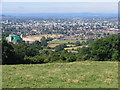
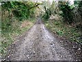
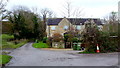
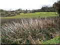
Nearby Images from Geograph Britain and Ireland:

©2025(licence)
©2005(licence)
©2009(licence)
©2014(licence)
©2009(licence)
The above images may not be of the site on this page, they are loaded from Geograph.
Please Submit an Image of this site or go out and take one for us!
Click here to see more info for this site
Nearby sites
Key: Red: member's photo, Blue: 3rd party photo, Yellow: other image, Green: no photo - please go there and take one, Grey: site destroyed
Download sites to:
KML (Google Earth)
GPX (GPS waypoints)
CSV (Garmin/Navman)
CSV (Excel)
To unlock full downloads you need to sign up as a Contributory Member. Otherwise downloads are limited to 50 sites.
Turn off the page maps and other distractions
Nearby sites listing. In the following links * = Image available
2.2km N 2° Cleeve Hill (Gloucestershire)* Hillfort (SO98492546)
3.0km N 3° Cleeve Hill Cross Dyke* Misc. Earthwork (SO98562625)
3.3km N 1° The Ring (Gloucestershire)* Ancient Village or Settlement (SO98472659)
3.4km W 267° The Wish Stone* Marker Stone (SO950231)
3.6km WSW 258° Cheltenham Centre Stone* Marker Stone (SO9488422583)
3.8km WSW 258° Cheltenham Museum* Museum (SO947225)
4.3km ENE 60° Belas Knap* Long Barrow (SP02092545)
4.4km N 6° Cleeve Hill Barrows Round Barrow(s) (SO98872767)
4.4km SSE 161° North Dowdeswell* Hillfort (SO99851910)
4.8km S 170° Lineover* Chambered Tomb (SO99231856)
5.1km N 4° Nottingham Hill Carving (Gotherington)* Rock Art (SO98752835)
5.1km N 360° Nottingham Hill* Hillfort (SO984284)
5.1km SSE 157° South Dowdeswell Hillfort (SP0040018600)
6.0km SW 215° Leckhampton Hill Barrow* Round Barrow(s) (SO94911838)
6.0km N 360° Odo and Dodo* Standing Stones (SO98402935)
6.1km SW 216° Leckhampton Hill* Hillfort (SO948184)
6.3km E 81° Roel Camp* Hillfort (SP04682434)
6.6km SSW 195° Seven Springs (Gloucestershire)* Holy Well or Sacred Spring (SO96631694)
7.4km NE 53° St. Kenelm's Well* Holy Well or Sacred Spring (SP0435827795)
7.7km SW 220° Crippet's Barrow* Chambered Tomb (SO93421739)
7.9km SW 218° Dry Heathfield Barrow Round Barrow(s) (SO93521711)
8.1km N 352° The Knolls* Ancient Village or Settlement (SO97253135)
8.2km SSW 201° Coberley* Chambered Tomb (SO95521564)
8.4km S 177° Norbury Hillfort (Colesbourne)* Hillfort (SO989149)
8.6km E 99° Slade Barn Chambered Cairn (SP069219)
View more nearby sites and additional images


 We would like to know more about this location. Please feel free to add a brief description and any relevant information in your own language.
 Wir möchten mehr über diese Stätte erfahren. Bitte zögern Sie nicht, eine kurze Beschreibung und relevante Informationen in Deutsch hinzuzufügen.
 Nous aimerions en savoir encore un peu sur les lieux. S'il vous plaît n'hesitez pas à ajouter une courte description et tous les renseignements pertinents dans votre propre langue.
 Quisieramos informarnos un poco más de las lugares. No dude en añadir una breve descripción y otros datos relevantes en su propio idioma.