Featured: How and why the ancients enchanted Great Britain and Brittany

How and why the ancients enchanted Great Britain and Brittany

Das Raetiastein GPS by Thomas Walli

Das Raetiastein GPS by Thomas Walli

Who's Online

There are currently, 232 guests and 1 members online.

You are a guest. To join in, please register for free by clicking here

Sponsors

<< Our Photo Pages >> Cleeve Hill (Gloucestershire) - Hillfort in England in Gloucestershire

Submitted by vicky on Monday, 07 October 2002  Page Views: 24676

Iron Age and Later PrehistorySite Name: Cleeve Hill (Gloucestershire)
Country: England County: Gloucestershire Type: Hillfort
Nearest Town: Cheltenham  Nearest Village: Southam
Map Ref: SO98492546  Landranger Map Number: 163
Latitude: 51.927654N  Longitude: 2.023367W
Condition:
5Perfect
4Almost Perfect
3Reasonable but with some damage
2Ruined but still recognisable as an ancient site
1Pretty much destroyed, possibly visible as crop marks
0No data.
-1Completely destroyed
3 Ambience:
5Superb
4Good
3Ordinary
2Not Good
1Awful
0No data.
3 Access:
5Can be driven to, probably with disabled access
4Short walk on a footpath
3Requiring a bit more of a walk
2A long walk
1In the middle of nowhere, a nightmare to find
0No data.
3 Accuracy:
5co-ordinates taken by GPS or official recorded co-ordinates
4co-ordinates scaled from a detailed map
3co-ordinates scaled from a bad map
2co-ordinates of the nearest village
1co-ordinates of the nearest town
0no data
5

Internal Links:
External Links:

I have visited· I would like to visit

SumDoood SolarMegalith would like to visit

TheCaptain visited on 14th Jun 2021 - their rating: Cond: 3 Amb: 4 Access: 3 Cotswold Way walk north around Cheltenham from Seven Springs to Cleeve Hill. Walk all around the ramparts of what is left of this hillfort, much of the western side of which has been quarried away. Fabulous views over Cheltenham.

drolaf h_fenton have visited here
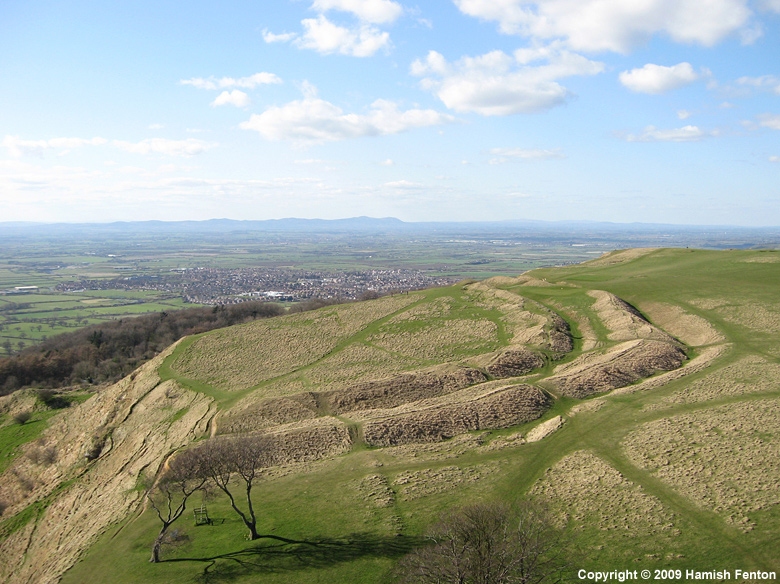
Cleeve Hill (Gloucestershire)
Cleeve Hill (Gloucestershire) submitted by h_fenton : Cleeve Hill - Hillfort. Kite Aerial Photograph, 29 March 2009 (Vote or comment on this photo)
Hillfort in Gloucestershire

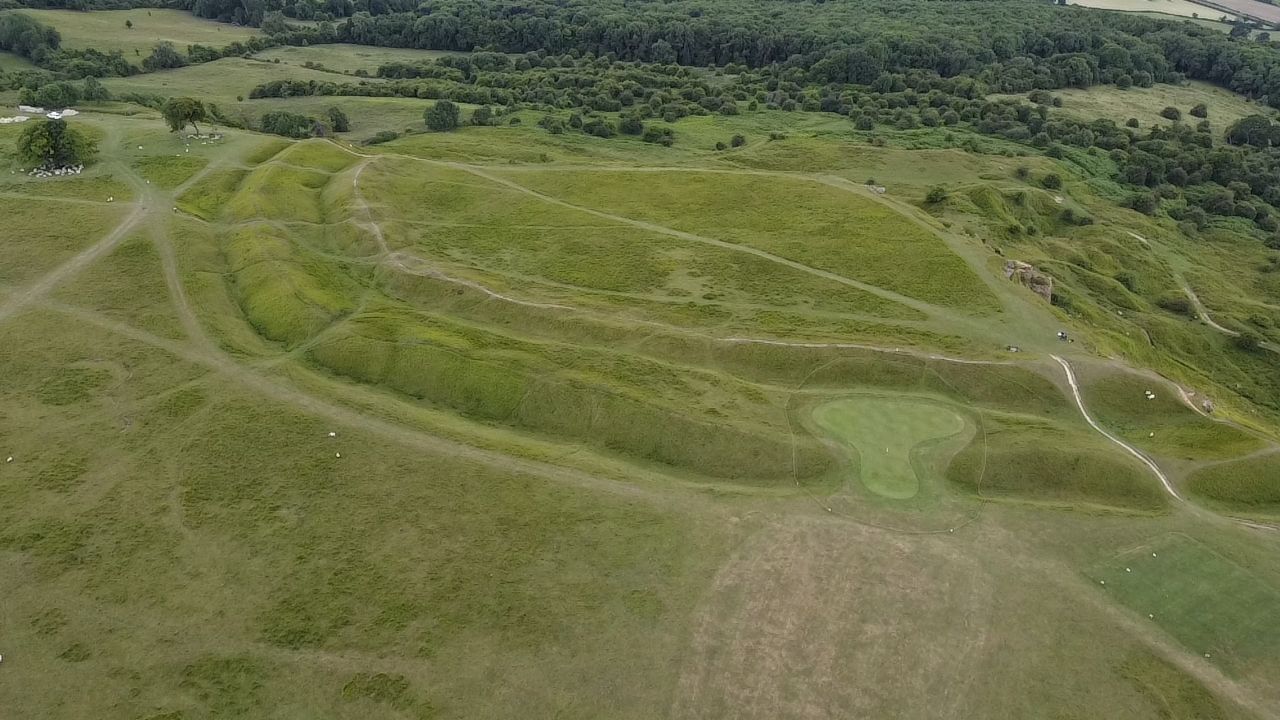
A golf course has impinged upon the fort so beware of flying balls!
You may be viewing yesterday's version of this page. To see the most up to date information please register for a free account.

Cleeve Hill (Gloucestershire)
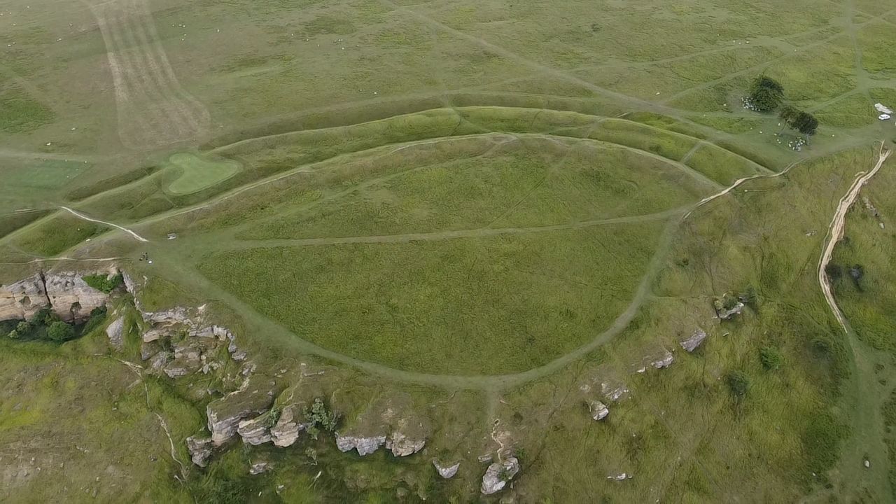
Cleeve Hill (Gloucestershire) submitted by h_fenton : Cleeve Hill Camp - Hillfort. from the Northwest showing how the banks currently end at the edge of the cotswold escarpment Kite Aerial Photograph, 29 March 2009 (Vote or comment on this photo)

Cleeve Hill (Gloucestershire)
Cleeve Hill (Gloucestershire) submitted by camperman : Aerial view looking west showing where the golf course has impinged on the bank and ditches. (Vote or comment on this photo)

Cleeve Hill (Gloucestershire)
Cleeve Hill (Gloucestershire) submitted by camperman : Cleeve Hill Camp, bivallate, plateau hillfort on the edge of the Cotswold scarp. (Vote or comment on this photo)

Cleeve Hill (Gloucestershire)
Cleeve Hill (Gloucestershire) submitted by h_fenton : Cleeve Hill Camp - Hillfort. Northern ends of the banks currently end at the edge of the cotswold escarpment, there is some argument as to how much these have been quarried away. Kite Aerial Photograph, 29 March 2009 (Vote or comment on this photo)

Cleeve Hill (Gloucestershire)
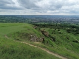
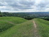
Cleeve Hill (Gloucestershire) submitted by TheCaptain : View southwest from the quarried cliff edge, along the Cotswold Edge and over Cheltenham

Cleeve Hill (Gloucestershire)
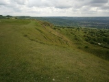
Cleeve Hill (Gloucestershire) submitted by TheCaptain : The northern end of the ramparts where they drop over the cliff edge. Malvern Hills in the distance.

Cleeve Hill (Gloucestershire)
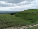
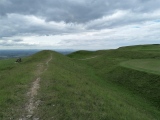
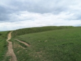
Cleeve Hill (Gloucestershire) submitted by TheCaptain : The northern section of ramparts

Cleeve Hill (Gloucestershire)
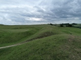
Cleeve Hill (Gloucestershire) submitted by TheCaptain : The northeastern ramparts

Cleeve Hill (Gloucestershire)
Cleeve Hill (Gloucestershire) submitted by TheCaptain : The southern end of the ramparts where they drop over the cliff edge. Fabulous views south along the Cotswold Edge and outskirts of Cheltenham

Cleeve Hill (Gloucestershire)
Cleeve Hill (Gloucestershire) submitted by TheCaptain : Approaching from the south along the Cotswold Way

Cleeve Hill (Gloucestershire)
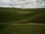
Cleeve Hill (Gloucestershire) submitted by drolaf : Cleeve Hill Camp, showing the golf green built into the camp bank.

Cleeve Hill (Gloucestershire)
Cleeve Hill (Gloucestershire) submitted by drolaf : Cleeve Hill/Nutterswood Hill Camp. from the north.

Do not use the above information on other web sites or publications without permission of the contributor.
Click here to see more info for this site

Nearby sites

Click here to view sites on an interactive OS map

Key: Red: member's photo, Blue: 3rd party photo, Yellow: other image, Green: no photo - please go there and take one, Grey: site destroyed

Download sites to:
KML (Google Earth)
GPX (GPS waypoints)
CSV (Garmin/Navman)
CSV (Excel)

To unlock full downloads you need to sign up as a Contributory Member. Otherwise downloads are limited to 50 sites.


Turn off the page maps and other distractions

Nearby sites listing. In the following links * = Image available
 793m N 5° Cleeve Hill Cross Dyke* Misc. Earthwork (SO98562625)
 1.1km N 359° The Ring (Gloucestershire)* Ancient Village or Settlement (SO98472659)
 2.2km S 182° Prestbury (Glos) Chambered Tomb (SO984233)
 2.2km N 10° Cleeve Hill Barrows Round Barrow(s) (SO98872767)
 2.9km N 5° Nottingham Hill Carving (Gotherington)* Rock Art (SO98752835)
 2.9km N 358° Nottingham Hill* Hillfort (SO984284)
 3.6km E 90° Belas Knap* Long Barrow (SP02092545)
 3.9km N 359° Odo and Dodo* Standing Stones (SO98402935)
 4.2km SW 236° The Wish Stone* Marker Stone (SO950231)
 4.6km SW 231° Cheltenham Centre Stone* Marker Stone (SO9488422583)
 4.8km SW 232° Cheltenham Museum* Museum (SO947225)
 6.0km NNW 348° The Knolls* Ancient Village or Settlement (SO97253135)
 6.3km E 100° Roel Camp* Hillfort (SP04682434)
 6.3km ENE 68° St. Kenelm's Well* Holy Well or Sacred Spring (SP0435827795)
 6.5km SSE 168° North Dowdeswell* Hillfort (SO99851910)
 6.7km NNE 13° Alderton Cursus Cursus (SP00023199)
 6.9km S 174° Lineover* Chambered Tomb (SO99231856)
 7.1km SSE 164° South Dowdeswell Hillfort (SP0040018600)
 7.4km NNE 32° The Warren Hillfort (SP024318)
 7.9km SSW 207° Leckhampton Hill Barrow* Round Barrow(s) (SO94911838)
 8.0km SSW 208° Leckhampton Hill* Hillfort (SO948184)
 8.3km ENE 69° Farmcote gatepost* Standing Stone (Menhir) (SP0624828468)
 8.5km ENE 57° Hailes Wood Earthworks Misc. Earthwork (SP05663009)
 8.7km NNW 346° The Tibblestone* Standing Stone (Menhir) (SO96333384)
 8.7km E 83° Guiting Wood Bowl Barrow* Round Barrow(s) (SP0710826545)
View more nearby sites and additional images

<< Bloody Acre Camp

Ardalanish >>

Please add your thoughts on this site

Long Barrows of the Cotswolds, Darvill

Long Barrows of the Cotswolds, Darvill

Sponsors

Auto-Translation (Google)

Translate from English into:

"Cleeve Hill (Gloucestershire)" | Login/Create an Account | 4 News and Comments
  
Go back to top of page    Comments are owned by the poster. We aren't responsible for their content.
Re: Cleeve Hill by drolaf on Thursday, 01 June 2017
(User Info | Send a Message)
The hill camp is on the southern edge of Cleeve common.
From Cleeve hill you can see sw across the Severn to the Black mountains (77miles), nw to the Malverns, and south to Painswick beacon , and the Severn bridge, and up the Evesham valley. On a very clear day you can see Winsford Hill on Exmoor (90miles).
There is a dewpond on top of the common, possibly a water source in prehistory.

It’s a shame the golf course has been allowed to put a green on the Hillcamp bank.
Cleeve common is privately owned and managed by the Board of Conservators, representatives appointed by Cheltenham Borough Council and the Parish Councils. So if you are local you might get a say in what happens on this land.
[ Reply to This ]

Cleeve Common web site with news, information and what's ons by Andy B on Tuesday, 20 December 2011
(User Info | Send a Message)
Cleeve Common web site with news, information and what's ons
http://www.cleevecommon.org.uk/
[ Reply to This ]

Turf damage repaired at Cleeve Hill Camp by Andy B on Tuesday, 20 December 2011
(User Info | Send a Message)
Archaeologists have stepped in to save an ancient iron age monument on Cleeve Common.

The historic hill fort located on the edge of the scarp on the common had been eroded by the thousands of walkers who use the beauty spot.

Part of the turf had come away to expose the soil underneath, putting the scheduled monument at risk.

But archaeologists from Gloucestershire County Council were called in and with funding from Natural England, the damage was repaired.

Conservation officer for Cleeve Common, Ellie Phillips, said: "It is a scheduled monument and as such is protected by law from damage because it is such an important site. We have so many people using the common and this is what led to the erosion of the hill fort on one side."

The hilltop area is made up of open grassland used for recreation, including the golf course and gallops.

County archaeologist Jan Wills said the Cleeve Hill site would have been occupied during the iron age between 400BC up the Roman occupation in 43AD.

She said: "It is a very important settlement site. Physically it is an area of high ground on the top of the common.

"There are sites like this along the Cotswold escarpment, including one at Crickley Hill.

"The problem is they are well used by people and this problem was caused just by the footfall."

She added: "Once that has eroded, it is very susceptible to further damage from rain or ice in the winter." Under the guidance of the county council's archaeologist Andrew Armstrong, they made a record of what was exposed under the earth.

Staff from the council's estates team, led by Alan Watson, were called in to lay soil and turf and then a wire mesh was laid over the top to keep the earthworks in place.

Jan said: "This is a nationally important archaeological site and one of only 500 across the county that has this special protection."

The common is of national importance for the quality of its landscape, geology, archaeology, nature conservation and scientific interest.

It is the largest area of unimproved limestone grassland in Gloucestershire. Almost all of it is designated as a Site of Special Scientific Interest (SSSI), which means it is overseen by Natural England.

Source:
http://www.thisisgloucestershire.co.uk/story-13977277-detail/story.html?
[ Reply to This ]

Re: Cleeve Hill by coldrum on Monday, 30 August 2010
(User Info | Send a Message)
Pastscape site entry:

http://www.pastscape.org.uk/hob.aspx?hob_id=117630
[ Reply to This ]

Your Name: Anonymous [ Register Now ]
Subject:


Add your comment or contribution to this page. Spam or offensive posts are deleted immediately, don't even bother

<<< What is five plus one as a number? (Please type the answer to this question in the little box on the left)
You can also embed videos and other things. For Youtube please copy and paste the 'embed code'.
For Google Street View please include Street View in the text.
Create a web link like this: <a href="https://www.megalithic.co.uk">This is a link</a>  

Allowed HTML is:
<p> <b> <i> <a> <img> <em> <br> <strong> <blockquote> <tt> <li> <ol> <ul> <object> <param> <embed> <iframe>

We would like to know more about this location. Please feel free to add a brief description and any relevant information in your own language.
Wir möchten mehr über diese Stätte erfahren. Bitte zögern Sie nicht, eine kurze Beschreibung und relevante Informationen in Deutsch hinzuzufügen.
Nous aimerions en savoir encore un peu sur les lieux. S'il vous plaît n'hesitez pas à ajouter une courte description et tous les renseignements pertinents dans votre propre langue.
Quisieramos informarnos un poco más de las lugares. No dude en añadir una breve descripción y otros datos relevantes en su propio idioma.