<< Our Photo Pages >> Walshaw Dean Reservoir - Stone Circle in England in Yorkshire (West)
Submitted by LivingRocks on Friday, 08 September 2006 Page Views: 20251
Neolithic and Bronze AgeSite Name: Walshaw Dean ReservoirCountry: England County: Yorkshire (West) Type: Stone Circle
Map Ref: SD96473355 Landranger Map Number: 103
Latitude: 53.798243N Longitude: 2.055073W
Condition:
| 5 | Perfect |
| 4 | Almost Perfect |
| 3 | Reasonable but with some damage |
| 2 | Ruined but still recognisable as an ancient site |
| 1 | Pretty much destroyed, possibly visible as crop marks |
| 0 | No data. |
| -1 | Completely destroyed |
| 5 | Superb |
| 4 | Good |
| 3 | Ordinary |
| 2 | Not Good |
| 1 | Awful |
| 0 | No data. |
| 5 | Can be driven to, probably with disabled access |
| 4 | Short walk on a footpath |
| 3 | Requiring a bit more of a walk |
| 2 | A long walk |
| 1 | In the middle of nowhere, a nightmare to find |
| 0 | No data. |
| 5 | co-ordinates taken by GPS or official recorded co-ordinates |
| 4 | co-ordinates scaled from a detailed map |
| 3 | co-ordinates scaled from a bad map |
| 2 | co-ordinates of the nearest village |
| 1 | co-ordinates of the nearest town |
| 0 | no data |
Internal Links:
External Links:

Ling Roth places the circle 'on the left hand side of the valley going up, a few yards above the dam of the second reservoir' the published GPS co-ordinates put it beyond the dam of the third reservoir. Working from Ling Roth’s description I was able to confirm that the circle still exists in the position he describes, very close to the dam near the lodge. (My co-ordinates - SD96472 33553 Garmin Etrex).
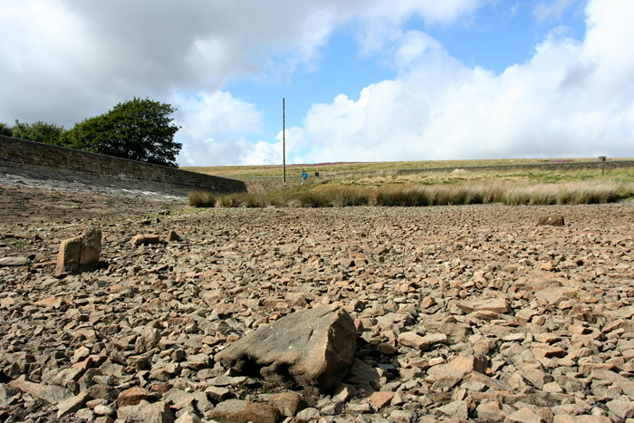
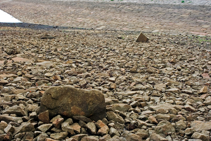
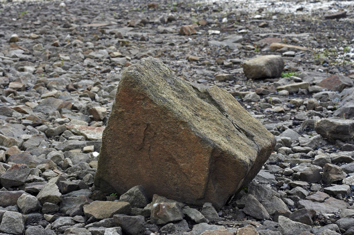
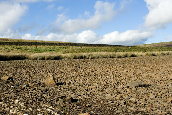
There appear to be 6 (possibly 7) of the original stones still earthfast in their original positions, and I was able to recreate the 1902 photo of the site published by Ling Roth, matching up both the remaining stones & the landscape.
There is no trace of the central horseshoe shaped feature shown in the 1902 photo but this is not surprising as Ling Roth recorded it as having gone by 1906, it is described in the description of the site as a possible cairn, my own feeling is that it may have been a grouse butt of more modern origin.
The position of the circle is below the waterline of the reservoir and it is now packed with the lining stones, but it is still clearly identifiable and deposits will no doubt remain below ground.
At the present time water levels are low and the site is fully exposed, judging from its position close to the bank of the reservoir, I would expect it to be frequently accessible, no more than a 2-3 metre drop in levels will leave the stones high and dry.
This site is also featured on The Northern Antiquarian (TNA) - see their entry for Walshaw Dean, Wadsworth Moor, West Yorkshire, which gives directions for finding this site, together with a plan of the stone circle (by Walshaw Dean), an early photo of the circle, and descriptions from a number of sources. TNA notes: "There is also the peculiar addition inside this stone circle of an arc of walling facing southeast, which is unique in this part of Britain. But this walling seems to have been a later addition and has the hallmarks of being some small shelter ... To my knowledge, no subsequent excavation of the site has ever been done, but it would appear that the waters have washed part of the site away and any remains that may once have been found within the ring have been discarded by more than a century of erosion. Traces of small walled structures have also been noted close to the circle in recent years, suggestive of settlement remains." TNA confirms the site can still be seen "in a good drought".
Note: Lost Stone Circle in West Yorkshire found!
You may be viewing yesterday's version of this page. To see the most up to date information please register for a free account.


Do not use the above information on other web sites or publications without permission of the contributor.
Nearby Images from Geograph Britain and Ireland:

©2022(licence)

©2009(licence)

©2005(licence)

©2009(licence)

©2014(licence)
The above images may not be of the site on this page, they are loaded from Geograph.
Please Submit an Image of this site or go out and take one for us!
Click here to see more info for this site
Nearby sites
Key: Red: member's photo, Blue: 3rd party photo, Yellow: other image, Green: no photo - please go there and take one, Grey: site destroyed
Download sites to:
KML (Google Earth)
GPX (GPS waypoints)
CSV (Garmin/Navman)
CSV (Excel)
To unlock full downloads you need to sign up as a Contributory Member. Otherwise downloads are limited to 50 sites.
Turn off the page maps and other distractions
Nearby sites listing. In the following links * = Image available
413m NW 323° Shaw Dyke Hill* Standing Stones (SD96223388)
581m SSW 203° Deerstones Rock Art (SD9624233015)
1.8km WSW 254° Pisser Rough (North) Standing Stones (SD9469233048)
2.0km WSW 250° Sutcliffe Rough Standing Stone (Menhir) (SD9461132872)
2.3km NNE 21° Alcomden Stones* Rock Outcrop (SD9731335737)
2.5km SSW 208° Ridge Rough* Rock Art (SD9530831358)
2.5km SSW 211° Ridge Rough* Standing Stones (SD95153140)
2.5km WSW 249° The Notch* Standing Stones (SD94093262)
2.6km SSW 200° Graining Water Standing Stones (SD95593115)
2.7km SSW 202° King Common Rough* Standing Stone (Menhir) (SD95443102)
2.8km SSW 204° Black Scout* Rock Art (SD9530431001)
2.9km E 95° Thurrish Rough* Standing Stone (Menhir) (SD9933833320)
3.0km NNE 28° Robin Hood Well* Holy Well or Sacred Spring (SD979362)
3.3km NNE 27° Ponden Kirk* Rock Outcrop (SD9796936483)
3.3km NE 49° Cuckoo Stone (Yorkshire)* Standing Stones (SD99023573)
3.4km WNW 292° Dove Stones (Widdop Moor)* Natural Stone / Erratic / Other Natural Feature (SD93333479)
3.4km S 187° Pailer End Slade* Standing Stone (Menhir) (SD96053019)
3.5km N 9° Lad of Crow Hill* Not Known (by us) (SD970370)
3.5km SSW 198° Standing Stone Hill (Heptonstall)* Standing Stone (Menhir) (SD9535430190)
3.7km W 264° Widdop Rock Art (SD9282633159)
3.7km NW 317° Boulsworth Hill Carvings* Carving (SD9397836237)
3.9km SSE 152° Turn Hill Rock Art (SD9828830147)
3.9km W 273° Grey Stone Hill* Rock Art (SD9259433766)
3.9km SSW 213° Reap's Cross (Heptonstall Moor) Ancient Cross (SD9435830268)
4.1km ENE 65° Wether Hill Brigstone Standing Stone (Menhir) (SE00203526)
View more nearby sites and additional images


 We would like to know more about this location. Please feel free to add a brief description and any relevant information in your own language.
 Wir möchten mehr über diese Stätte erfahren. Bitte zögern Sie nicht, eine kurze Beschreibung und relevante Informationen in Deutsch hinzuzufügen.
 Nous aimerions en savoir encore un peu sur les lieux. S'il vous plaît n'hesitez pas à ajouter une courte description et tous les renseignements pertinents dans votre propre langue.
 Quisieramos informarnos un poco más de las lugares. No dude en añadir una breve descripción y otros datos relevantes en su propio idioma.