<< Our Photo Pages >> Goldsborough Rigg 10 - Rock Art in England in County Durham
Submitted by SolarMegalith on Tuesday, 26 November 2013 Page Views: 2492
Rock ArtSite Name: Goldsborough Rigg 10 Alternative Name: GR 8 (P&B Brown 2008); ERA-1720Country: England
NOTE: This site is 0.4 km away from the location you searched for.
County: County Durham Type: Rock Art
Nearest Town: Barnard Castle Nearest Village: Cotherstone
Map Ref: NY9559417708
Latitude: 54.554595N Longitude: 2.069636W
Condition:
| 5 | Perfect |
| 4 | Almost Perfect |
| 3 | Reasonable but with some damage |
| 2 | Ruined but still recognisable as an ancient site |
| 1 | Pretty much destroyed, possibly visible as crop marks |
| 0 | No data. |
| -1 | Completely destroyed |
| 5 | Superb |
| 4 | Good |
| 3 | Ordinary |
| 2 | Not Good |
| 1 | Awful |
| 0 | No data. |
| 5 | Can be driven to, probably with disabled access |
| 4 | Short walk on a footpath |
| 3 | Requiring a bit more of a walk |
| 2 | A long walk |
| 1 | In the middle of nowhere, a nightmare to find |
| 0 | No data. |
| 5 | co-ordinates taken by GPS or official recorded co-ordinates |
| 4 | co-ordinates scaled from a detailed map |
| 3 | co-ordinates scaled from a bad map |
| 2 | co-ordinates of the nearest village |
| 1 | co-ordinates of the nearest town |
| 0 | no data |
Internal Links:
External Links:
I have visited· I would like to visit
SolarMegalith visited on 16th Nov 2013 - their rating: Cond: 3 Amb: 4 Access: 4
")
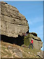
A large boulder (2.40 x 2.30m) located just east of the summit of Goldsborough is decorated with two cup-marks. The site was recorded as GR 8 by P. and B. Brown (2008).
Brown, P. and B. 2008. "Prehistoric Rock Art in the Northern Dales". Stroud: Tempus, p. 285 (as GR 8).
For more information see England's Rock Art entry for ERA-1720 Goldsborough Rigg 10, which includes NADRAP's notes, photographs, a sketch of the rock and its motifs, plus photogrammetry.
It is not recorded if this rock art panel is on Open Access or private land; land usage given is 'unmanaged grassland'.
You may be viewing yesterday's version of this page. To see the most up to date information please register for a free account.
")
Do not use the above information on other web sites or publications without permission of the contributor.
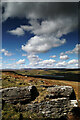
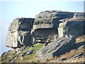
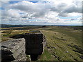
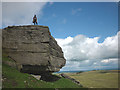
Nearby Images from Geograph Britain and Ireland:
©2021(licence)
©2009(licence)
©2010(licence)
©2012(licence)
©2008(licence)
The above images may not be of the site on this page, they are loaded from Geograph.
Please Submit an Image of this site or go out and take one for us!
Click here to see more info for this site
Nearby sites
Key: Red: member's photo, Blue: 3rd party photo, Yellow: other image, Green: no photo - please go there and take one, Grey: site destroyed
Download sites to:
KML (Google Earth)
GPX (GPS waypoints)
CSV (Garmin/Navman)
CSV (Excel)
To unlock full downloads you need to sign up as a Contributory Member. Otherwise downloads are limited to 50 sites.
Turn off the page maps and other distractions
Nearby sites listing. In the following links * = Image available
85m ESE 108° Goldsborough Rigg 11 Rock Art (NY9567517681)
86m ESE 108° Goldsborough Rigg 9* Rock Art (NY9567617682)
90m ESE 111° Goldsborough Rigg 5* Rock Art (NY9567817676)
101m E 96° Goldsborough Rigg 3* Rock Art (NY9569517697)
111m E 98° Goldsborough Rigg 12 Rock Art (NY9570417692)
113m E 93° Goldsborough Rigg 13 Rock Art (NY9570717701)
117m E 91° Goldsborough Rigg 1.* Rock Art (NY9571117705)
190m E 87° Goldsborough Rigg 2* Rock Art (NY9578417719)
215m E 101° Goldsborough Rigg 4 Rock Art (NY9580517666)
248m E 81° Goldsborough Rigg 14 Rock Art (NY9584017745)
402m E 85° Goldsborough Rigg 7 Rock Art (NY9599617742)
457m ENE 67° Goldsborough Rigg 6 Rock Art (NY9601717884)
492m ENE 61° Goldsborough Rigg 15 Rock Art (NY9602517948)
747m ESE 109° How Beck Head 8* Rock Art (NY9630317467)
1.1km ESE 121° West Loups's 5* Rock Art (NY9655117135)
1.1km ESE 118° West Loups's 4* Rock Art (NY9658717169)
1.1km NW 319° Blackton Reservoir 1* Rock Art (NY9484518555)
1.2km ESE 108° West Loups's 0 Rock Art (NY9671017340)
1.2km ESE 108° West Loups's 1 Rock Art (NY9671817345)
1.2km ESE 112° West Loups's 2* Rock Art (NY9669617259)
1.2km ESE 115° West Loups's 3* Rock Art (NY9670817181)
1.2km E 101° Loups's Hill 3* Rock Art (NY9680617480)
1.4km E 80° Loups's Hill 2* Rock Art (NY9700017948)
1.4km SE 129° Kearton Rigg 1* Rock Art (NY9670916801)
1.4km SE 129° Kearton Rigg 2 Rock Art (NY9671816799)
View more nearby sites and additional images


 We would like to know more about this location. Please feel free to add a brief description and any relevant information in your own language.
 Wir möchten mehr über diese Stätte erfahren. Bitte zögern Sie nicht, eine kurze Beschreibung und relevante Informationen in Deutsch hinzuzufügen.
 Nous aimerions en savoir encore un peu sur les lieux. S'il vous plaît n'hesitez pas à ajouter une courte description et tous les renseignements pertinents dans votre propre langue.
 Quisieramos informarnos un poco más de las lugares. No dude en añadir una breve descripción y otros datos relevantes en su propio idioma.