


<< Text Pages >> Winklebury Camp (Wiltshire) - Hillfort in England in Wiltshire
Submitted by vicky on Sunday, 21 July 2002 Page Views: 15505
Iron Age and Later PrehistorySite Name: Winklebury Camp (Wiltshire) Alternative Name: Winkelbury Camp (Wiltshire)Country: England County: Wiltshire Type: Hillfort
Nearest Town: Shaftesbury Nearest Village: Berwick St John
Map Ref: ST952218 Landranger Map Number: 184
Latitude: 50.995574N Longitude: 2.069771W
Condition:
| 5 | Perfect |
| 4 | Almost Perfect |
| 3 | Reasonable but with some damage |
| 2 | Ruined but still recognisable as an ancient site |
| 1 | Pretty much destroyed, possibly visible as crop marks |
| 0 | No data. |
| -1 | Completely destroyed |
| 5 | Superb |
| 4 | Good |
| 3 | Ordinary |
| 2 | Not Good |
| 1 | Awful |
| 0 | No data. |
| 5 | Can be driven to, probably with disabled access |
| 4 | Short walk on a footpath |
| 3 | Requiring a bit more of a walk |
| 2 | A long walk |
| 1 | In the middle of nowhere, a nightmare to find |
| 0 | No data. |
| 5 | co-ordinates taken by GPS or official recorded co-ordinates |
| 4 | co-ordinates scaled from a detailed map |
| 3 | co-ordinates scaled from a bad map |
| 2 | co-ordinates of the nearest village |
| 1 | co-ordinates of the nearest town |
| 0 | no data |
Be the first person to rate this site - see the 'Contribute!' box in the right hand menu.
Internal Links:
External Links:
Hillfort / Promontory fort in Wiltshire
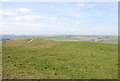
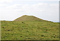
An Iron Age promontory fort on a scarp overlooking the village of Berwick St John. Its single rampart and ditch enclose around 17 acres. It was excavated by Pitt-Rivers in 1881, who found evidence of an Iron Age settlement within the defences.
Have you visited this site? Please add a comment below.
You may be viewing yesterday's version of this page. To see the most up to date information please register for a free account.
Do not use the above information on other web sites or publications without permission of the contributor.
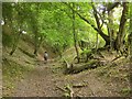
Nearby Images from Geograph Britain and Ireland:
©2014(licence)
©2007(licence)
©2014(licence)
©2007(licence)
©2014(licence)
The above images may not be of the site on this page, they are loaded from Geograph.
Please Submit an Image of this site or go out and take one for us!
Click here to see more info for this site
Nearby sites
Key: Red: member's photo, Blue: 3rd party photo, Yellow: other image, Green: no photo - please go there and take one, Grey: site destroyed
Download sites to:
KML (Google Earth)
GPX (GPS waypoints)
CSV (Garmin/Navman)
CSV (Excel)
To unlock full downloads you need to sign up as a Contributory Member. Otherwise downloads are limited to 50 sites.
Turn off the page maps and other distractions
Nearby sites listing. In the following links * = Image available
2.3km N 8° Gallows Hill, Wiltshire Round Barrow(s) (ST95542411)
2.6km NNW 338° White Sheet Hill Long Barrow (ST94242419)
3.0km E 96° South Down Ox Drove Tumuli* Round Barrow(s) (ST982215)
4.4km SSE 153° Scrubbity Barrows* Barrow Cemetery (ST97201789)
4.8km W 272° Chapel Well (Donhead St Mary) Holy Well or Sacred Spring (ST90372196)
4.9km ESE 118° Mistlebury* Hillfort (ST99581948)
5.5km NE 34° Sutton Down long barrow* Long Barrow (ST983264)
6.0km NNE 32° Buxbury Hill* Round Barrow(s) (ST984269)
6.3km ESE 107° Bokerley Dyke Misc. Earthwork (SU01241990)
6.6km SSW 199° Caesar's Camp (Dorset)* Hillfort (ST930156)
6.6km N 10° Castle Ditches (Wiltshire)* Hillfort (ST963283)
6.8km E 83° Marleycombe Hill, earthworks* Misc. Earthwork (SU020226)
7.1km WNW 298° Castle Rings* Hillfort (ST889251)
7.5km SE 127° Wor Barrow* Long Barrow (SU01241729)
7.6km WSW 243° Fontmell Down* Misc. Earthwork (ST884183)
8.0km SE 124° Oakley Down Barrows* Barrow Cemetery (SU01821731)
8.1km N 359° Tisbury Circle* Stone Circle (ST951299)
8.2km E 95° Vernditch Chase (North)* Long Barrow (SU03402113)
8.3km SE 132° Bottlebush Down barrows* Barrow Cemetery (SU01381625)
8.4km E 100° Vernditch Chase (South)* Long Barrow (SU035204)
8.4km S 190° Chettle Long Barrow* Long Barrow (ST937135)
8.4km SE 140° Wyke Down henge* Henge (SU006153)
8.7km SSE 154° Gussage Hill Ancient Village or Settlement (ST990140)
8.7km SE 139° Wyke Down barrows* Round Barrow(s) (SU009152)
8.7km SE 132° Dorset Cursus* Cursus (SU01751600)
View more nearby sites and additional images


 We would like to know more about this location. Please feel free to add a brief description and any relevant information in your own language.
 Wir möchten mehr über diese Stätte erfahren. Bitte zögern Sie nicht, eine kurze Beschreibung und relevante Informationen in Deutsch hinzuzufügen.
 Nous aimerions en savoir encore un peu sur les lieux. S'il vous plaît n'hesitez pas à ajouter une courte description et tous les renseignements pertinents dans votre propre langue.
 Quisieramos informarnos un poco más de las lugares. No dude en añadir una breve descripción y otros datos relevantes en su propio idioma.