Featured: Explore Scotland (and everywhere else) with our Megalithic Portal iPhone app

Explore Scotland (and everywhere else) with our Megalithic Portal iPhone app

Prehistoric Cumbria

Prehistoric Cumbria

Who's Online

There are currently, 190 guests and 2 members online.

You are a guest. To join in, please register for free by clicking here

Sponsors

<< Our Photo Pages >> Leckhampton Hill - Hillfort in England in Gloucestershire

Submitted by vicky on Wednesday, 20 August 2008  Page Views: 19164

Iron Age and Later PrehistorySite Name: Leckhampton Hill
Country: England County: Gloucestershire Type: Hillfort
Nearest Town: Cheltenham  Nearest Village: Leckhampton
Map Ref: SO948184  Landranger Map Number: 163
Latitude: 51.864155N  Longitude: 2.076921W
Condition:
5Perfect
4Almost Perfect
3Reasonable but with some damage
2Ruined but still recognisable as an ancient site
1Pretty much destroyed, possibly visible as crop marks
0No data.
-1Completely destroyed
3 Ambience:
5Superb
4Good
3Ordinary
2Not Good
1Awful
0No data.
3 Access:
5Can be driven to, probably with disabled access
4Short walk on a footpath
3Requiring a bit more of a walk
2A long walk
1In the middle of nowhere, a nightmare to find
0No data.
3 Accuracy:
5co-ordinates taken by GPS or official recorded co-ordinates
4co-ordinates scaled from a detailed map
3co-ordinates scaled from a bad map
2co-ordinates of the nearest village
1co-ordinates of the nearest town
0no data
4

Internal Links:
External Links:

I have visited· I would like to visit

TheCaptain visited on 4th Aug 2021 - their rating: Cond: 3 Amb: 4 Access: 4 Cotswold Way walk around Leckhampton Hill from Seven Springs, wonderful views all over Cheltenham and the Severn valley all the way round, with an exploration of the hillfort, trig point and quarry with the Devil's Chimney. Then south to Ullenwood, turning east past Cuckoopen Farm and then down past the big old longbarrow to Coberley and heading back north to the Seven Springs for a pint.

h_fenton have visited here
Leckhampton Hill
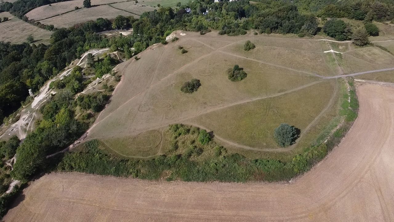
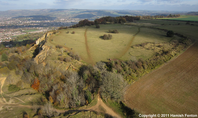
Leckhampton Hill submitted by h_fenton : Leckhampton Hill hillfort / promontory fort, Gloucestershire. Viewed from the south-west. Kite Aerial Photograph 6 November 2011 (Vote or comment on this photo)
Leckhampton is one of a number Hillforts constructed along the Cotswold escarpment between 500-100BC, others include Painswick and Crickley Hill. The enclosure at Leckhampton is made up of a single bank and ditch cutting off a projecting headland. These sorts of hillforts are sometimes called promontory forts.

Excavations in the 1920s and again in 1969/70, revealed that the enclosure bank was originally 2-3m high with a ditch 4m wide and 1.5m deep. A combination of wooden palisade and stone walls helped strengthen the bank. The excavation also showed that the wooden defences had been burnt, so much so that the heat had reddened the yellow limestone. It is not known what caused the fire, but it must have brought to a dramatic end the defensive value of the hillfort.
You may be viewing yesterday's version of this page. To see the most up to date information please register for a free account.

Leckhampton Hill Barrow
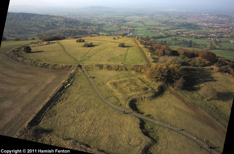
Leckhampton Hill Barrow submitted by h_fenton : Square enclosure containing Leckhampton Hill Barrow (or its remains) with the rampart of Leckhampton Hill hillfort / promontory fort behind. Viewed from the east. Kite Aerial Photograph 6 November 2011 (Vote or comment on this photo)

Leckhampton Hill
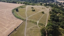
Leckhampton Hill submitted by h_fenton : Leckhampton Hill hillfort / promontory fort, Gloucestershire. Viewed from the east. Kite Aerial Photograph 6 November 2011 (1 comment - Vote or comment on this photo)

Leckhampton Hill Barrow
Leckhampton Hill Barrow submitted by h_fenton : Vertical Kite Aerial Photograph of the Square enclosure and barrow/pit remains of Leckhampton Hill Barrow. (top of photograph is north) 6 November 2011 (Vote or comment on this photo)

Leckhampton Hill
Leckhampton Hill submitted by camperman : An aerial view from the south. (Vote or comment on this photo)

Leckhampton Hill
Leckhampton Hill submitted by camperman : A view showing the curving single rampart visible running from N cliffs, initially running in S direction, then curving around to W to meet the cliffs on W side. Outer ditch visible to N end of this bank, but not visible elsewhere

Leckhampton Hill
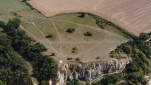
Leckhampton Hill submitted by camperman : Leckhampton Promontory hillfort showing the limestone Cotswold scarp face on the west and northern sides.

Leckhampton Hill
Leckhampton Hill submitted by TheCaptain : Looking around the outer side of the ramparts of Leckhampton Hill at the lower, southwestern end

Leckhampton Hill
Leckhampton Hill submitted by TheCaptain : Looking around the inner side of the ramparts of Leckhampton Hill at the southwestern end

Leckhampton Hill
Leckhampton Hill submitted by TheCaptain : Looking north along the ramparts of Leckhampton Hill at the eastern side

Leckhampton Hill
Leckhampton Hill submitted by TheCaptain : Looking around the ramparts of Leckhampton Hill

Leckhampton Hill
Leckhampton Hill submitted by TheCaptain : Looking south around the ramparts of Leckhampton Hill from the trig point.

Leckhampton Hill
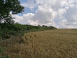
Leckhampton Hill submitted by TheCaptain : Approaching Leckhampton Hill from the east along the Cotswold Way. The trig point is on the high point of the defensive bank.

Do not use the above information on other web sites or publications without permission of the contributor.
Click here to see more info for this site

Nearby sites

Click here to view sites on an interactive OS map

Key: Red: member's photo, Blue: 3rd party photo, Yellow: other image, Green: no photo - please go there and take one, Grey: site destroyed

Download sites to:
KML (Google Earth)
GPX (GPS waypoints)
CSV (Garmin/Navman)
CSV (Excel)

To unlock full downloads you need to sign up as a Contributory Member. Otherwise downloads are limited to 50 sites.


Turn off the page maps and other distractions

Nearby sites listing. In the following links * = Image available
 112m E 100° Leckhampton Hill Barrow* Round Barrow(s) (SO94911838)
 1.7km SW 234° Crippet's Barrow* Chambered Tomb (SO93421739)
 1.8km SW 225° Dry Heathfield Barrow Round Barrow(s) (SO93521711)
 2.3km SE 129° Seven Springs (Gloucestershire)* Holy Well or Sacred Spring (SO96631694)
 2.8km SSW 208° Emma's Grove Round Barrows Round Barrow(s) (SO93481594)
 2.9km SSE 165° Coberley* Chambered Tomb (SO95521564)
 2.9km SSW 209° Barrow Wake Barrow Round Barrow(s) (SO93381585)
 3.0km SW 221° Crickley Hill* Hillfort (SO928161)
 3.7km SSW 209° Birdlip Barrow* Round Barrow(s) (SO9301015150)
 4.1km N 359° Cheltenham Museum* Museum (SO947225)
 4.2km SW 215° Birdlip Camp* Hillfort (SO924150)
 4.2km N 1° Cheltenham Centre Stone* Marker Stone (SO9488422583)
 4.4km SSW 214° Birdlip standing stones* Modern Stone Circle etc (SO9235214746)
 4.4km SSW 201° Birdlip Roundhouse Ancient Village or Settlement (SO932143)
 4.4km E 88° Lineover* Chambered Tomb (SO99231856)
 4.7km N 2° The Wish Stone* Marker Stone (SO950231)
 4.8km W 259° Badgeworth Round Barrow* Round Barrow(s) (SO90071750)
 5.1km E 82° North Dowdeswell* Hillfort (SO99851910)
 5.4km SE 130° Norbury Hillfort (Colesbourne)* Hillfort (SO989149)
 5.4km SSE 161° High Cross Stone (Elkstone)* Standing Stone (Menhir) (SO9653213246)
 5.6km E 88° South Dowdeswell Hillfort (SP0040018600)
 6.1km NE 36° Prestbury (Glos) Chambered Tomb (SO984233)
 6.3km SW 215° West Tump* Long Barrow (SO9112213241)
 6.4km SSE 163° Elkstone Churchyard Stones* Holed Stone (SO9671012316)
 6.7km W 274° Churchdown Hill Camp* Hillfort (SO881189)
View more nearby sites and additional images

<< Crockalaghta

Mount drum archaeological site >>

Please add your thoughts on this site

Long Barrows of the Cotswolds, Darvill

Long Barrows of the Cotswolds, Darvill

Sponsors

Auto-Translation (Google)

Translate from English into:

"Leckhampton Hill" | Login/Create an Account | 3 News and Comments
  
Go back to top of page    Comments are owned by the poster. We aren't responsible for their content.
Re: Leckhampton Hill by coldrum on Sunday, 03 January 2010
(User Info | Send a Message)
The following information from the Pastscape site.

"The promontory fort on Leckhampton Hill encloses an area of about 7 acres. The east and south sides are defined by a rampart with an outer ditch, the west and north sides by quarried scarp edges. Near its north end the rampart crosses a gully subsequently utilized by a quarry tramway. The entrance is in the east. The results of excavation in 1925 have been clarified by further work begun in 1969. Wherever it was examined, on the south side of the entrance, the rampart was found to be burnt. It was 20 ft wide and up to 6 ft high and consisted of a stone core revetted with dry stone walls, tied at the base by transverse timbers. The outer wall, better preserved than the inner, is 3 ft thick and survives to a height of 1 1/2ft. A berm 3 ft wide separates the rampart from the ditch, which is up to 14 ft wide and 9 ft deep with the bottom locally flat or V-shaped. "Guard chambers" formerly thought to be rectangular in plan, on either side of the entrance, are now seen to be circular or semi-circular and incorporated in the inturned ends of the rampart. Sherds of coarse IA pottery recovered during the 1925 and 1969-71 excavations are not closely dateable. RB pottery is reported from superficial positions. "

http://www.pastscape.org.uk/hob.aspx?hob_id=117424

[ Reply to This ]

Re: GEOPHYSICAL OPEN DAY, Friday 29th August 2008 by Andy B on Wednesday, 20 August 2008
(User Info | Send a Message)
More details at
http://www.gloucestershire.gov.uk/index.cfm?articleid=19425

and a PDF flyer can be downloaded from here
http://www.nationaltrail.co.uk/cotswold/event.asp?PageId=49&EventId=12
[ Reply to This ]

GEOPHYSICAL OPEN DAY, Friday 29th August 2008 by coldrum on Tuesday, 19 August 2008
(User Info | Send a Message)
GEOPHYSICAL OPEN DAY Leckhampton Hillfort Friday 29th August 2008

Ever wanted to try your hand at archaeological geophysical survey? Now's your chance by becoming part of the geophysical survey team on Leckhampton Hill, Cheltenham.

Five sessions will be available throughout the day providing an opportunity to take an active role in the geophysical survey of the Iron Age Hillfort

For more information on the event see the link below or contact the Countryside Archaeological Advisor at [email protected]

http://www.gloucestershire.gov.uk/archaeology/
[ Reply to This ]

Your Name: Anonymous [ Register Now ]
Subject:


Add your comment or contribution to this page. Spam or offensive posts are deleted immediately, don't even bother

<<< What is five plus one as a number? (Please type the answer to this question in the little box on the left)
You can also embed videos and other things. For Youtube please copy and paste the 'embed code'.
For Google Street View please include Street View in the text.
Create a web link like this: <a href="https://www.megalithic.co.uk">This is a link</a>  

Allowed HTML is:
<p> <b> <i> <a> <img> <em> <br> <strong> <blockquote> <tt> <li> <ol> <ul> <object> <param> <embed> <iframe>

We would like to know more about this location. Please feel free to add a brief description and any relevant information in your own language.
Wir möchten mehr über diese Stätte erfahren. Bitte zögern Sie nicht, eine kurze Beschreibung und relevante Informationen in Deutsch hinzuzufügen.
Nous aimerions en savoir encore un peu sur les lieux. S'il vous plaît n'hesitez pas à ajouter une courte description et tous les renseignements pertinents dans votre propre langue.
Quisieramos informarnos un poco más de las lugares. No dude en añadir una breve descripción y otros datos relevantes en su propio idioma.