<< Our Photo Pages >> Boles Barrow - Long Barrow in England in Wiltshire
Submitted by davidmorgan on Tuesday, 28 March 2023 Page Views: 3694
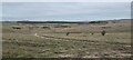
Neolithic and Bronze AgeSite Name: Boles Barrow Alternative Name: Heytesbury 1, Bowl's Barrow, Bowls BarrowCountry: England County: Wiltshire Type: Long Barrow
Nearest Town: Warminster
Map Ref: ST9420346771
Latitude: 51.220105N Longitude: 2.084387W
Condition:
| 5 | Perfect |
| 4 | Almost Perfect |
| 3 | Reasonable but with some damage |
| 2 | Ruined but still recognisable as an ancient site |
| 1 | Pretty much destroyed, possibly visible as crop marks |
| 0 | No data. |
| -1 | Completely destroyed |
| 5 | Superb |
| 4 | Good |
| 3 | Ordinary |
| 2 | Not Good |
| 1 | Awful |
| 0 | No data. |
| 5 | Can be driven to, probably with disabled access |
| 4 | Short walk on a footpath |
| 3 | Requiring a bit more of a walk |
| 2 | A long walk |
| 1 | In the middle of nowhere, a nightmare to find |
| 0 | No data. |
| 5 | co-ordinates taken by GPS or official recorded co-ordinates |
| 4 | co-ordinates scaled from a detailed map |
| 3 | co-ordinates scaled from a bad map |
| 2 | co-ordinates of the nearest village |
| 1 | co-ordinates of the nearest town |
| 0 | no data |
Internal Links:
External Links:
")
Source: Pastscape monument no. 211227
Access: This site is on Ministry of Defence land so access is very limited and only by arrangement with them.
Note: The recent Boles Barrow dig with Richard Osgood and army veteran volunteers has reportedly found the barrow much better preserved than previously thought. With thanks to Amanda Chadburn for photos from press day, more linked from our page.
You may be viewing yesterday's version of this page. To see the most up to date information please register for a free account.
")
Do not use the above information on other web sites or publications without permission of the contributor.
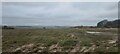
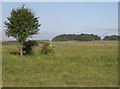
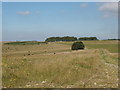
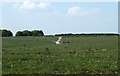
Nearby Images from Geograph Britain and Ireland:
©2021(licence)
©2007(licence)
©2007(licence)
©2011(licence)
©2021(licence)
The above images may not be of the site on this page, they are loaded from Geograph.
Please Submit an Image of this site or go out and take one for us!
Click here to see more info for this site
Nearby sites
Key: Red: member's photo, Blue: 3rd party photo, Yellow: other image, Green: no photo - please go there and take one, Grey: site destroyed
Download sites to:
KML (Google Earth)
GPX (GPS waypoints)
CSV (Garmin/Navman)
CSV (Excel)
To unlock full downloads you need to sign up as a Contributory Member. Otherwise downloads are limited to 50 sites.
Turn off the page maps and other distractions
Nearby sites listing. In the following links * = Image available
1.8km WSW 243° Norton Bavant 13 Long Barrow (ST92594595)
2.5km WSW 251° Norton Bavant 14 Long Barrow (ST91854596)
3.2km SW 214° West Hill long barrow Long Barrow (ST924441)
3.3km SSE 147° Knook Castle Hillfort (ST96004400)
3.8km W 279° Oxendean Down barrow Round Barrow(s) (ST904474)
3.9km W 280° Oxendean Down Barrow Round Barrow(s) (ST90404746)
3.9km WSW 241° Middle Hill* Round Barrow(s) (ST908449)
3.9km W 280° Warminster Bowl Barrow Round Barrow(s) (ST90384747)
4.0km W 276° Warminster Long Barrow Long Barrow (ST90244717)
4.0km SW 230° Scratchbury Camp* Hillfort (ST911442)
4.0km WNW 286° Oxendean Bottom Barrow Round Barrow(s) (ST90314788)
4.2km WNW 293° Warminster Down Tumulus Round Barrow(s) (ST90294841)
4.3km WNW 300° Bratton Round Barrow(s) (ST90434892)
4.5km WSW 255° Battlesbury Camp* Hillfort (ST898456)
4.6km WSW 253° Battlesbury Bowl Barrow 1 Round Barrow(s) (ST89804545)
4.6km WSW 253° Battlesbury bowl barrow 3 Round Barrow(s) (ST898454)
4.6km WSW 253° Battlesbury hillfort Barrows Round Barrow(s) (ST898454)
4.6km WSW 253° Battlesbury Bowl barrow 2 Round Barrow(s) (ST89774544)
4.7km SSE 164° Upton Great Barrow* Round Barrow(s) (ST955423)
4.7km W 274° Mancombe Down Enclosure Ancient Village or Settlement (ST89494710)
5.0km WSW 243° King Barrow (Warminster) Long Barrow (ST8975044477)
5.5km NNW 340° Luccombe Springs Holy Well or Sacred Spring (ST923519)
5.6km WSW 241° Boreham Mill Barrows Round Barrow(s) (ST89274400)
5.9km NNW 330° Church Springs Holy Well or Sacred Spring (ST913519)
5.9km E 79° Kill Barrow Long Barrow (SU0001547898)
View more nearby sites and additional images


 We would like to know more about this location. Please feel free to add a brief description and any relevant information in your own language.
 Wir möchten mehr über diese Stätte erfahren. Bitte zögern Sie nicht, eine kurze Beschreibung und relevante Informationen in Deutsch hinzuzufügen.
 Nous aimerions en savoir encore un peu sur les lieux. S'il vous plaît n'hesitez pas à ajouter une courte description et tous les renseignements pertinents dans votre propre langue.
 Quisieramos informarnos un poco más de las lugares. No dude en añadir una breve descripción y otros datos relevantes en su propio idioma.