<< Text Pages >> Coupland Henge - Henge in England in Northumberland
Submitted by vicky on Tuesday, 03 December 2002 Page Views: 8813
Neolithic and Bronze AgeSite Name: Coupland HengeCountry: England County: Northumberland Type: Henge
Nearest Village: Milfield
Map Ref: NT940330 Landranger Map Number: 74
Latitude: 55.590597N Longitude: 2.096757W
Condition:
| 5 | Perfect |
| 4 | Almost Perfect |
| 3 | Reasonable but with some damage |
| 2 | Ruined but still recognisable as an ancient site |
| 1 | Pretty much destroyed, possibly visible as crop marks |
| 0 | No data. |
| -1 | Completely destroyed |
| 5 | Superb |
| 4 | Good |
| 3 | Ordinary |
| 2 | Not Good |
| 1 | Awful |
| 0 | No data. |
| 5 | Can be driven to, probably with disabled access |
| 4 | Short walk on a footpath |
| 3 | Requiring a bit more of a walk |
| 2 | A long walk |
| 1 | In the middle of nowhere, a nightmare to find |
| 0 | No data. |
| 5 | co-ordinates taken by GPS or official recorded co-ordinates |
| 4 | co-ordinates scaled from a detailed map |
| 3 | co-ordinates scaled from a bad map |
| 2 | co-ordinates of the nearest village |
| 1 | co-ordinates of the nearest town |
| 0 | no data |
Internal Links:
External Links:
I have visited· I would like to visit
Modern-neolithic would like to visit
Have you visited this site? Please add a comment below.
You may be viewing yesterday's version of this page. To see the most up to date information please register for a free account.
Do not use the above information on other web sites or publications without permission of the contributor.
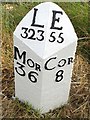
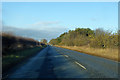
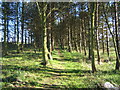
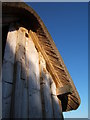
Nearby Images from Geograph Britain and Ireland:
©2019(licence)
©2019(licence)
©2009(licence)
©2009(licence)
©2012(licence)
The above images may not be of the site on this page, they are loaded from Geograph.
Please Submit an Image of this site or go out and take one for us!
Click here to see more info for this site
Nearby sites
Key: Red: member's photo, Blue: 3rd party photo, Yellow: other image, Green: no photo - please go there and take one, Grey: site destroyed
Download sites to:
KML (Google Earth)
GPX (GPS waypoints)
CSV (Garmin/Navman)
CSV (Excel)
To unlock full downloads you need to sign up as a Contributory Member. Otherwise downloads are limited to 50 sites.
Turn off the page maps and other distractions
Nearby sites listing. In the following links * = Image available
630m N 360° Milfield Reconstructed Henge at Maelmin Heritage Centre* Henge (NT9400033631)
761m SSE 157° Milfield Cursus Cursus (NT943323)
774m SSE 163° East Marleyknowe Henge Henge (NT94233226)
905m N 6° Maelmin Anglo-Saxon Royal Settlement. Ancient Village or Settlement (NT941339)
1.7km NNW 339° Milfield South Henge (NT934346)
1.8km NNW 338° Whitton Hill Timber Circle (NT933347)
1.9km NNW 342° Milfield North Timber Circle (NT934348)
1.9km SE 129° Ewart Cursus Cursus (NT955318)
2.0km ESE 107° Thirlings Ancient Village or Settlement (NT959324)
2.1km SE 127° Ewart Park Henge Henge (NT95693172)
2.7km NW 322° Flodden Camp Hillfort (NT92373510)
2.7km NNW 338° Milfield North* Henge (NT930355)
2.8km SSW 201° Battle Stone (Kirknewton)* Standing Stone (Menhir) (NT92993038)
2.8km SSW 204° Old Yeavering Henge* Henge (NT92853043)
2.8km SSW 207° Ad Gefrin* Ancient Palace (NT9270630484)
3.0km SE 141° West Akeld Steads Henge Henge (NT95883070)
3.8km SW 224° St. Gregory's The Great (Kirknewton)* Sculptured Stone (NT9134630251)
3.9km SSW 198° Yeavering Bell* Hillfort (NT92802931)
4.0km SW 217° St Gregory's Hill* Hillfort (NT9161329805)
4.0km SSE 167° White Law Hillfort (NT949291)
4.1km SSE 169° Gleads Cleugh Hillfort (NT948290)
4.3km N 359° Ford Westfield a & b Rock Art (NT9390037300)
4.5km S 189° Whitelaw (Kirknewton) Rock Art (NT9330028600)
4.5km SE 141° Bendor Stone* Standing Stone (Menhir) (NT9681929460)
4.6km ENE 58° Fenton Hill Hillfort (NT979354)
View more nearby sites and additional images


 We would like to know more about this location. Please feel free to add a brief description and any relevant information in your own language.
 Wir möchten mehr über diese Stätte erfahren. Bitte zögern Sie nicht, eine kurze Beschreibung und relevante Informationen in Deutsch hinzuzufügen.
 Nous aimerions en savoir encore un peu sur les lieux. S'il vous plaît n'hesitez pas à ajouter une courte description et tous les renseignements pertinents dans votre propre langue.
 Quisieramos informarnos un poco más de las lugares. No dude en añadir una breve descripción y otros datos relevantes en su propio idioma.