<< Text Pages >> Barrow Wake Barrow - Round Barrow(s) in England in Gloucestershire
Submitted by coldrum on Tuesday, 05 January 2010 Page Views: 6061
Neolithic and Bronze AgeSite Name: Barrow Wake BarrowCountry: England County: Gloucestershire Type: Round Barrow(s)
Map Ref: SO93381585
Latitude: 51.841213N Longitude: 2.097493W
Condition:
| 5 | Perfect |
| 4 | Almost Perfect |
| 3 | Reasonable but with some damage |
| 2 | Ruined but still recognisable as an ancient site |
| 1 | Pretty much destroyed, possibly visible as crop marks |
| 0 | No data. |
| -1 | Completely destroyed |
| 5 | Superb |
| 4 | Good |
| 3 | Ordinary |
| 2 | Not Good |
| 1 | Awful |
| 0 | No data. |
| 5 | Can be driven to, probably with disabled access |
| 4 | Short walk on a footpath |
| 3 | Requiring a bit more of a walk |
| 2 | A long walk |
| 1 | In the middle of nowhere, a nightmare to find |
| 0 | No data. |
| 5 | co-ordinates taken by GPS or official recorded co-ordinates |
| 4 | co-ordinates scaled from a detailed map |
| 3 | co-ordinates scaled from a bad map |
| 2 | co-ordinates of the nearest village |
| 1 | co-ordinates of the nearest town |
| 0 | no data |
Be the first person to rate this site - see the 'Contribute!' box in the right hand menu.
Internal Links:
External Links:
Round Barrow(s) in Gloucestershire
From Pastscape:
"The round barrow at the north end of Barrow Wake had been almost quarried away when seen by Grinsell in 1959, and only the extreme north edge remained. Approximately 14.0 metres across and up to 1.3 metres high; only the north half survives."
http://www.pastscape.org.uk/hob.aspx?hob_id=117417
You may be viewing yesterday's version of this page. To see the most up to date information please register for a free account.
")
")
Do not use the above information on other web sites or publications without permission of the contributor.
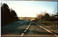
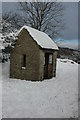
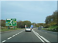
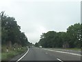
Nearby Images from Geograph Britain and Ireland:
©2009(licence)
©2009(licence)
©2014(licence)
©2013(licence)
©2013(licence)
The above images may not be of the site on this page, they are loaded from Geograph.
Please Submit an Image of this site or go out and take one for us!
Click here to see more info for this site
Nearby sites
Key: Red: member's photo, Blue: 3rd party photo, Yellow: other image, Green: no photo - please go there and take one, Grey: site destroyed
Download sites to:
KML (Google Earth)
GPX (GPS waypoints)
CSV (Garmin/Navman)
CSV (Excel)
To unlock full downloads you need to sign up as a Contributory Member. Otherwise downloads are limited to 50 sites.
Turn off the page maps and other distractions
Nearby sites listing. In the following links * = Image available
134m NE 48° Emma's Grove Round Barrows* Round Barrow(s) (SO93481594)
630m WNW 293° Crickley Hill* Hillfort (SO928161)
791m SSW 208° Birdlip Barrow* Round Barrow(s) (SO9301015150)
1.3km N 6° Dry Heathfield Barrow Round Barrow(s) (SO93521711)
1.3km SW 229° Birdlip Camp* Hillfort (SO924150)
1.5km SW 223° Birdlip standing stones* Modern Stone Circle etc (SO9235214746)
1.5km N 1° Crippet's Barrow* Chambered Tomb (SO93421739)
1.6km S 187° Birdlip Roundhouse Ancient Village or Settlement (SO932143)
2.1km E 96° Coberley* Chambered Tomb (SO95521564)
2.9km NNE 29° Leckhampton Hill* Hillfort (SO948184)
3.0km NNE 31° Leckhampton Hill Barrow* Round Barrow(s) (SO94911838)
3.4km ENE 71° Seven Springs (Gloucestershire)* Holy Well or Sacred Spring (SO96631694)
3.4km SW 221° West Tump* Long Barrow (SO9112213241)
3.7km WNW 296° Badgeworth Round Barrow* Round Barrow(s) (SO90071750)
3.8km SSW 212° Bucks Head Round Barrow* Round Barrow(s) (SO91321260)
4.1km SE 130° High Cross Stone (Elkstone)* Standing Stone (Menhir) (SO9653213246)
4.1km WSW 242° Tile Well* Holy Well or Sacred Spring (SO89721395)
4.2km SSW 201° Climperwell* Holy Well or Sacred Spring (SO91891192)
4.3km SSW 204° Climperwell Round Barrows* Round Barrow(s) (SO91641196)
4.7km WSW 244° High Brotheridge* Misc. Earthwork (SO89121381)
4.8km SE 137° Elkstone Churchyard Stones* Holed Stone (SO9671012316)
5.6km WSW 241° Cranham Corner Earthworks* Misc. Earthwork (SO88501313)
5.6km E 100° Norbury Hillfort (Colesbourne)* Hillfort (SO989149)
5.8km SE 137° Barrow Clump* Round Barrow(s) (SO974116)
6.1km WNW 300° Churchdown Hill Camp* Hillfort (SO881189)
View more nearby sites and additional images


 We would like to know more about this location. Please feel free to add a brief description and any relevant information in your own language.
 Wir möchten mehr über diese Stätte erfahren. Bitte zögern Sie nicht, eine kurze Beschreibung und relevante Informationen in Deutsch hinzuzufügen.
 Nous aimerions en savoir encore un peu sur les lieux. S'il vous plaît n'hesitez pas à ajouter une courte description et tous les renseignements pertinents dans votre propre langue.
 Quisieramos informarnos un poco más de las lugares. No dude en añadir una breve descripción y otros datos relevantes en su propio idioma.