<< Our Photo Pages >> Hare Hill ring cairn - Cairn in England in Yorkshire (West)
Submitted by drolaf on Wednesday, 31 August 2022 Page Views: 1054
Neolithic and Bronze AgeSite Name: Hare Hill ring cairnCountry: England County: Yorkshire (West) Type: Cairn
Nearest Town: Skipton Nearest Village: Earby
Map Ref: SD9295347697
Latitude: 53.925357N Longitude: 2.108798W
Condition:
| 5 | Perfect |
| 4 | Almost Perfect |
| 3 | Reasonable but with some damage |
| 2 | Ruined but still recognisable as an ancient site |
| 1 | Pretty much destroyed, possibly visible as crop marks |
| 0 | No data. |
| -1 | Completely destroyed |
| 5 | Superb |
| 4 | Good |
| 3 | Ordinary |
| 2 | Not Good |
| 1 | Awful |
| 0 | No data. |
| 5 | Can be driven to, probably with disabled access |
| 4 | Short walk on a footpath |
| 3 | Requiring a bit more of a walk |
| 2 | A long walk |
| 1 | In the middle of nowhere, a nightmare to find |
| 0 | No data. |
| 5 | co-ordinates taken by GPS or official recorded co-ordinates |
| 4 | co-ordinates scaled from a detailed map |
| 3 | co-ordinates scaled from a bad map |
| 2 | co-ordinates of the nearest village |
| 1 | co-ordinates of the nearest town |
| 0 | no data |
Internal Links:
External Links:
I have visited· I would like to visit
Hordernm would like to visit
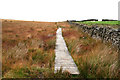
drolaf visited on 28th May 2022 - their rating: Cond: 3 Amb: 5 Access: 4 definitely one to go back to for the fantastic panorama of the Ribble valley.
")
Article 1
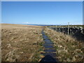
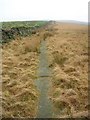
An early Bronze Age ring cairn or cairn circle that has lost its covering mound of earth and stones, but its outer ditch just about survives at the NW and SW sides, and there is possibly an inner ditch. Its raised bank is about 0.7m high, while the whole monument has a diameter of roughly 24m. Considering how long ago that this burial mound was constructed it is in a reasonably well preserved state. A fine Bronze Age dagger was found in a field below the Manor House Residential Home, just up the road, in the 1960’s.
Source
A very large collared funery urn with patternation, which broke into many pieces on being unearthed from the stone cist, but it was eventually (partly) restored and deposited in The Craven Museum, Skipton.
Article 2
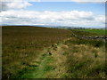
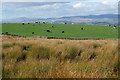
The site has rising ground to the south, but commands extensive views of the broad valley of Earby and Thornton Becks below to the west and the hills of Airedale to the north. Conspicuous both on the ground and from aerial photography. Archaeologist Dr Keith Boughey has written a book about the excavation of the bronze age ring cairn on Thornton Moor by Welbury Holgate and his sisters in the 1930's. The Holgates spent years on this project and their many finds eventually went to the Craven Museum but no report was ever written. Dr Boughey has studied the finds, applying modern techniques such as radio carbon dating to them and this book, about to be published by the YAS* is the result of his research.
Source
*YAS is now YAHS Yorkshire Archaeology and History Society.
You may be viewing yesterday's version of this page. To see the most up to date information please register for a free account.
")
")
Do not use the above information on other web sites or publications without permission of the contributor.
Nearby Images from Geograph Britain and Ireland:
©2022(licence)
©2007(licence)
©2011(licence)
©2009(licence)
©2006(licence)
The above images may not be of the site on this page, they are loaded from Geograph.
Please Submit an Image of this site or go out and take one for us!
Click here to see more info for this site
Nearby sites
Key: Red: member's photo, Blue: 3rd party photo, Yellow: other image, Green: no photo - please go there and take one, Grey: site destroyed
Download sites to:
KML (Google Earth)
GPX (GPS waypoints)
CSV (Garmin/Navman)
CSV (Excel)
To unlock full downloads you need to sign up as a Contributory Member. Otherwise downloads are limited to 50 sites.
Turn off the page maps and other distractions
Nearby sites listing. In the following links * = Image available
1.5km ENE 58° Standrise Earth Circle (Carleton in Craven) Misc. Earthwork (SD94194847)
2.3km SSW 208° Bleara Moor Cairnfield (Earby) Cairn (SD919457)
2.3km S 187° Bleara Lowe* Cairn (SD9266145388)
2.4km SSW 193° Bleara Moor Cairn* Cairn (SD9242745396)
2.8km WNW 282° Church Well (Thornton-in-Craven)* Holy Well or Sacred Spring (SD902483)
2.9km WNW 282° Church Well (Thornton-in-Craven)* Holy Well or Sacred Spring (SD901483)
3.7km NW 324° St Peter (East Marton)* Ancient Cross (SD9080750694)
4.2km NNE 28° Broughton Circle Stone Circle (SD9490551404)
4.5km ESE 109° Babyhouse Lane (Cononley) Ancient Village or Settlement (SD97194627)
4.6km WSW 240° Jinny Well, Salterforth* Holy Well or Sacred Spring (SD8898145411)
5.9km N 10° Kirk Sink (Gargrave) Ancient Village or Settlement (SD9396753517)
6.1km N 1° The Garris* Ancient Village or Settlement (SD9306153776)
6.2km N 2° St Andrew (Gargrave)* Ancient Cross (SD93205391)
6.4km N 2° Roman Ford (Gargrave)* Ancient Trackway (SD9316354086)
6.5km S 190° Cold Well (Laneshawbridge)* Holy Well or Sacred Spring (SD91804125)
6.7km SE 139° Oakworth Old Lane (Cowling) Rock Art (SD9730042625)
6.7km SW 216° Tallers Cross* Ancient Cross (SD890423)
6.7km ENE 72° Low Snaygill Stone (Skipton) Rock Art (SD9939949729)
6.7km SW 227° The Lark Hill Stone (Whitemoor)* Standing Stone (Menhir) (SD880431)
6.9km ENE 71° High Laithe Stone (17) Rock Art (SD9951649914)
7.0km S 178° Hullown Well* Holy Well or Sacred Spring (SD93204067)
7.2km ENE 67° Horse Close Hill (Skipton) Ancient Village or Settlement (SD9965350468)
7.2km ENE 67° Great Wood Laithe (19) Rock Art (SD9962050551)
7.3km NE 56° Craven Museum* Museum (SD9902451734)
7.3km E 90° Hamblethorpe (Low Bradley)* Standing Stones (SE0030347622)
View more nearby sites and additional images


 We would like to know more about this location. Please feel free to add a brief description and any relevant information in your own language.
 Wir möchten mehr über diese Stätte erfahren. Bitte zögern Sie nicht, eine kurze Beschreibung und relevante Informationen in Deutsch hinzuzufügen.
 Nous aimerions en savoir encore un peu sur les lieux. S'il vous plaît n'hesitez pas à ajouter une courte description et tous les renseignements pertinents dans votre propre langue.
 Quisieramos informarnos un poco más de las lugares. No dude en añadir una breve descripción y otros datos relevantes en su propio idioma.